
MyTopo
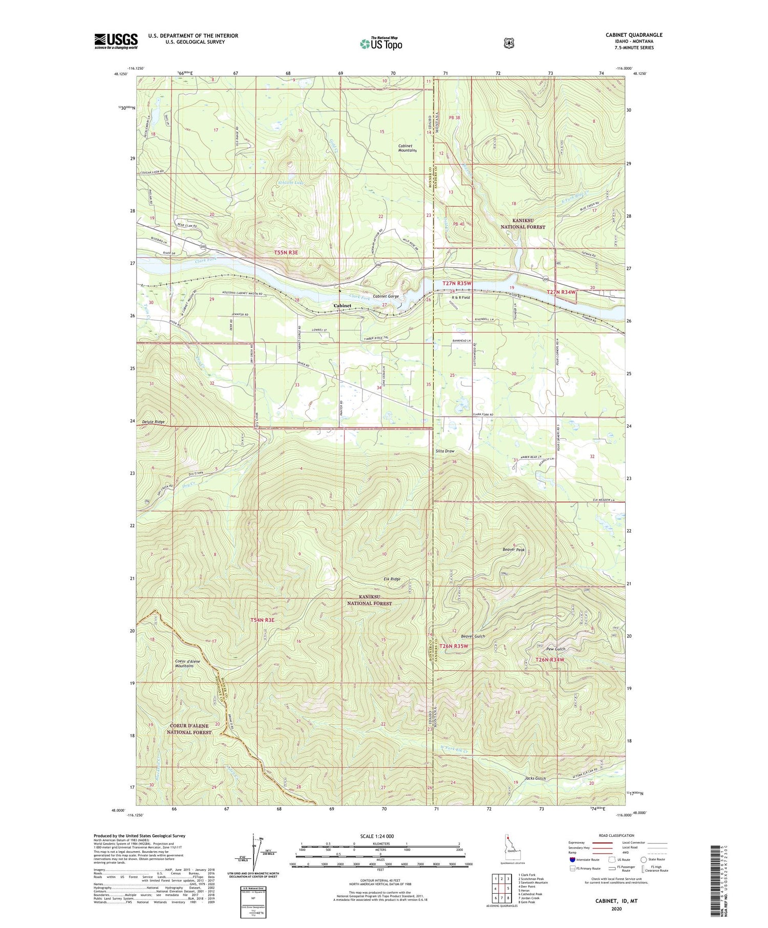
Cabinet Idaho US Topo Map
Couldn't load pickup availability
Also explore the Cabinet Forest Service Topo of this same quad for updated USFS data
2024 topographic map quadrangle Cabinet in the states of Idaho, Montana. Scale: 1:24000. Based on the newly updated USGS 7.5' US Topo map series, this map is in the following counties: Bonner, Sanders, Shoshone. The map contains contour data, water features, and other items you are used to seeing on USGS maps, but also has updated roads and other features. This is the next generation of topographic maps. Printed on high-quality waterproof paper with UV fade-resistant inks.
Quads adjacent to this one:
West: Derr Point
Northwest: Clark Fork
North: Scotchman Peak
Northeast: Sawtooth Mountain
East: Heron
Southeast: Gem Peak
South: Jordan Creek
Southwest: Cathedral Peak
Contains the following named places: 27N34W30ADAD01 Well, 27N35W24DADA01 Well, Beaver Peak, Blue Creek, Cabinet, Cabinet Dam Viewpoint, Cabinet Gorge, Cabinet Gorge Dam, Cabinet Gorge Hatchery, Cabinet Gorge Reservoir, Carpie Mine, Cedar, Clark Fork Fish Hatchery, Dry Creek, East Fork Blue Creek, Echo River School, Elk Ridge, Gold Creek, Jacks Gulch, Little Blue Dam, R & R Field, River Echo School, Schlicht Lake, Silta Draw


