MyTopo
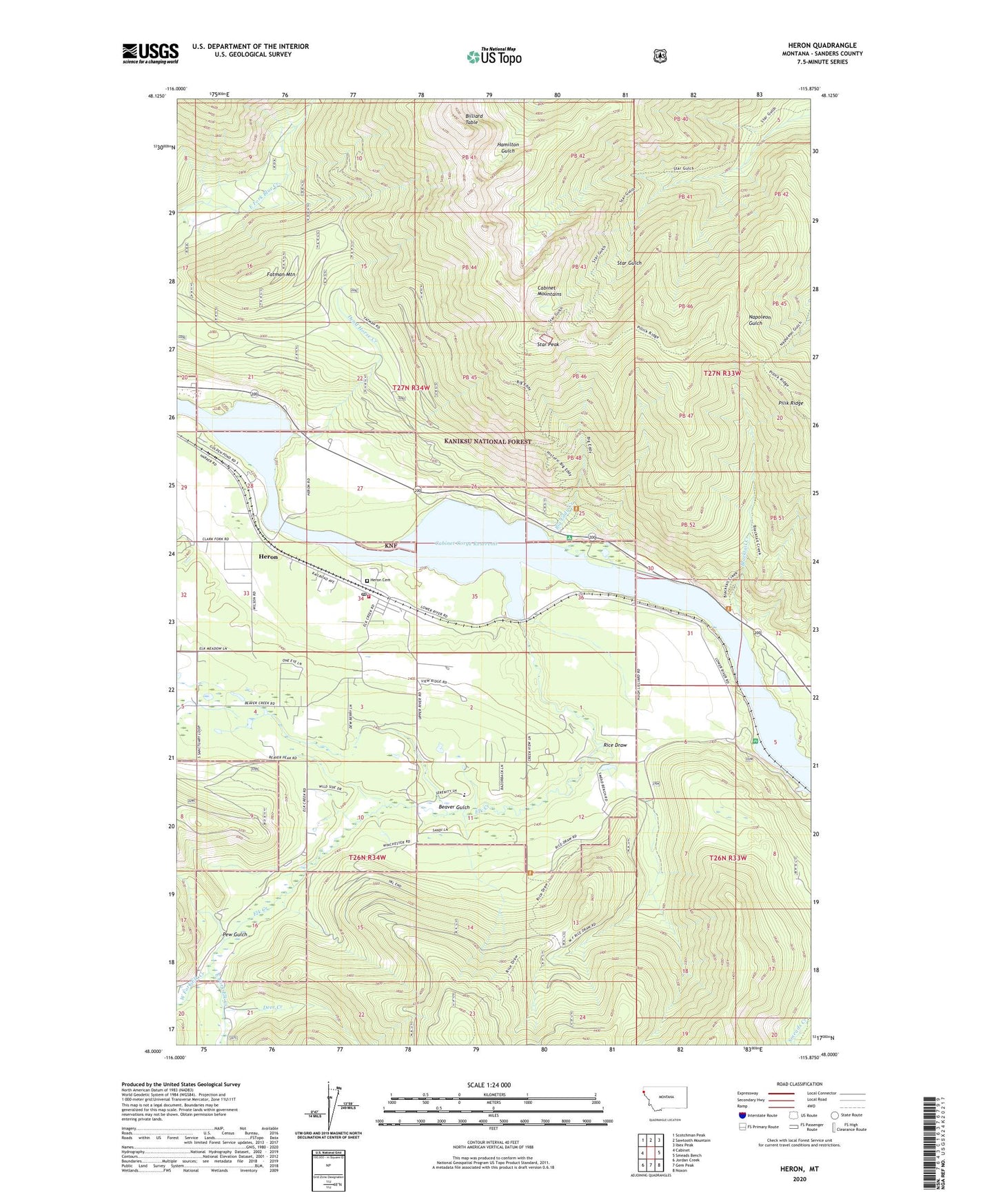
Heron Montana US Topo Map
Couldn't load pickup availability
Also explore the Heron Forest Service Topo of this same quad for updated USFS data
2024 topographic map quadrangle Heron in the state of Montana. Scale: 1:24000. Based on the newly updated USGS 7.5' US Topo map series, this map is in the following counties: Sanders. The map contains contour data, water features, and other items you are used to seeing on USGS maps, but also has updated roads and other features. This is the next generation of topographic maps. Printed on high-quality waterproof paper with UV fade-resistant inks.
Quads adjacent to this one:
West: Cabinet
Northwest: Scotchman Peak
North: Sawtooth Mountain
Northeast: Ibex Peak
East: Smeads Bench
Southeast: Noxon
South: Gem Peak
Southwest: Jordan Creek
This map covers the same area as the classic USGS quad with code o48115a8.
Contains the following named places: 26N34W03CDBC01 Well, 27N34W28DCDA01 Well, 27N34W35DABA01 Well, 59844, Beaver Gulch, Big Eddy Creek, Billiard Table, Blacktail Creek, Blue Creek Mine, Broken Hill Mine, Brown Hill Mine, Cabinet Gorge Reservoir, Caseys, Dead Horse Creek, Deer Creek, East Fork Elk Creek, Elk Creek, Fatman Mountain, First Baptist Church of Heron, Fredrick and Wind Mine, Gopher Hole Mine, Heron, Heron Cemetery, Heron Census Designated Place, Heron Community Clinic, Heron Methodist Church, Heron Post Office, Heron Rural Fire District, Heron School, Knott, Laurie Hill Library, Lucky Star Mine, Pew Gulch, Proctor, Red Fir/Amazon Mine, Rice Draw, Rice Draw Trail, Russelville, Star Peak, Star Peak Lookout Station