MyTopo
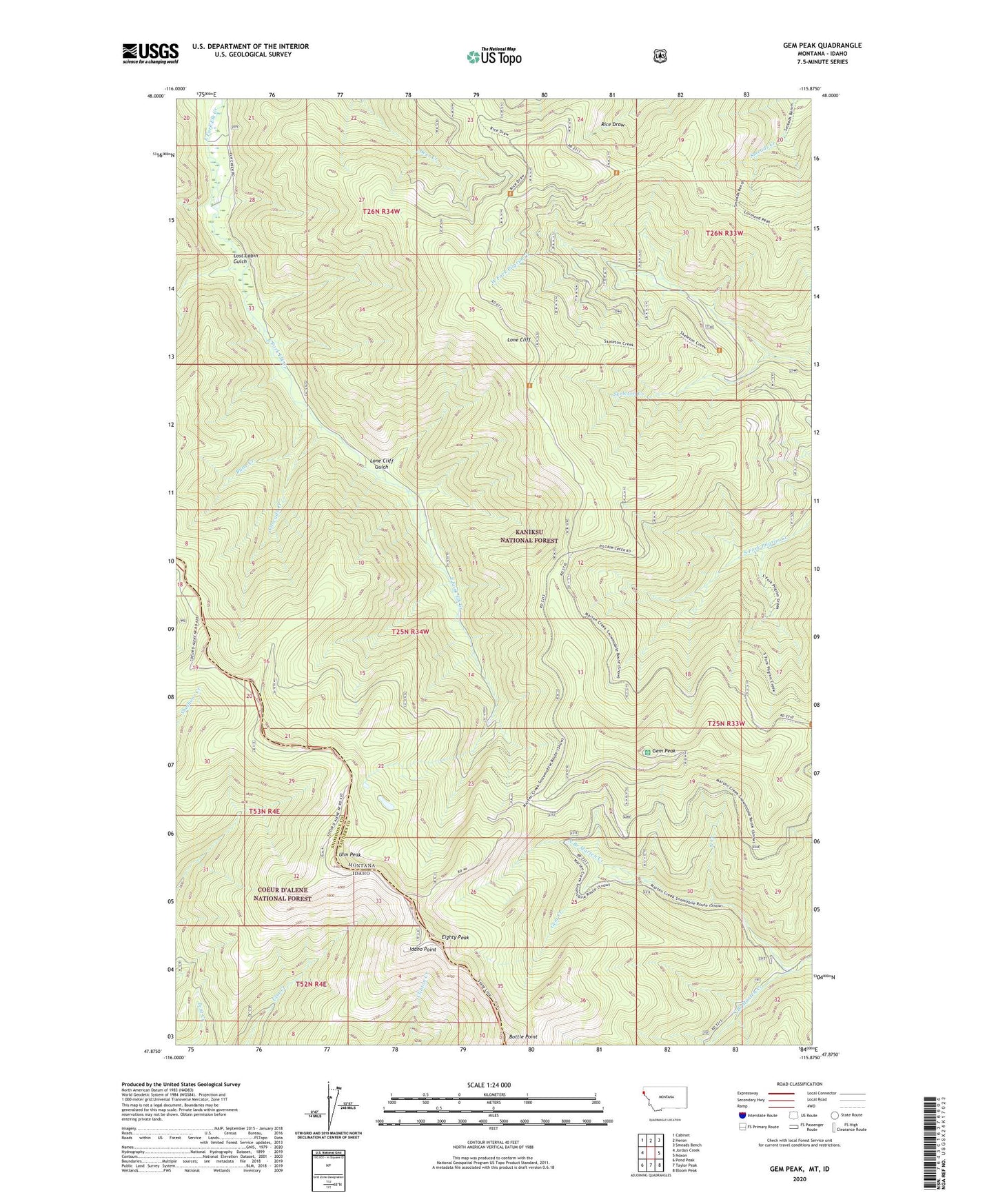
Gem Peak Montana US Topo Map
Couldn't load pickup availability
Also explore the Gem Peak Forest Service Topo of this same quad for updated USFS data
2024 topographic map quadrangle Gem Peak in the states of Montana, Idaho. Scale: 1:24000. Based on the newly updated USGS 7.5' US Topo map series, this map is in the following counties: Sanders, Shoshone. The map contains contour data, water features, and other items you are used to seeing on USGS maps, but also has updated roads and other features. This is the next generation of topographic maps. Printed on high-quality waterproof paper with UV fade-resistant inks.
Quads adjacent to this one:
West: Jordan Creek
Northwest: Cabinet
North: Heron
Northeast: Smeads Bench
East: Noxon
Southeast: Bloom Peak
South: Taylor Peak
Southwest: Pond Peak
This map covers the same area as the classic USGS quad with code o47115h8.
Contains the following named places: 26N34W21CCBD01 Well, Bottle Point, Butte Creek, Cascade Creek, Eighty Peak, Gem Creek, Gem Peak, Gem Peak Lookout, Holliday Mine, Idaho Point, Kaniksu National Forest, Lone Cliff, Lone Cliff Gulch, Lost Cabin Gulch, Loveland Peak Trail, North Branch Marten Creek, North Creek, Skeleton Creek, South Branch Marten Creek, State Line Trail, Ulm Peak