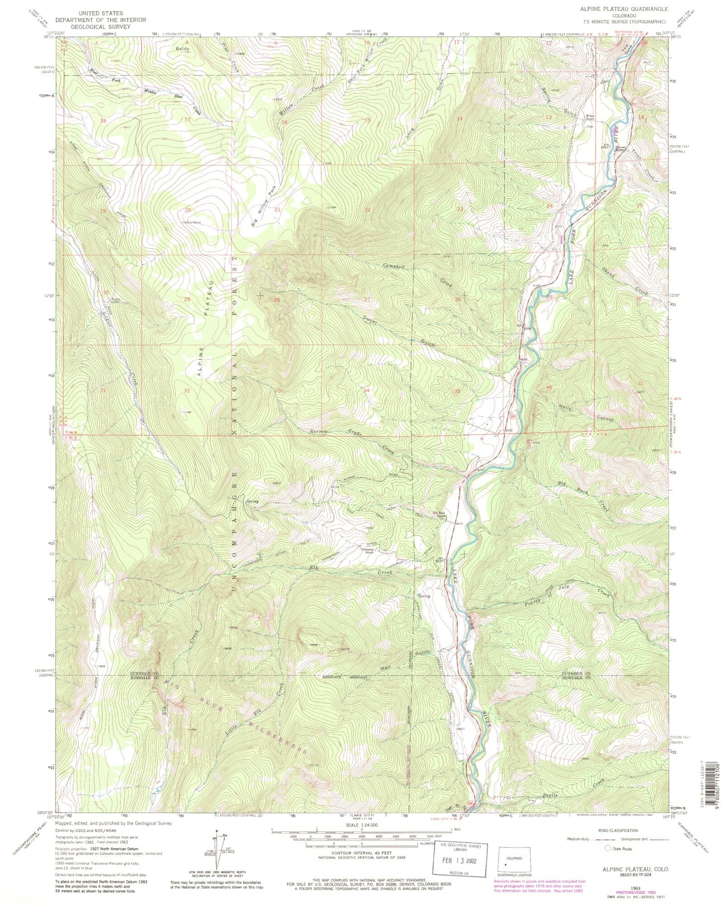
MyTopo
Classic USGS Alpine Plateau Colorado 7.5'x7.5' Topo Map
Couldn't load pickup availability
Historical USGS topographic quad map of Alpine Plateau in the state of Colorado. Typical map scale is 1:24,000, but may vary for certain years, if available. Print size: 24" x 27"
This quadrangle is in the following counties: Gunnison, Hinsdale.
The map contains contour lines, roads, rivers, towns, and lakes. Printed on high-quality waterproof paper with UV fade-resistant inks, and shipped rolled.
Contains the following named places: Thomas Ranch, Wilson Ranch, Spring Gulch, Big Willow Park, Alpine Corral, Little Elk Creek, Elk Creek, Well Gulch, High Bridge Gulch, Devils Creek, Fourth of July Creek, Big Buck Creek, Alpine Plateau, Baldy, The Gate, Campbell Creek, Dwyer Gulch, Hells Canyon, Narrow Grade Creek, Thompson Ditch Number 2, Thompson Ditch, Youman Ditch, Copeland Elk Creek Ditch, Thompson Ranch, Ute Trail Ranch, Skunk Creek, Trout Creek, Whinnery Ranch, Ridge Stock Driveway, Ferrara Ranch Mine, Nurse - Brownlee Cemetery