MyTopo
Eagle Cap MyTopo Explorer Series Map
Couldn't load pickup availability
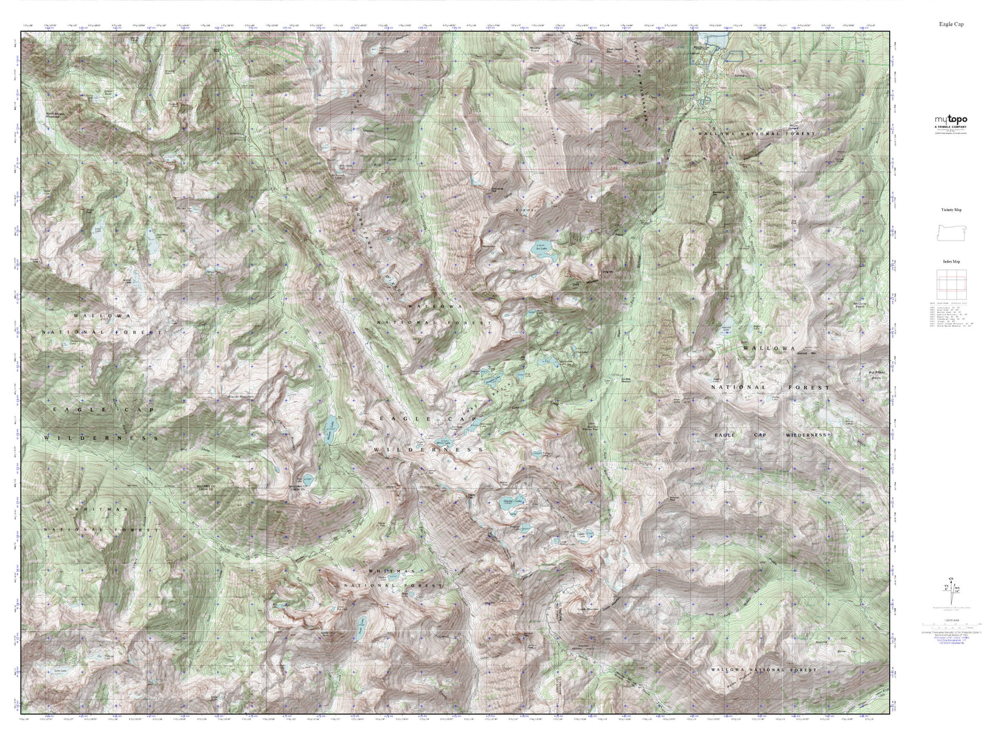
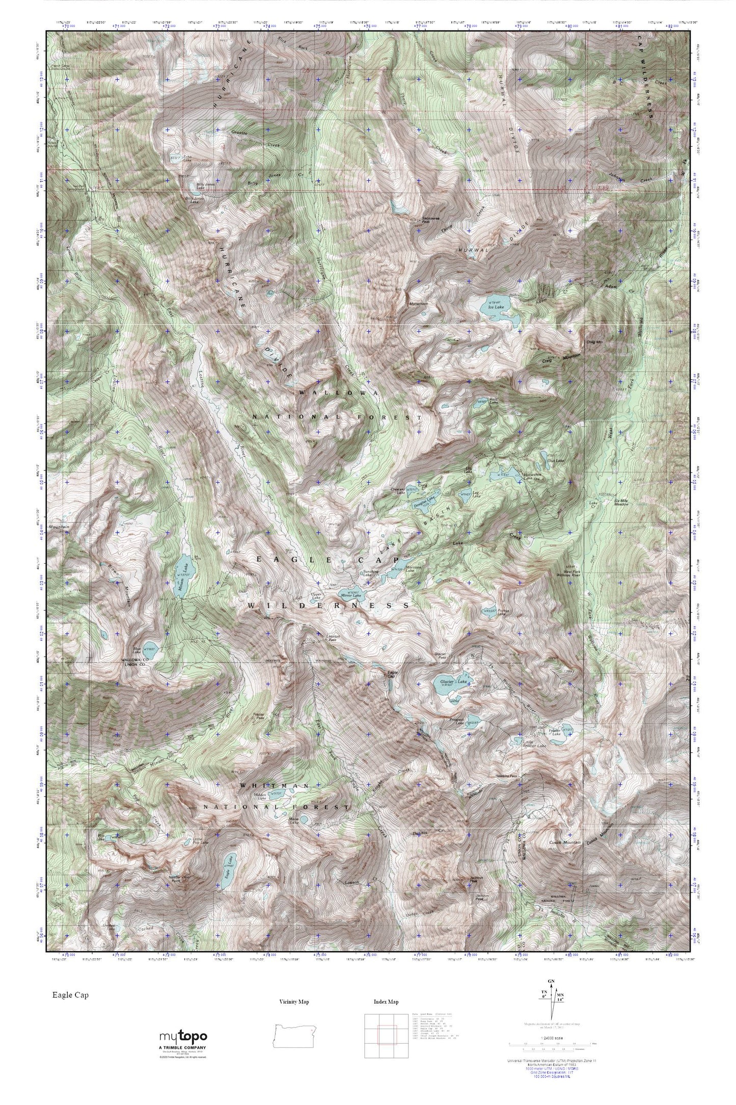
Topographic map of Eagle Cap in the state of Oregon. From the MyTopo Explorer Series.
This topo map features shaded relief and comes with UTM / MGRS and Latitude/Longitude grids.
For more than two decades, MyTopo has provided maps to the most adventurous among us.. those who love to explore our nation’s remote wilderness areas, climb our highest peaks, and trek across our vast public lands. This map is part of a curated collection of the most popular places for which MyTopo customers have designed maps. It is a “bucket list” of the most amazing places to hike, hunt, and explore.
This map contains the following named places: Benson Glacier,Billy Jones Creek,Billy Jones Lake,Blue Lake,Craig Lake,Craig Mountain,Crescent Lake,Cusick Mountain,Dennis Creek,Douglas Lake,Eagle Cap,Echo Lake,Frazier Lake,Frazier Pass,Glacier Lake,Glacier Pass,Granite Creek,Granite Lake,Granite Meadow,Hawkins Pass,Hidden Lake,Horseshoe Lake,Horton Pass,Hurwal Divide,Ice Lake,Knight Creek,Lake Basin,Lake Creek,Lee Lake,Lilly Lake,Little Frazier Lake,Little Pop Lake,Matterhorn,Minam Lake,Minam Lake Dam,Mirror Lake,Moccasin Lake,Moon Lake,Pocket Lake,Pop Creek,Prospect Lake,Razz Lake,Roudoth Spring,Sacajawea Peak,Six Mile Meadow,Sunshine Lake,Unit Lake,Upper Lake,Wallowa Mountains