MyTopo
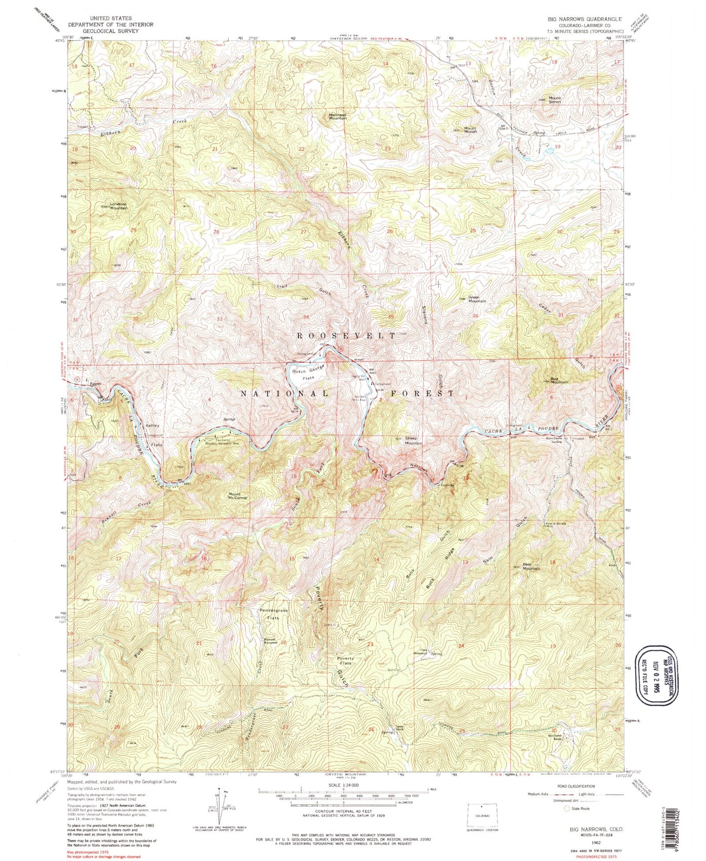
Classic USGS Big Narrows Colorado 7.5'x7.5' Topo Map
Couldn't load pickup availability
Historical USGS topographic quad map of Big Narrows in the state of Colorado. Typical map scale is 1:24,000, but may vary for certain years, if available. Print size: 24" x 27"
This quadrangle is in the following counties: Larimer.
The map contains contour lines, roads, rivers, towns, and lakes. Printed on high-quality waterproof paper with UV fade-resistant inks, and shipped rolled.
Contains the following named places: Cache La Poudre Wilderness, Elkhorn Creek, Dutch George Flats, Pendergrass Flats, Kelley Flats, Buck Gulch, Poverty Gulch, Bennett Creek, South Fork Cache la Poudre River, Hole-in-the-Wall Mine, Sky Corral Ranch, Lewis Ranch, Clark Homestead, Bosworth Homestead, Stove Prairie Landing, Narrows Picnic Area, Eggers, Fort Collins Mountain Recreation Area, Big Narrows, Poverty Flats, Bear Mountain, Mount Simon, Mount Morian, Manhead Mountain, Lonetree Mountain, Sheep Mountain, Green Mountain, Red Mountain, Mount McConnel, Buck Ridge, Cedar Gulch, Trail Gulch, Skin Gulch, Stevens Gulch, Pendergrass Creek, Narrows Campground, Narrows Picnic Area, Stevens Gulch Campground, Stove Prairie Landing Campground, Upper Landing Campground, Eggers Rest Area, Kelly Flats Campground, Mount McConnel Trailhead, Mount McConnel Trail, Mountain Park Campground, Kreutzer Nature Trail, Larimer County, Heline Property Mine, Lookout Lode, Mica Dike Claims, Red Mountain Lode, Eggers Post Office (historical), Kitty Lyon Grave, Adams Cemetery, Azuba Batterson Grave