MyTopo
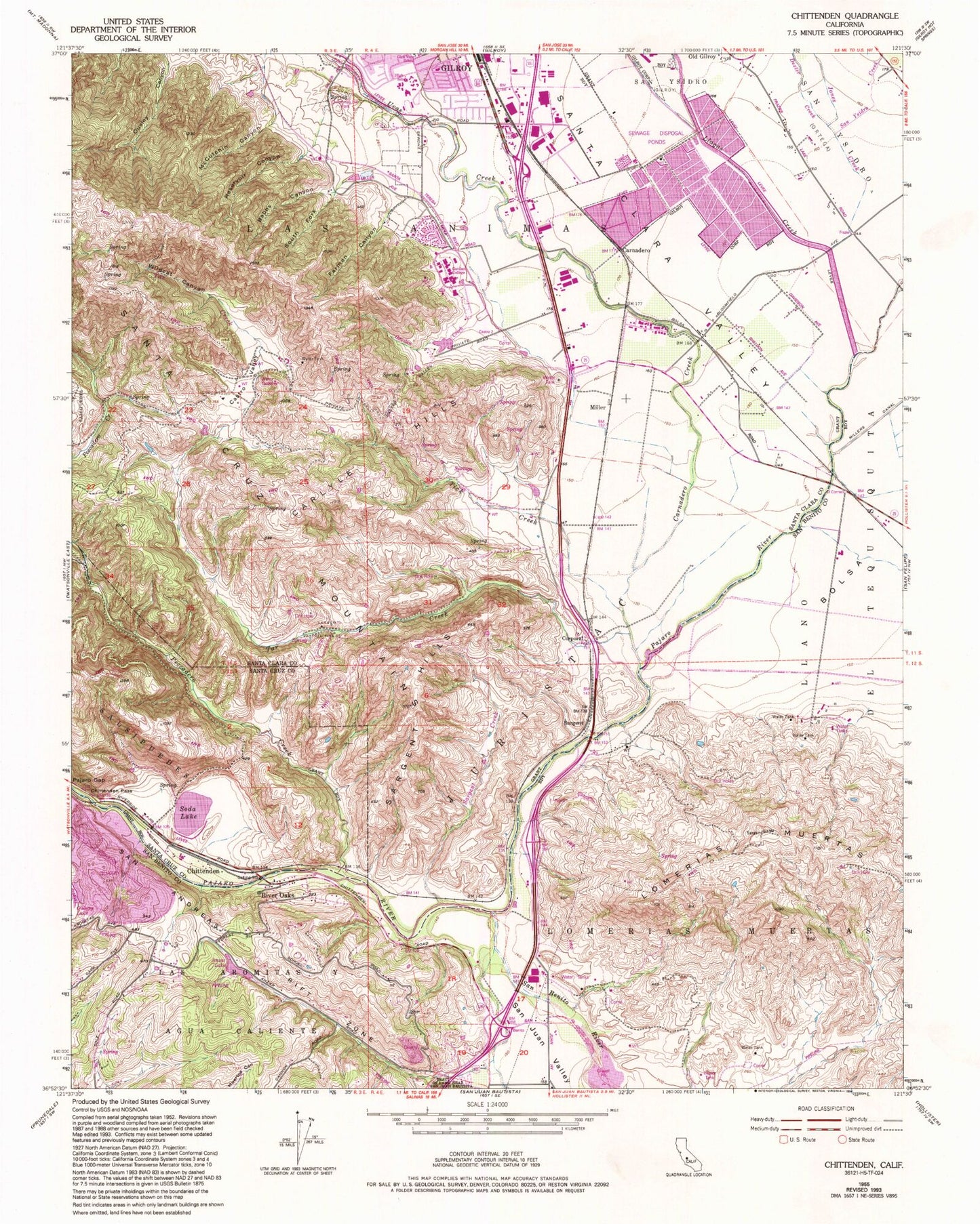
Classic USGS Chittenden California 7.5'x7.5' Topo Map
Couldn't load pickup availability
Historical USGS topographic quad map of Chittenden in the state of California. Map scale may vary for some years, but is generally around 1:24,000. Print size is approximately 24" x 27"
This quadrangle is in the following counties: San Benito, Santa Clara, Santa Cruz.
The map contains contour lines, roads, rivers, towns, and lakes. Printed on high-quality waterproof paper with UV fade-resistant inks, and shipped rolled.
Contains the following named places: Anzar High School, Anzar Lake, Babbs Canyon, Betabel, Carlyle Hills, Carnadero, Carnadero Creek, Carnadero School, Castro Valley, Chittenden, Christmas Hill, Corporal, Dexter Creek, El Pajaro Springs, Farman Canyon, Fep, Gavilan College Golf Course, Gavilan College Library, Gavilan College Main Campus, Gavilan Creek, Gavilan Hills Academy, Gilroy Early College Academy, Gilroy High School, Gilroy Wastewater Treatment Plant, Jones Creek, Jurista, Las Animas, Las Animas Elementary School, Llagas Creek, Lomerias Muertas, McCutchin Canyon, Miller, Miller Slough, Nema, Old Gilroy, Pescadero Creek, Plantel, Quarry Lake, Reservoir Canyon, River Oaks, San Benito River, San Benito Valley, San Juan Valley, San Ysidro, San Ysidro Creek, Sargent, Sargent Creek, Sargent Hills, Sargent Oil Field, Sawyers Crossing, Soda Lake, Soda Lake 636 Dam, South Fork Babbs Canyon, Star Creek, Sunnybrook School, Tar Creek, Tick Creek, Uvas Creek, Wildcat Canyon, Z - Best Composting Facility