MyTopo
Classic USGS Colorado City Arizona 7.5'x7.5' Topo Map
Couldn't load pickup availability
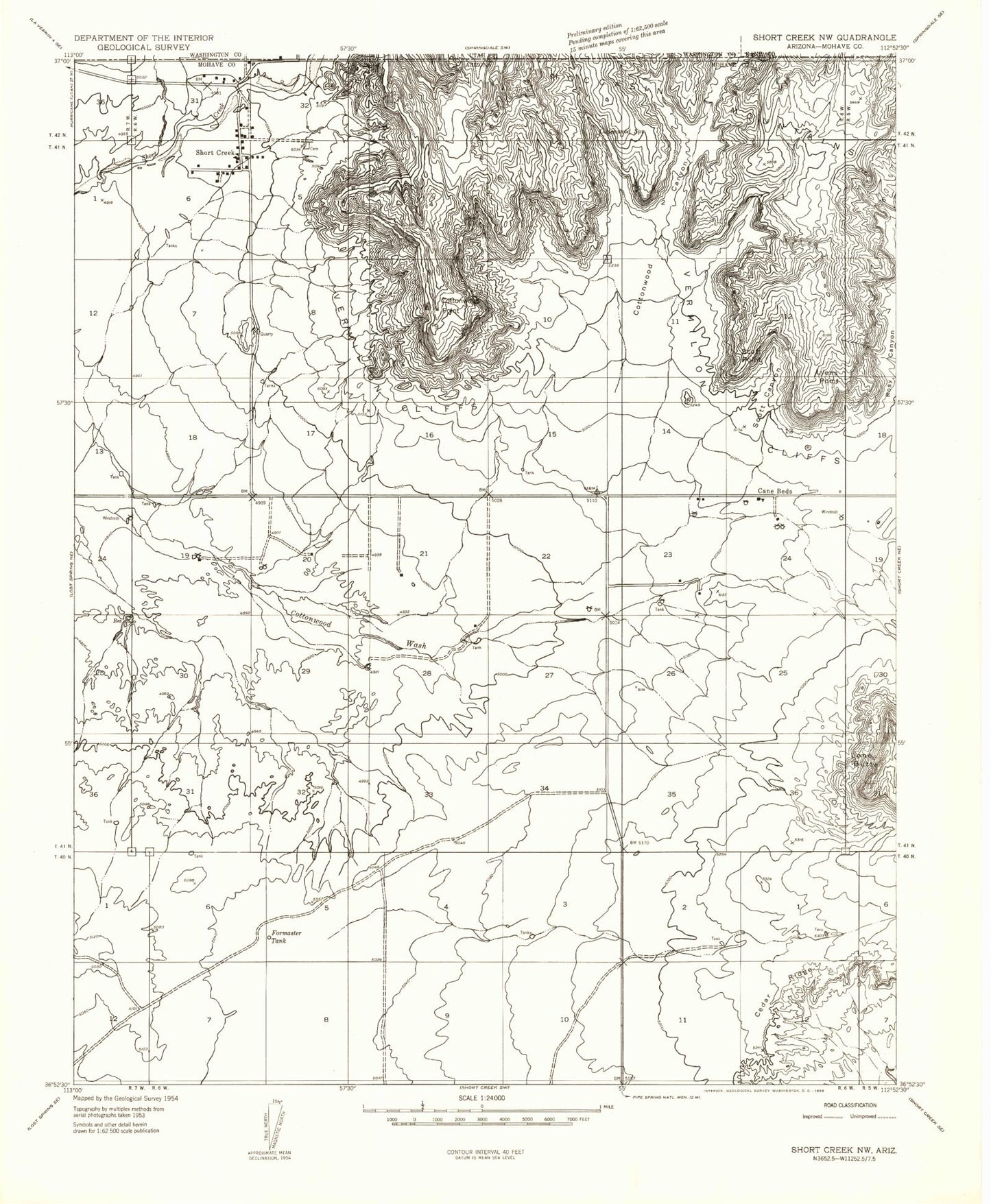
Historical USGS topographic quad map of Colorado City in the state of Arizona. Map scale may vary for some years, but is generally around 1:24,000. Print size is approximately 24" x 27"
This quadrangle is in the following counties: Mohave.
The map contains contour lines, roads, rivers, towns, and lakes. Printed on high-quality waterproof paper with UV fade-resistant inks, and shipped rolled.
Contains the following named places: Cane Beds, Cane Beds Census Designated Place, Centennial Park Census Designated Place, Colorado City, Colorado City Elementary School, Colorado City Fire Department, Colorado City Police Department, Colorado City Post Office, Cottonwood Canyon, Cottonwood Point, Cottonwood Point Wilderness, Cottonwood Spring Number One, Cottonwood Spring Number Three, Cottonwood Wash, Cox Family Cemetery, Formaster Tank, Isaac Carling Memorial Park, Lone Butte, Lyons Point, Masada Charter School, Mohave Community College North Mohave Campus, Scott Canyon, Scotts Point, Short Creek Reservoir Number Two, Short Creek Reservoir Number Two Dam, Short Creek Southside Number Two, Short Creek Southside Number Two Dam, Sungabi Creek, Town of Colorado City