MyTopo
Classic USGS Devils Gulch Colorado 7.5'x7.5' Topo Map
Couldn't load pickup availability
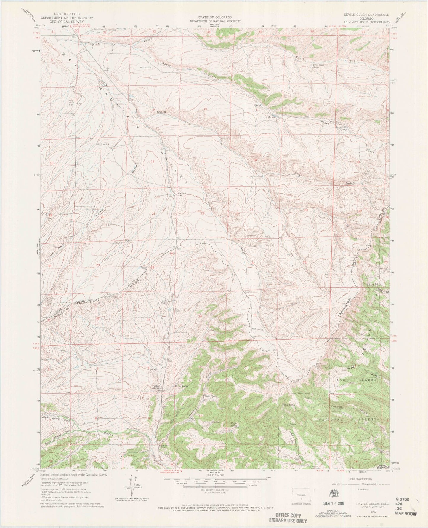
Historical USGS topographic quad map of Devils Gulch in the state of Colorado. Map scale may vary for some years, but is generally around 1:24,000. Print size is approximately 24" x 27"
This quadrangle is in the following counties: Custer, Huerfano.
The map contains contour lines, roads, rivers, towns, and lakes. Printed on high-quality waterproof paper with UV fade-resistant inks, and shipped rolled.
Contains the following named places: Akin Ranch, Bailey Spring, Bradford, Bradford and Swire Ditch, Cedar Spring, Cordrey Windmill, Devils Gulch, Foster Gulch, Froze Creek Spring, Hess Windmill, Jim Watkins Windmill, Lincoln Ditch Number 2, Moss Gulch, Mud Spring, North Foster Gulch, North Muddy Creek, Oaks Windmill, Patton Spring, Promontory Divide, Robsin Windmill, Rush Windmill, Sheep Creek, Sheep Creek Spring, South Muddy Creek, South Windmill, Top Windmill, Troyer Spring, Watkins Gulch