MyTopo
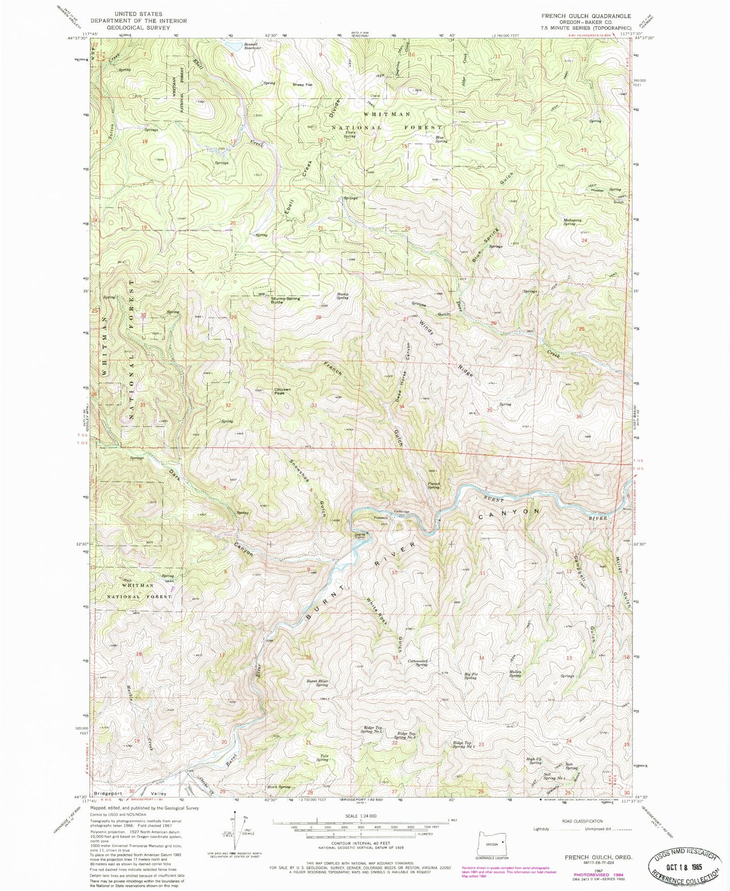
Classic USGS French Gulch Oregon 7.5'x7.5' Topo Map
Couldn't load pickup availability
Historical USGS topographic quad map of French Gulch in the state of Oregon. Map scale may vary for some years, but is generally around 1:24,000. Print size is approximately 24" x 27"
This quadrangle is in the following counties: Baker.
The map contains contour lines, roads, rivers, towns, and lakes. Printed on high-quality waterproof paper with UV fade-resistant inks, and shipped rolled.
Contains the following named places: Bennett Dam, Bennett Reservoir, Big Fir Spring, Birch Spring, Blue Spring, Blue Spring Gulch, Bridgeport Valley, Burnt River Spring, Campbell Gulch, Chicken Peak, Clarks Creek, Cottonwood Spring, Dark Canyon, Dead Horse Canyon, Ebell Creek Divide, Fawn Spring, French Gulch, French Spring, Grouse Gulch, High Up Spring, Mahogany Spring, Marble Creek, Miller Gulch, Mullen Spring, Ridge Top Spring Number Four, Ridge Top Spring Number Three, Ridge Top Spring Number Two, Salt Spring, Salt Spring Number One, Sheep Flat, Snowshoe Gulch, Stump Spring, Stump Spring Butte, Tule Spring, White Rock Gulch, Windy Ridge