MyTopo
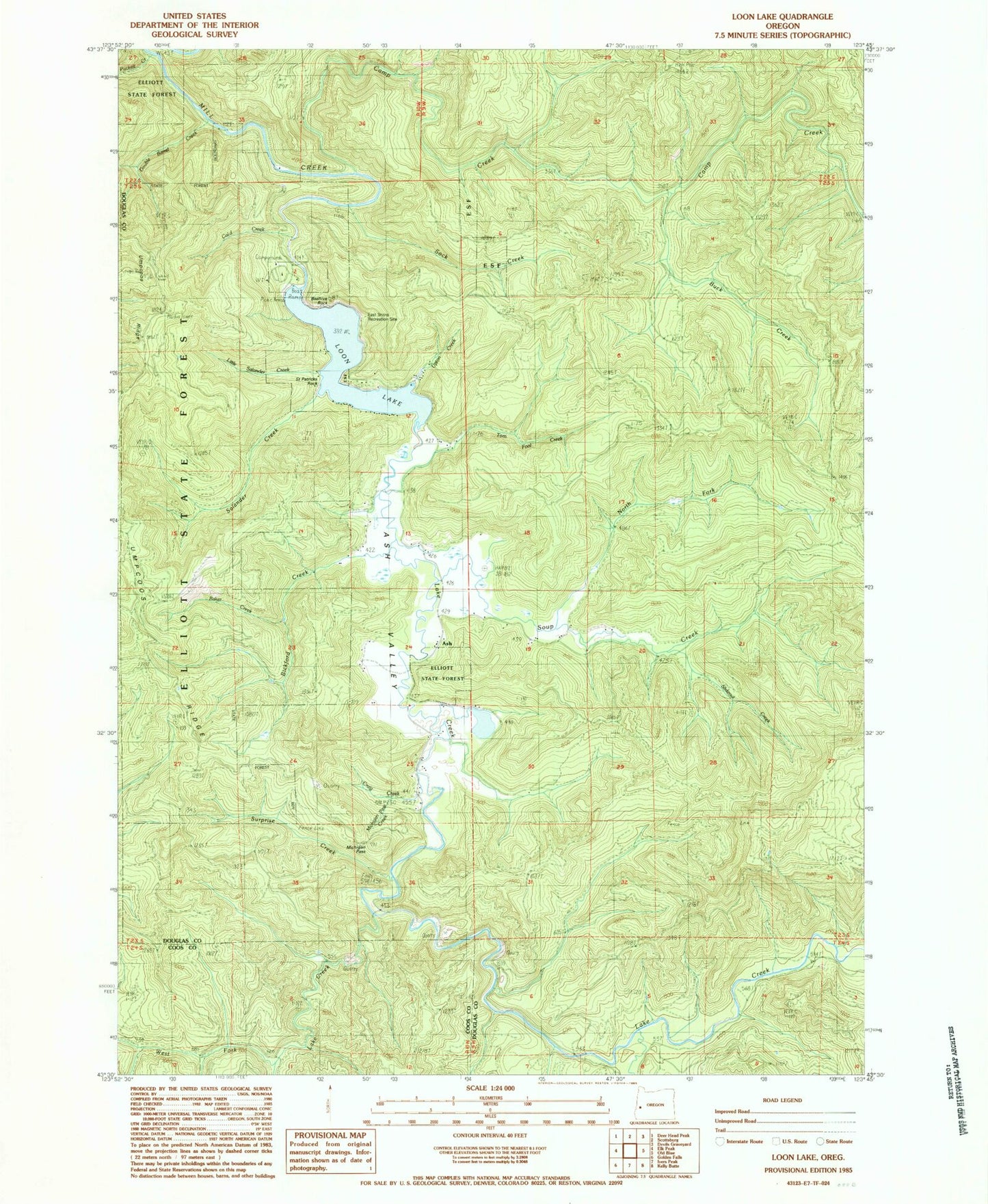
Classic USGS Loon Lake Oregon 7.5'x7.5' Topo Map
Couldn't load pickup availability
Historical USGS topographic quad map of Loon Lake in the state of Oregon. Map scale may vary for some years, but is generally around 1:24,000. Print size is approximately 24" x 27"
This quadrangle is in the following counties: Coos, Douglas.
The map contains contour lines, roads, rivers, towns, and lakes. Printed on high-quality waterproof paper with UV fade-resistant inks, and shipped rolled.
Contains the following named places: Ash, Ash Post Office, Ash Valley, Baker Creek, Beehive Rock, Bickford Creek, Buck Creek, Bureau of Land Management Loon Lake Recreation Park Field Office, Camp Creek, Craig Creek, Double Barrel Creek, East Shore Recreation Site, Kelly Creek, Lake Creek, Little Salander Creek, Loon Lake, Loon Lake East Shore Boat Ramp, Loon Lake Recreation Area, Loon Lake Resort Boat Ramp, Michigan Pass, Michigan Pass Creek, North Fork Soup Creek, Platinum Falls, Pucket Creek, Saint Patricks Rock, Salander Creek, Slideout Creek, Sock Creek, Soup Creek, Surprise Creek, Tom Fool Creek, Upton Creek, West Fork Lake Creek