MyTopo
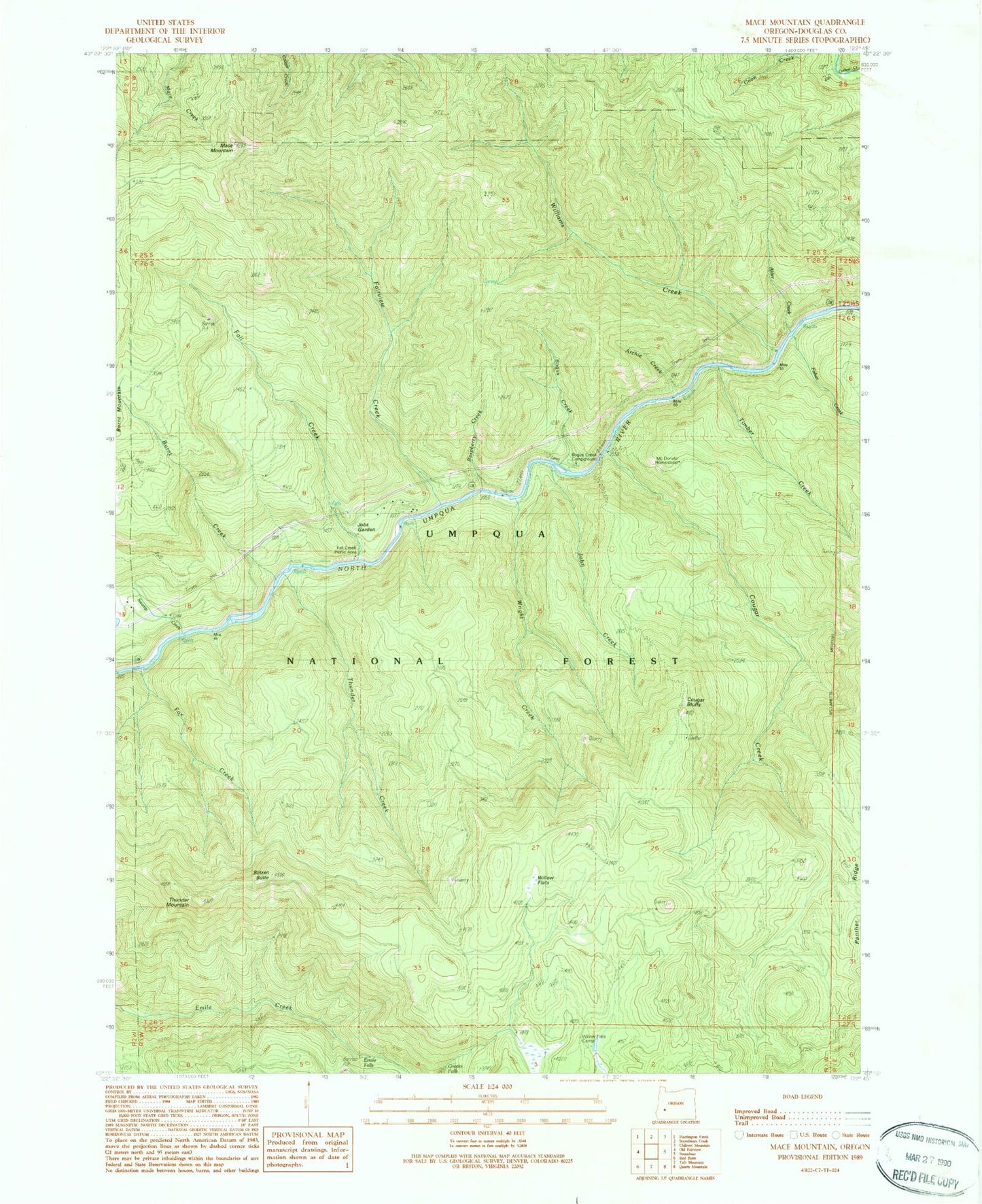
Classic USGS Mace Mountain Oregon 7.5'x7.5' Topo Map
Couldn't load pickup availability
Historical USGS topographic quad map of Mace Mountain in the state of Oregon. Map scale may vary for some years, but is generally around 1:24,000. Print size is approximately 24" x 27"
This quadrangle is in the following counties: Douglas.
The map contains contour lines, roads, rivers, towns, and lakes. Printed on high-quality waterproof paper with UV fade-resistant inks, and shipped rolled.
Contains the following named places: Alder Creek, Archie Creek, Blitzen Butte, Bogus Creek, Bogus Creek Recreation Site, Burnt Creek, Cougar Bluffs, Cougar Creek, Emile Falls, Fairview Creek, Fall Creek, Fall Creek Recreation Site, Fisher Creek, Fox Creek, Gobblers Knob, Grotto Falls, Jobs Garden, John Creek, Mace Mountain, Mott Trail, Raspberry Creek, Swamp Creek, Thunder Creek, Thunder Mountain, Thunder Mountain Trail, Timber Creek, Williams Creek, Williams Creek Recreation Site, Williams Creek Trail, Willow Flats, Willow Flats Recreation Site, Wright Creek