MyTopo
Classic USGS Middle Dam Maine 7.5'x7.5' Topo Map
Couldn't load pickup availability
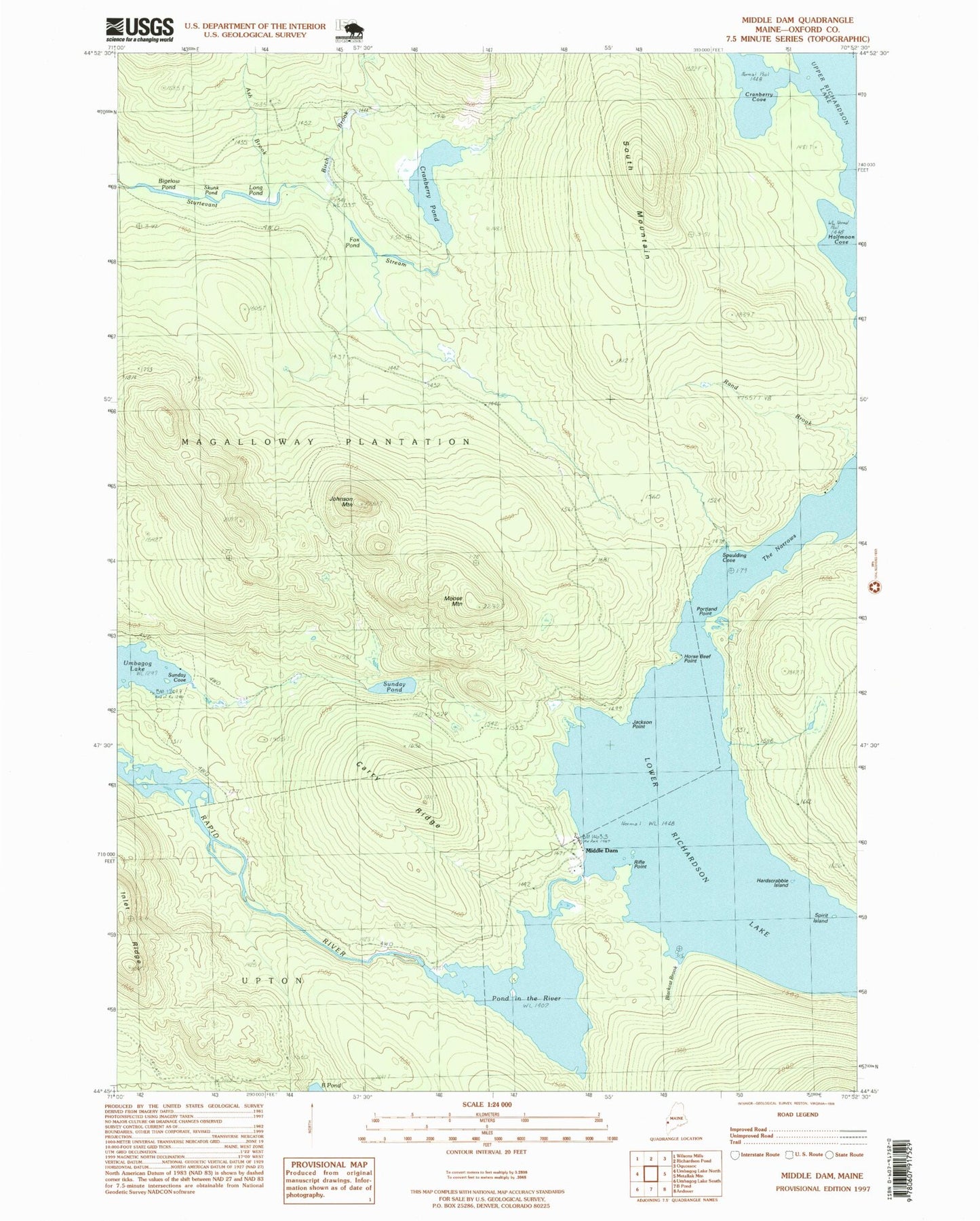
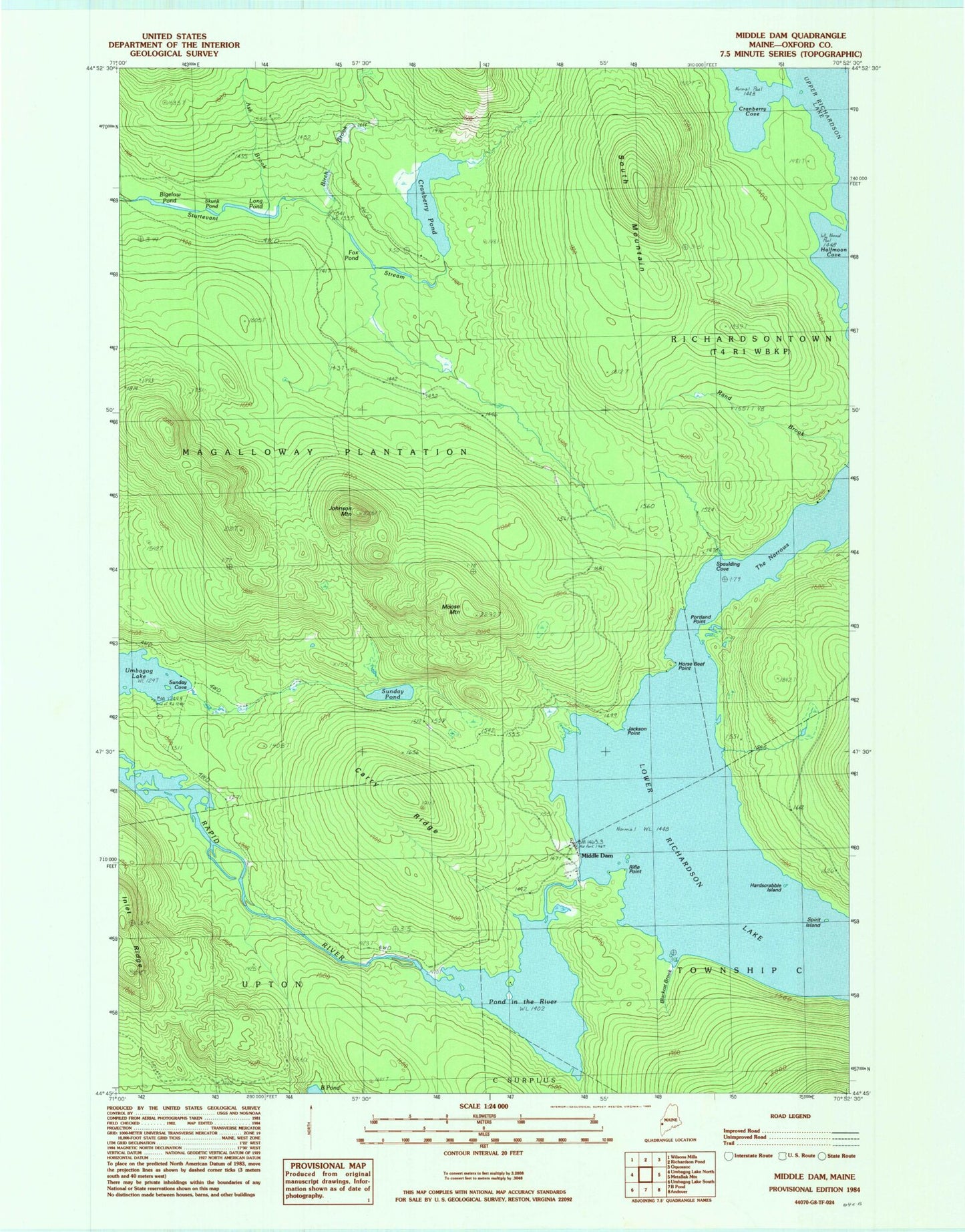
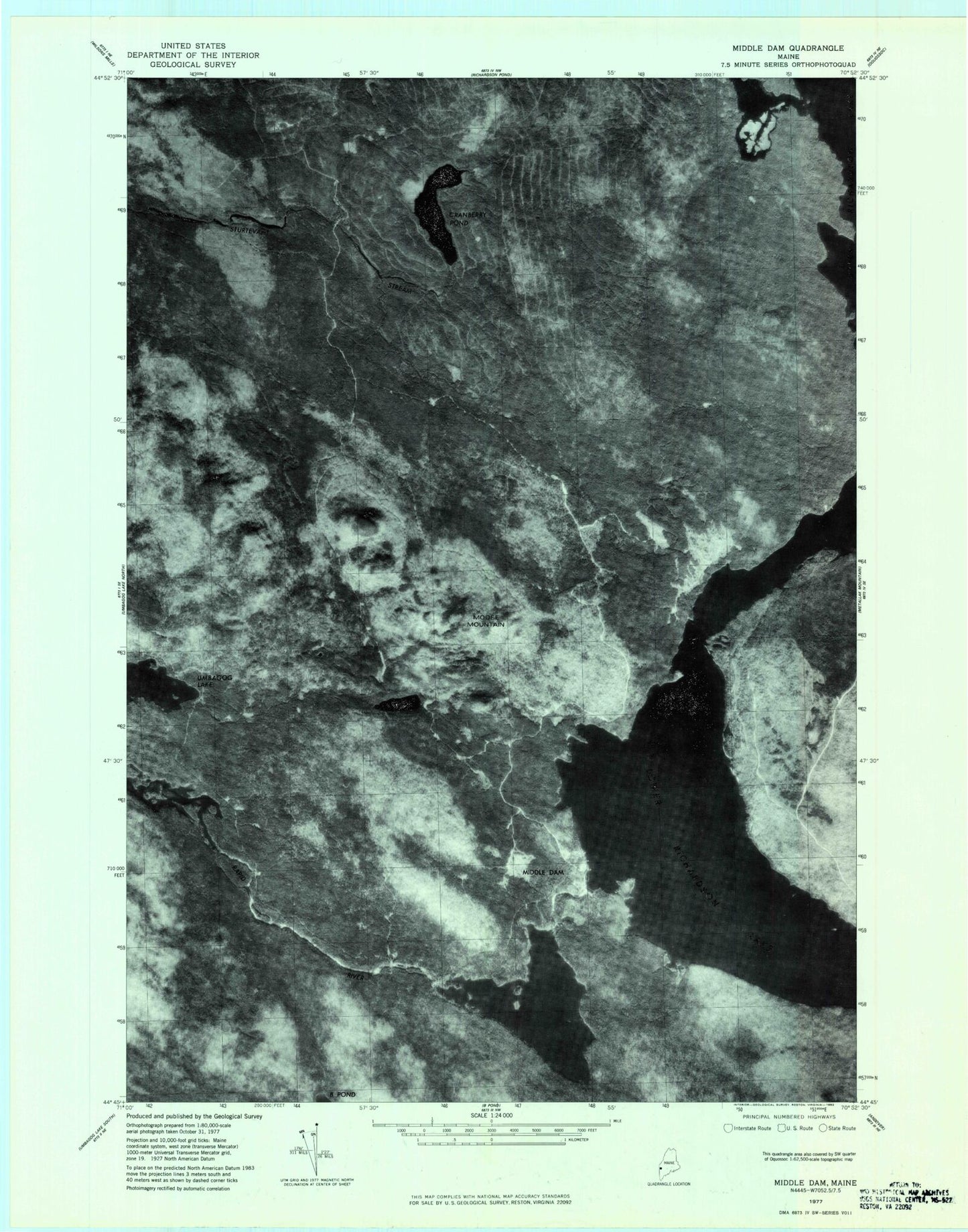
Historical USGS topographic quad map of Middle Dam in the state of Maine. Typical map scale is 1:24,000, but may vary for certain years, if available. Print size: 24" x 27"
This quadrangle is in the following counties: Oxford.
The map contains contour lines, roads, rivers, towns, and lakes. Printed on high-quality waterproof paper with UV fade-resistant inks, and shipped rolled.
Contains the following named places: Ash Brook, Bigelow Pond, Birch Brook, Blackcat Brook, Carry Ridge, Cranberry Cove, Cranberry Pond, Fox Pond, Halfmoon Cove, Hardscrabble Island, Horse Beef Point, Inlet Ridge, Jackson Point, Johnson Mountain, Long Pond, Lower Richardson Lake, Middle Dam, Moose Mountain, Old Magalloway Trail, Pond in the River, Portland Point, Rand Brook, Rifle Point, Skunk Pond, South Mountain, Spaulding Cove, Spirt Island, Sunday Pond, The Narrows, Plantation of Magalloway, Middle Dam, Richardson Lake, Ash Brook, Bigelow Pond, Birch Brook, Blackcat Brook, Carry Ridge, Cranberry Cove, Cranberry Pond, Fox Pond, Halfmoon Cove, Hardscrabble Island, Horse Beef Point, Inlet Ridge, Jackson Point, Johnson Mountain, Long Pond, Lower Richardson Lake, Middle Dam, Moose Mountain, Old Magalloway Trail, Pond in the River, Portland Point, Rand Brook, Rifle Point, Skunk Pond, South Mountain, Spaulding Cove, Spirt Island, Sunday Pond, The Narrows, Plantation of Magalloway, Middle Dam, Richardson Lake