MyTopo
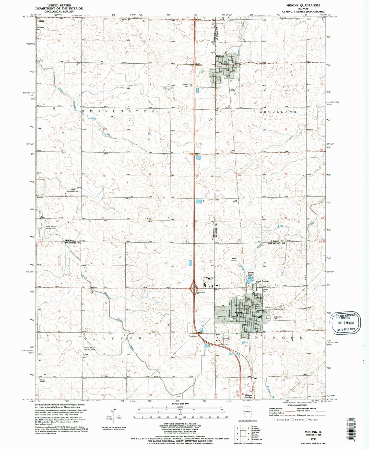
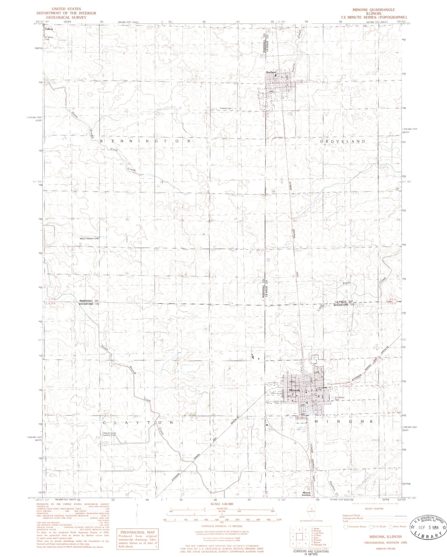
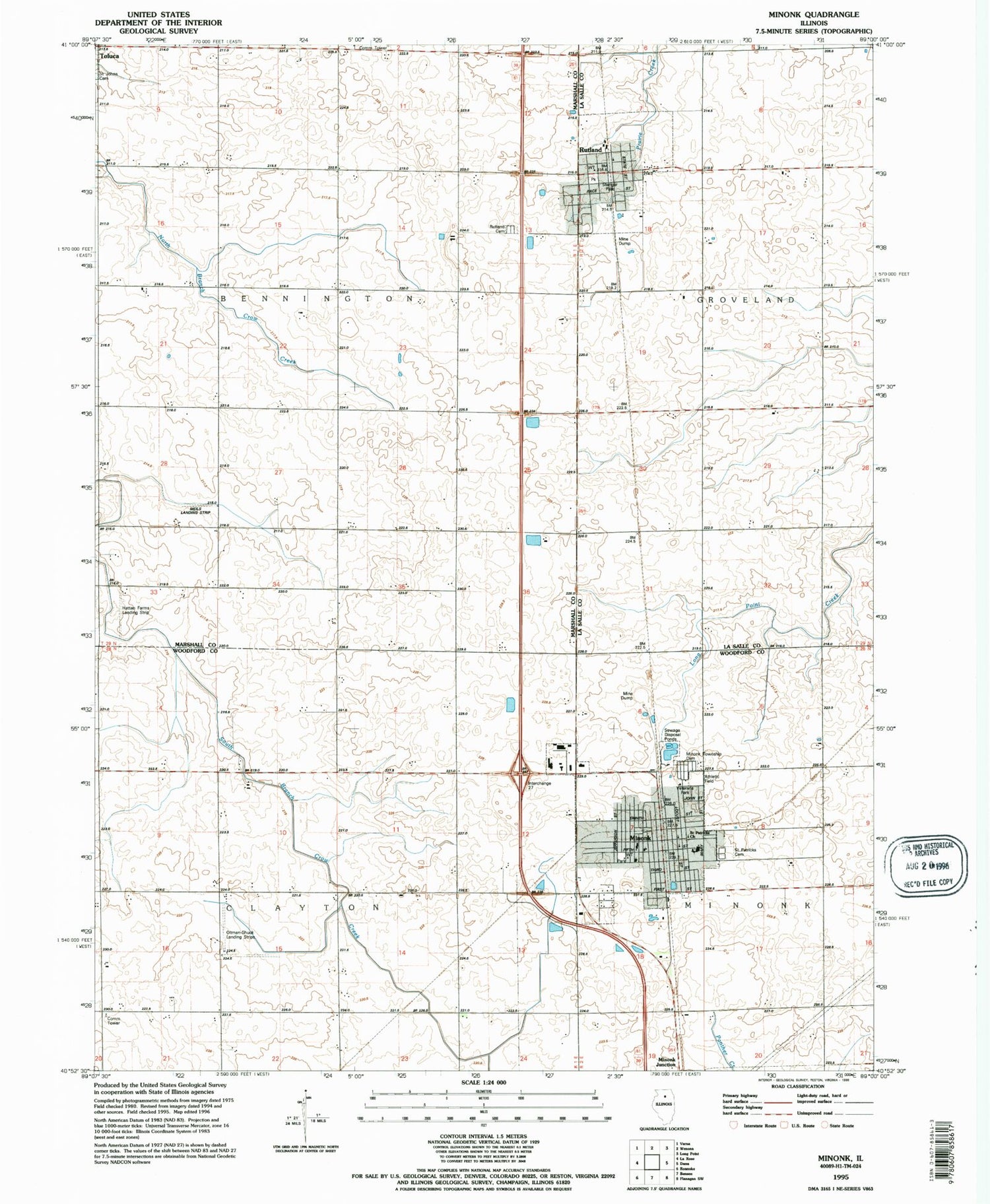
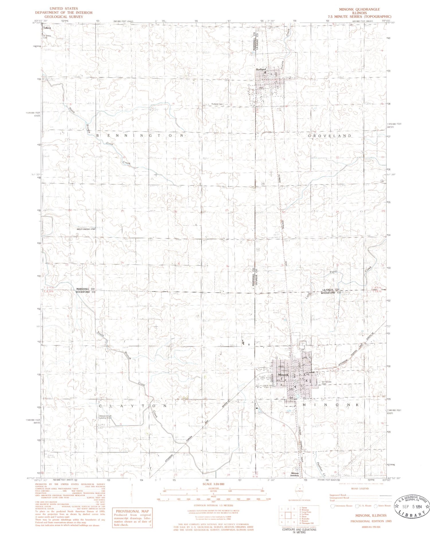
Classic USGS Minonk Illinois 7.5'x7.5' Topo Map
Couldn't load pickup availability
Historical USGS topographic quad map of Minonk in the state of Illinois. Map scale may vary for some years, but is generally around 1:24,000. Print size is approximately 24" x 27"
This quadrangle is in the following counties: LaSalle, Marshall, Woodford.
The map contains contour lines, roads, rivers, towns, and lakes. Printed on high-quality waterproof paper with UV fade-resistant inks, and shipped rolled.
Contains the following named places: City of Minonk, Fieldcrest Elementary School-South, Fieldcrest High School, Hattan Farms Airport, Immanuel Lutheran Church, John W Meils RLA Airport, Minonk, Minonk Baptist Church, Minonk Emergency Squad, Minonk Fire Protection District, Minonk Police Department, Minonk Post Office, Minonk Township Cemetery, Oltman-Shuck Airport, Rutland, Rutland Cemetery, Rutland Fire Protection District, Rutland Post Office, Saint Patrick Cemetery, Saint Patrick Church, Saint Patricks School, Saint Pauls United Church of Christ, Township of Bennington, Township of Clayton, United Methodist Church of Minonk, Village of Rutland, ZIP Codes: 61358, 61760