MyTopo
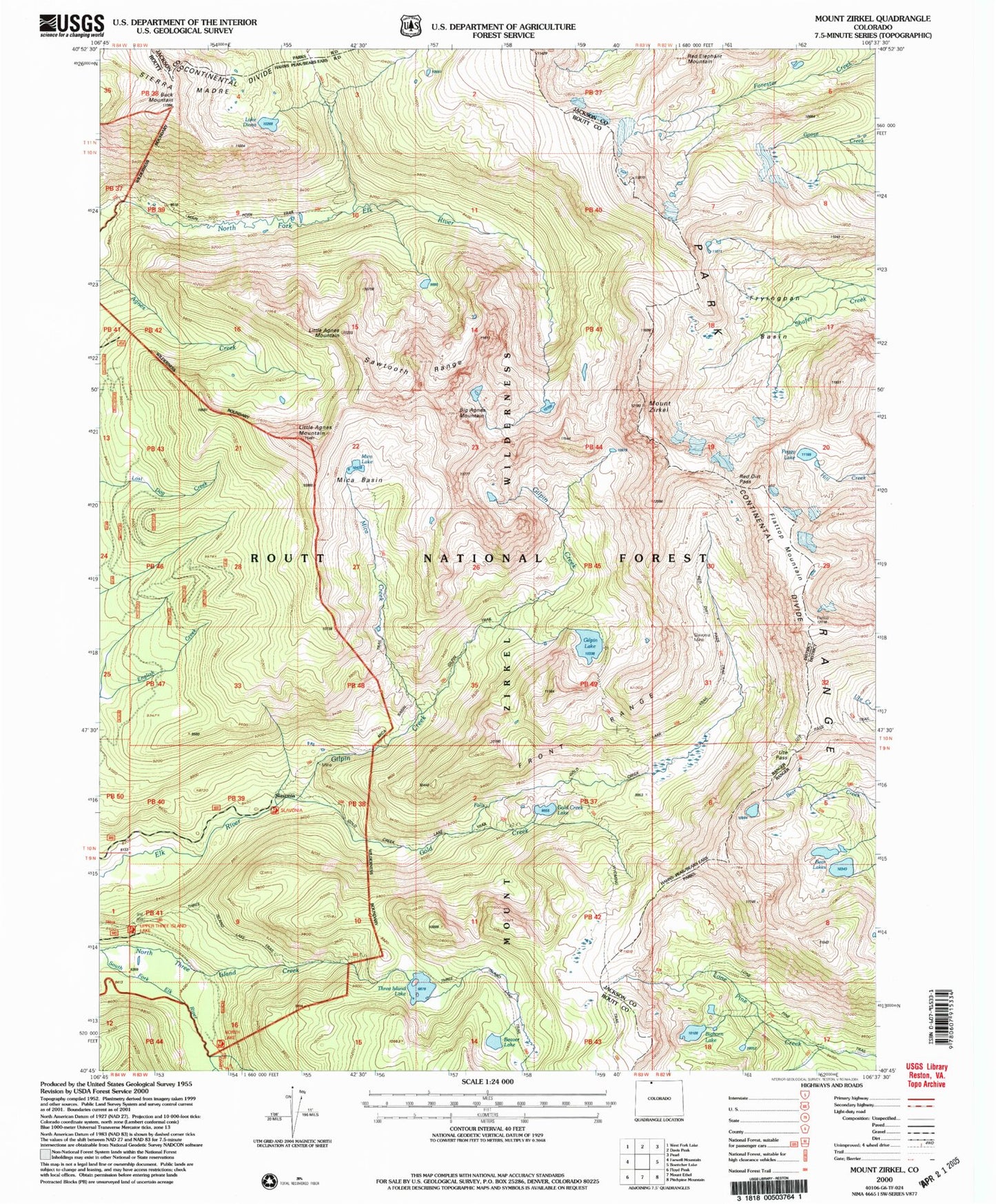
USGS Classic Mount Zirkel Colorado 7.5'x7.5' Topo Map
Couldn't load pickup availability
Historical USGS topographic quad map of Mount Zirkel in the state of Colorado. Scale: 1:24000. Print size: 24" x 27"
This quadrangle is in the following counties: Jackson, Routt.
The map contains contour lines, roads, rivers, towns, lakes, and grids including latitude / longitude and UTM / MGRS. Printed on high-quality waterproof paper with UV fade-resistant inks.
Contains the following named places: Mount Zirkel Wilderness, North Fork Poudre Campground, Lake Diana, Three Island Lake, Gold Creek Lake, Gilpin Trail, Upper Slavonia Mine, Beaver Lake, Bighorn Lake, Bear Lakes, Fryingpan Basin, Flattop Mountain, Mica Creek, Ute Pass, Peggy Lake, Mount Zirkel, Big Agnes Mountain, Mica Lake, Mica Basin, Little Agnes Mountain, Sawtooth Range, Gilpin Lake, Gilpin Creek, Gold Creek, Swamp Park, Lower Slavonia Mine, Slavonia, Red Dirt Pass Trail, Encampment Meadows, Buck Mountain, Lone Pine Trail, Mica Basin Trail, Three Island Lake Trail, Slavonia Mine