MyTopo
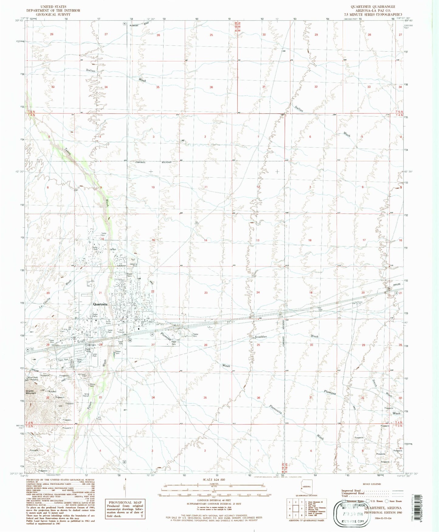
Classic USGS Quartzsite Arizona 7.5'x7.5' Topo Map
Couldn't load pickup availability
Historical USGS topographic quad map of Quartzsite in the state of Arizona. Typical map scale is 1:24,000, but may vary for certain years, if available. Print size: 24" x 27"
This quadrangle is in the following counties: La Paz.
The map contains contour lines, roads, rivers, towns, and lakes. Printed on high-quality waterproof paper with UV fade-resistant inks, and shipped rolled.
Contains the following named places: Hi Jolly Monument, La Cholla Wash, Plomosa Wash, Plomosita Wash, Quartzsite, Scaddan Wash, Smith Wash, Quartzsite Airport (historical), Quartzsite Elementary School, La Posa Long-Term Visitor Area, Arizona Highway Maintenance Yard - Quartzsite, KBUX-FM (Quartzsite), Fly-in Picnic Grounds Airport (historical), Ora Acres Airport (historical), Town of Quartzsite, Scholars Academy, Quartzsite Public Library, Quartzite Town Hall, Town of Quartzsite Wastewater Reclamation Facility, Crawfords Trailer Park, Coyote Pass Recreational Vehicle Park, Mountain Quail Mobile Home Park, 88 Shades Recreational Vehicle Park, Arizona Sun Recreational Vehicle Resort, Covenant Lutheran Church, First Baptist Church of Quartzite, Quartzsite Alliance Church, Quartzsite Community Bible Church, Quartzsite Southern Baptist Church, Queen of Peace Catholic Church, Quartzsite Fire and Rescue Department, Quartzsite Police Department, Quartzsite Post Office, Hi Jolly Cemetery