MyTopo
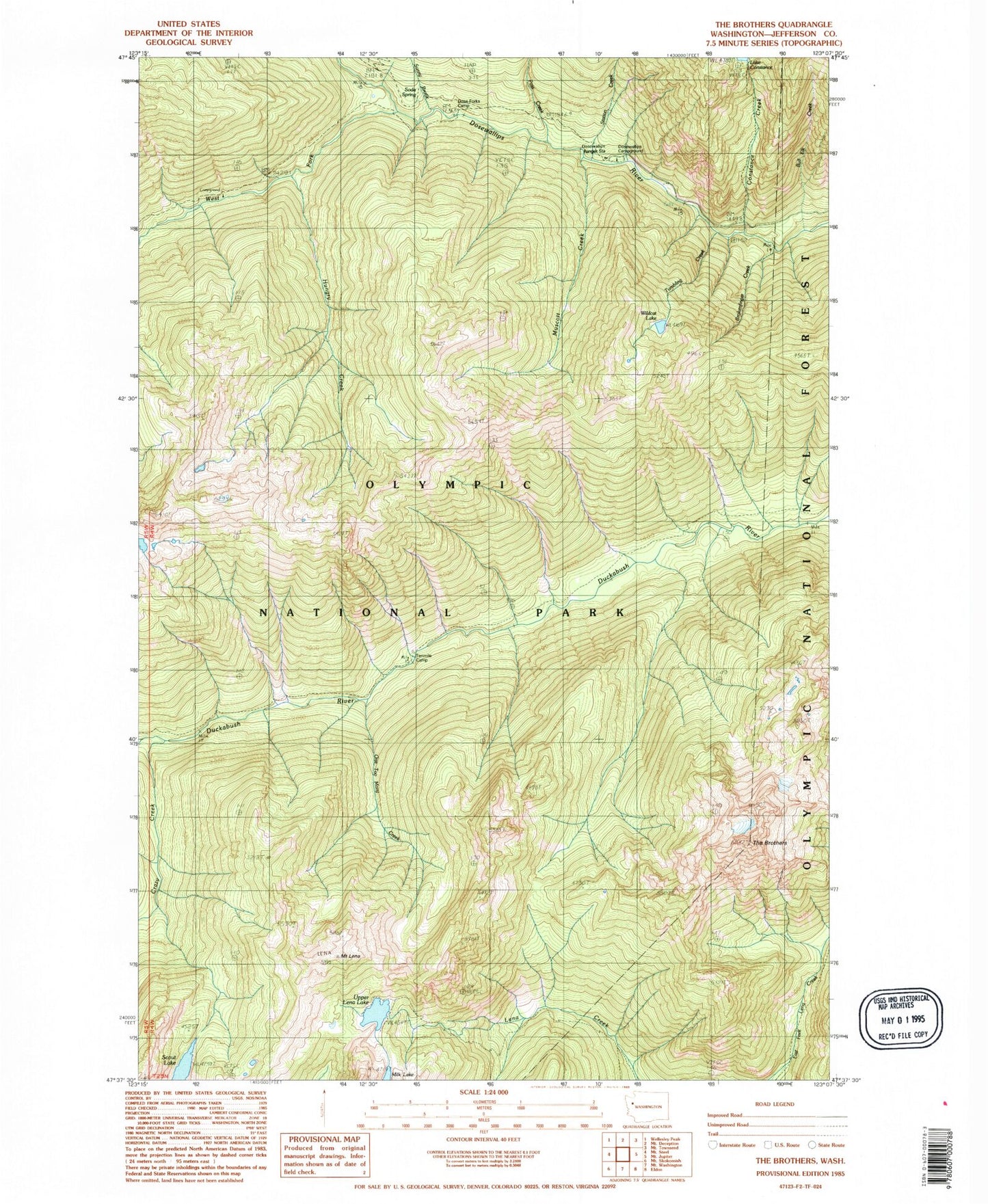
Classic USGS The Brothers Washington 7.5'x7.5' Topo Map
Couldn't load pickup availability
Historical USGS topographic quad map of The Brothers in the state of Washington. Typical map scale is 1:24,000, but may vary for certain years, if available. Print size: 24" x 27"
This quadrangle is in the following counties: Jefferson.
The map contains contour lines, roads, rivers, towns, and lakes. Printed on high-quality waterproof paper with UV fade-resistant inks, and shipped rolled.
Contains the following named places: Brokenfinger Creek, Bull Elk Canyon, Dosewallips Campground, Constance Creek, Crazy Creek, Dose Forks Camp, Hungry Creek, Mount Lena, Muscott Creek, One Too Many Creek, Pass Creek, Scout Lake, Soda Springs, Station Creek, Sunny Brook, Tenmile Camp, The Brothers, Tumbling Creek, West Fork Dosewallips River, Wildcat Lake, Bull Elk Creek, Dosewallips Ranger Station, Upper Lena Lake