MyTopo
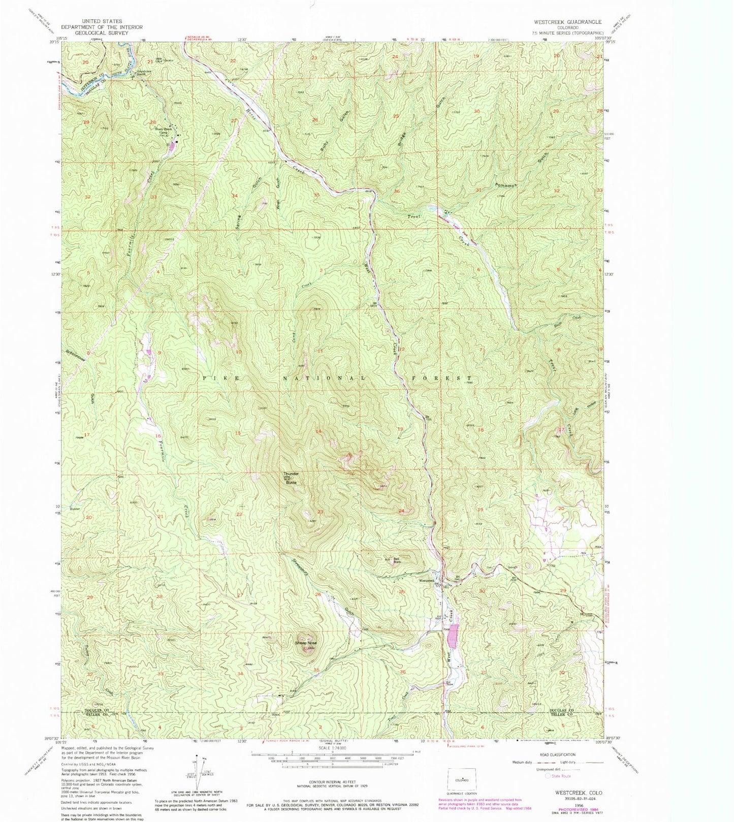
Classic USGS Westcreek Colorado 7.5'x7.5' Topo Map
Couldn't load pickup availability
Historical USGS topographic quad map of Westcreek in the state of Colorado. Typical map scale is 1:24,000, but may vary for certain years, if available. Print size: 24" x 27"
This quadrangle is in the following counties: Douglas, Jefferson, Teller.
The map contains contour lines, roads, rivers, towns, and lakes. Printed on high-quality waterproof paper with UV fade-resistant inks, and shipped rolled.
Contains the following named places: Trout Creek, Trail Creek, West Creek, Fourmile Creek, Shady Brook Camp, Fletcher Ranch, Grandview Resort, Spring Gulch, Wren Gulch, Ruby Gulch, Bridge Gulch, Saddle String Ranch, Polhemus Gulch, Long Hollow, Eagle Creek, Camp Creek, Thunder Butte, Pollock Ranch, Deluna Ranch, Sheep Nose, Bell Rock, Westcreek Lake (historical), Westcreek, Shrewsbury Gulch, Orion Ranch, J O Hill Dam, J O Hill Reservoir, West Creek Dam, Mountain Communities Fire Protection District Westcreek Station, Westcreek Census Designated Place