MyTopo
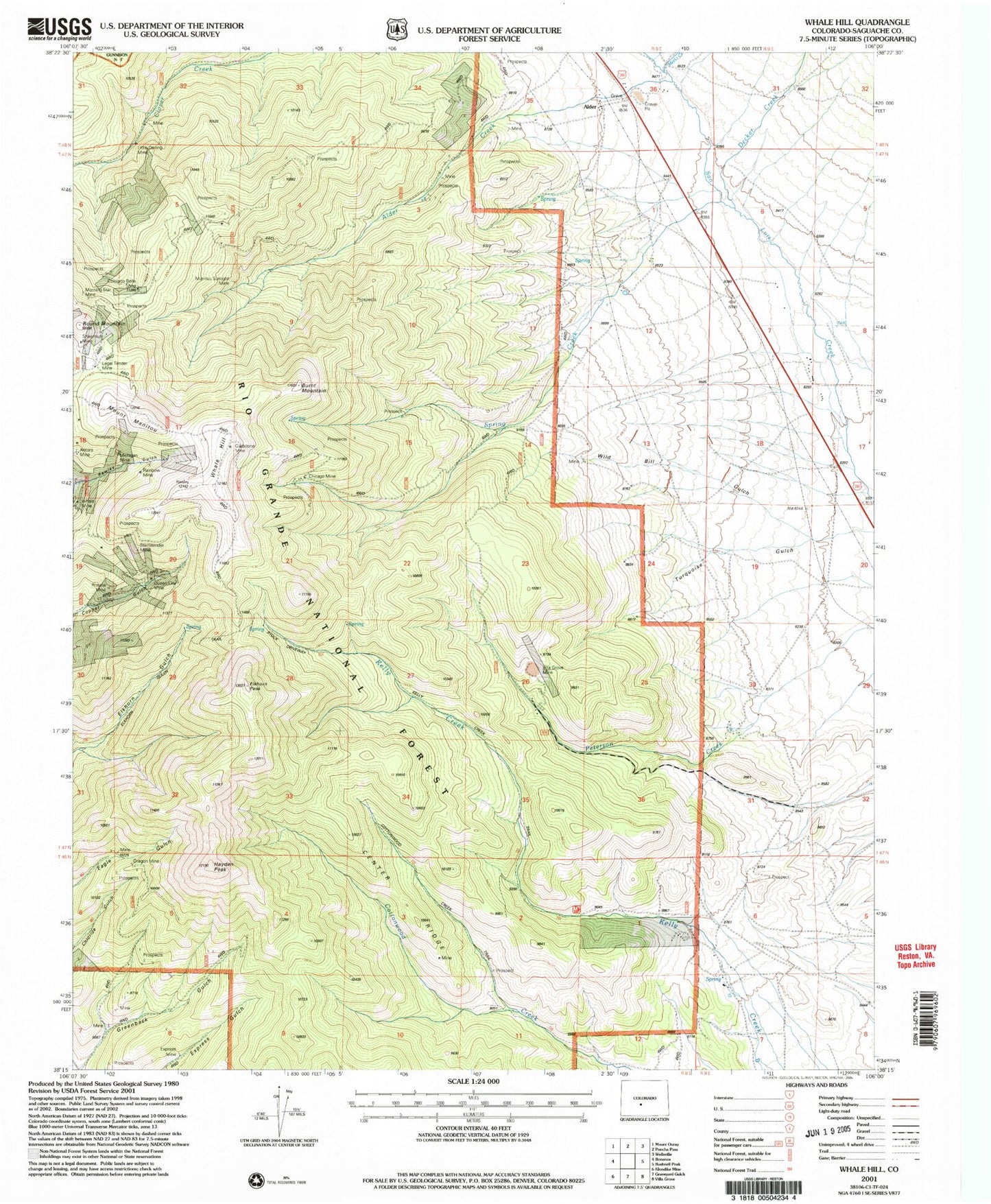
Classic USGS Whale Hill Colorado 7.5'x7.5' Topo Map
Couldn't load pickup availability
Historical USGS topographic quad map of Whale Hill in the state of Colorado. Map scale may vary for some years, but is generally around 1:24,000. Print size is approximately 24" x 27"
This quadrangle is in the following counties: Saguache.
The map contains contour lines, roads, rivers, towns, and lakes. Printed on high-quality waterproof paper with UV fade-resistant inks, and shipped rolled.
Contains the following named places: Ajax Mine, Alder, Alder Creek, Antoro Tunnel, Burnt Mountain, Center Ridge, Chicago Mine, Clover Creek District Mine, Colorado Belle Mine, Davidson Ranch, Decker Creek, Elkhorn Peak, Express Mine, Gladstone Shaft, Great Mogul Mine, Greenback Gulch, Hall Turquoise Mine, Hayden Peak, Hornet Manganese Mine, Joe Wheeler Mine, Legal Tender Mine, Little Darling Mine, Little Manitou Mine, Manitou Sunlight Mine, Merkt Creek, Michigan Shaft, Morning Star Mine, Mount Manitou, Oregon Mine, Oregon Tunnel, Queen City Mine, Rainbow Mine, Rosalie Mine, Round Mountain, Round Mountain Trail, Shawmut Mine, Spring Creek, Stemwinder Minne, Turquoise Gulch, Villa Grove Mine, Whale Hill, Wild Bill Gulch, Zero Tunnel Mine, ZIP Code: 81155