MyTopo
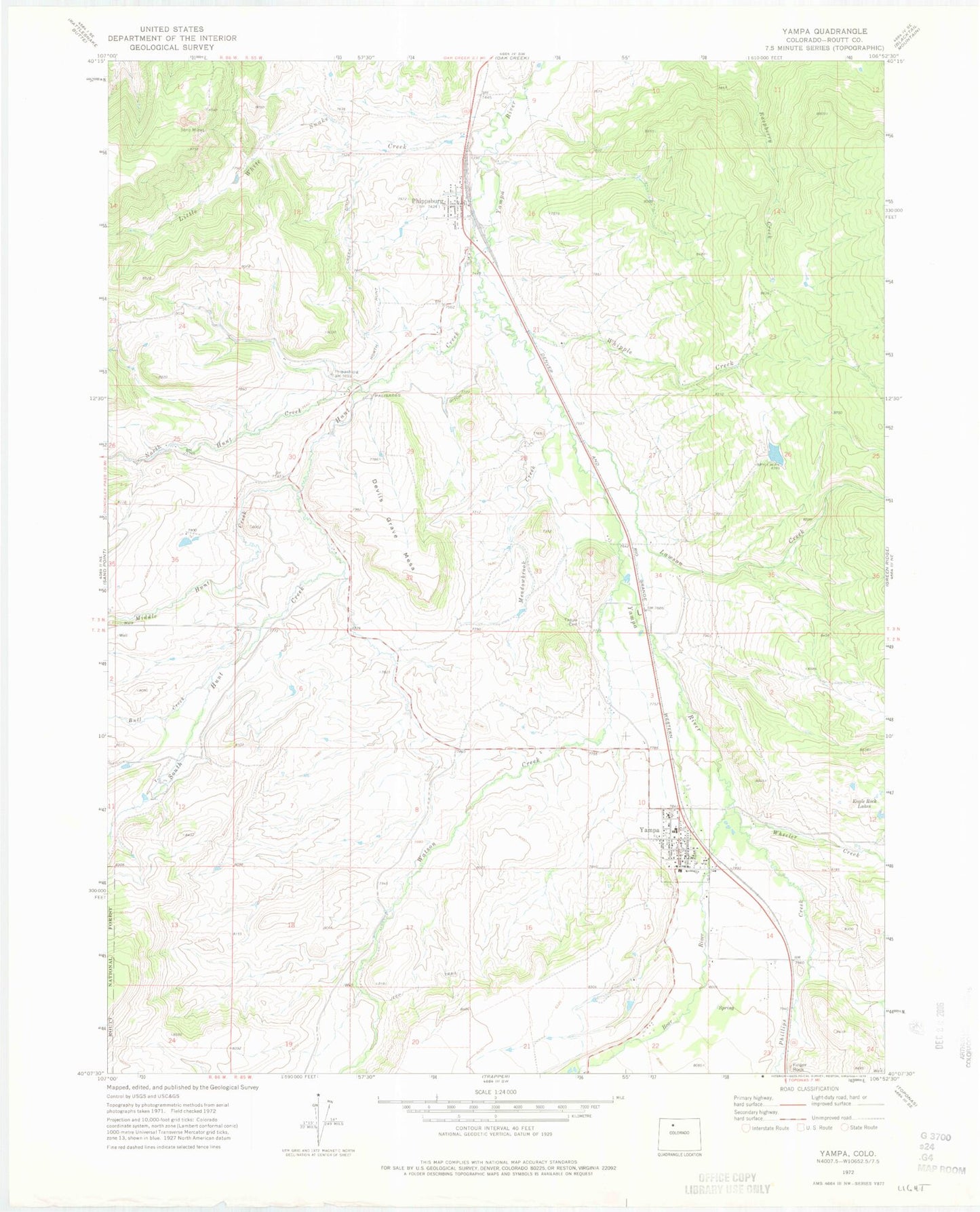
Classic USGS Yampa Colorado 7.5'x7.5' Topo Map
Couldn't load pickup availability
Historical USGS topographic quad map of Yampa in the state of Colorado. Map scale may vary for some years, but is generally around 1:24,000. Print size is approximately 24" x 27"
This quadrangle is in the following counties: Routt.
The map contains contour lines, roads, rivers, towns, and lakes. Printed on high-quality waterproof paper with UV fade-resistant inks, and shipped rolled.
Contains the following named places: Bull Creek, Burnt Mesa Ditch, Devils Grave Mesa, Eagle Rock Lakes, Finger Rock, Hunt Creek, KFMU-FM (Oak Creek), Lawson Creek, Little White Snake Creek, Meadowbrook Creek, Middle Hunt Creek, North Hunt Creek, North Hunt Creek Ditch, Palisades Ditch, Phillips Creek, Phippsburg, Phippsburg Census Designated Place, Phippsburg Heliport, Phippsburg Post Office, Seven Points Pit, South Hunt Creek, Town of Yampa, Watson Creek, Wheeler Creek, Whipple Creek, Whiteley-Nelson Dam, Whiteley-Nelson Reservoir, Yampa, Yampa Cemetery, Yampa Fire Protection District, Yampa Post Office, ZIP Code: 80469