MyTopo
Cordova C-5 SW Alaska US Topo Map
Couldn't load pickup availability
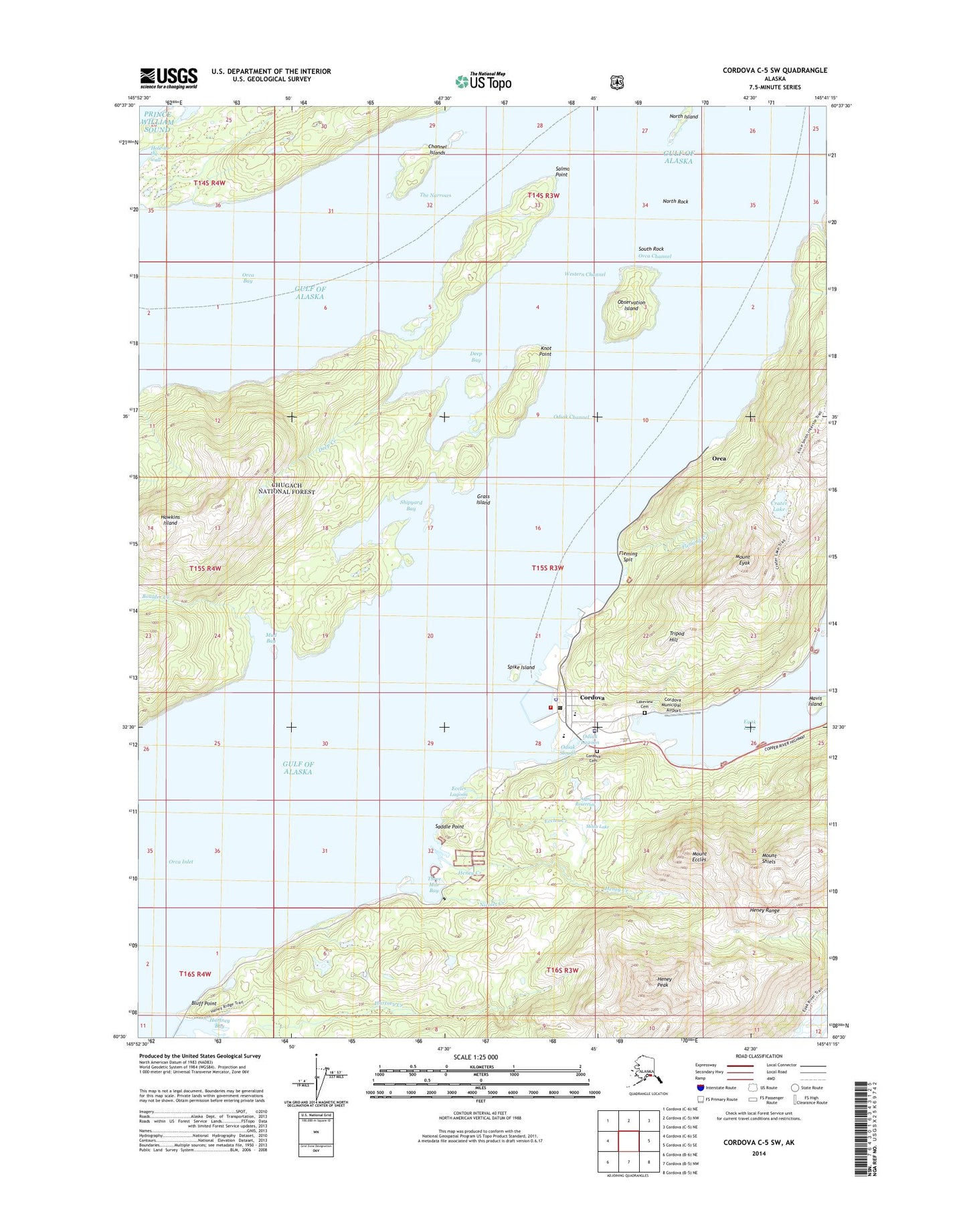
2014 topographic map quadrangle Cordova C-5 SW in the state of Alaska. Scale: 1:25000. Print Size: 24" x 29"
Based on the newly updated USGS 7.5' US Topo series, this map has UTM / MGRS grids and is in the following counties: Valdez-Cordova (CA).
The map contains contour data, water features, and other items you are used to seeing on U.S. Geological Survey maps, but also has updated roads and other features. This is the next generation of topographic maps. Printed on high-quality waterproof paper with UV fade-resistant inks.
Contains the following named places: Deep Creek, Orca Channel, Orca Inlet, Saddle Point, Salmo Point, Mount Shiels, Shipyard Bay, South Rock, Spike Island, The Narrows, Three Mile Bay, Tripod Hill, Western Channel, Odiak Lagoon, Meals Lake Dam, Meals Lake, Apw Dam Number 1, APW Reservoir, APW Dam Number 2, Cordova Municipal Airport, Cordova Municipal Airport, KLAM-AM (Cordova), Bluff Point, Boulder Creek, Channel Islands, Cordova, Crater Lake, Deep Bay, Eccles Creek, Eccles Lagoon, Mount Eccles, Mount Eyak, Fleming Creek, Fleming Spit, Grass Island, Hartney Creek, Heney Creek, Heney Peak, Hole-in-the-wall, Knot Point, Mavis Island, Mud Bay, Nicolet Creek, North Island, North Rock, Observation Island, Odiak Channel, Odiak Slough, Orca, Cordova Volunteer Fire Department, Cordova Community Medical Center, Cordova Public Health Center, Native Village of Eyak / Chugachmiut Tribal Organization - Ilanka Community Health Center, Cordova Emergency Medical Services, Cordova Post Office, Alaska State Troopers Cordova, Cordova Police Department, Cordova Cemetery, Lakeview Cemetery