MyTopo
Wallace Lake Louisiana US Topo Map
Couldn't load pickup availability
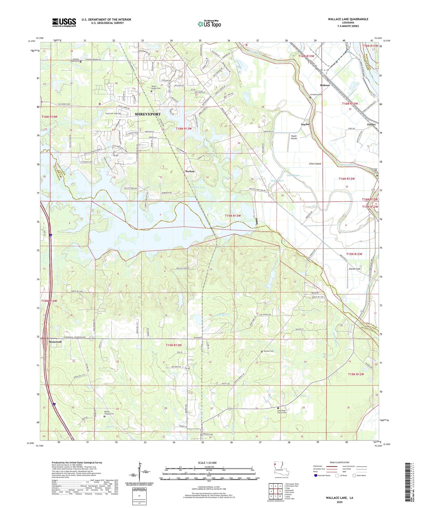
2020 topographic map quadrangle Wallace Lake in the state of Louisiana. Scale: 1:24000. Based on the newly updated USGS 7.5' US Topo map series, this map is in the following counties: De Soto, Caddo, Bossier. The map contains contour data, water features, and other items you are used to seeing on USGS maps, but also has updated roads and other features. This is the next generation of topographic maps. Printed on high-quality waterproof paper with UV fade-resistant inks.
Quads adjacent to this one:
West: Stonewall
Northwest: Shreveport West
North: Shreveport East
Northeast: Sligo
East: Elm Grove
Southeast: Clear Lake
South: Holly
Southwest: Gloster
Contains the following named places: Antioch Cemetery, Aulds, B and S Landing, Bethel Church, Caddo Parish Fire District 5 Station 1, Chico Bayou, Chico Island, Daisy Grove School, De Broeck Landing, De Soto, Elizabeth Church, Ellerbe Field, Ellerbe Woods, Evergreen Church, Forbing Union Cemetery, Friendship Church, Frierson, Gandy Bayou, Gayles, Good Hope Church, Great Elizabeth Church, Heinsohns Airfield, Holy Angels School, Kelly Bayou, Kervin Branch, Leonard Chapel, Mary Evergreen Church, Mount Pleasant Church, Naylor, Naylor Airport, New Light Church, Norton, Palmer Landing, Parish Governing Authority District 9, Pleasant Hill Church, Ravenwood School, Robson, Saint Abraham Church, Saint Davis Church, Saint Elizabeth Church, Shadow Pine Estates, Shreveport Fire Department Station 22, Wallace Bayou, Wallace Lake, Wallace Lake Dam, Wildoak, ZIP Code: 71027