MyTopo
Biddeford Pool Maine US Topo Map
Couldn't load pickup availability
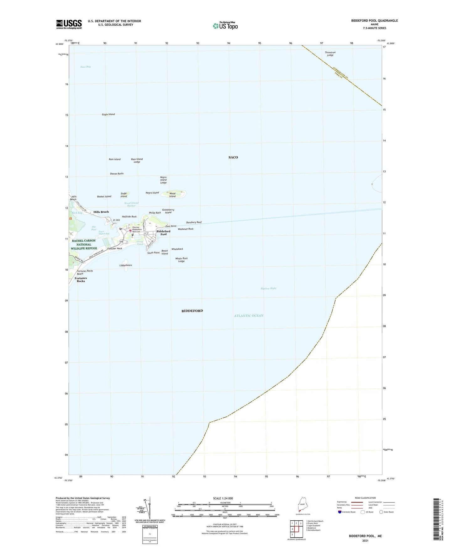
2021 topographic map quadrangle Biddeford Pool in the state of Maine. Scale: 1:24000. Based on the newly updated USGS 7.5' US Topo map series, this map is in the following counties: York, Cumberland. The map contains contour data, water features, and other items you are used to seeing on USGS maps, but also has updated roads and other features. This is the next generation of topographic maps. Printed on high-quality waterproof paper with UV fade-resistant inks.
Quads adjacent to this one:
West: Biddeford
Northwest: Old Orchard Beach
North: Prouts Neck
Northeast: Cape Elizabeth
Southwest: Kennebunkport
Contains the following named places: Abenakee Golf Club, Back Bay, Basket Island, Beach Island, Biddeford Fire Department Station 2, Biddeford Hills Beach Fire Station, Biddeford Pool, Biddeford Pool Post Office, Biddeford Pool Yacht Club, Dansbury Reef, Eagle Island, East Point, East Point Sanctuary, Fletcher Neck, Fort Hill, Fortunes Rocks Beach, Gooseberry Island, Great Pond, Halftide Rock, Hills Beach, Libbyshears, Marie Joseph Academy, Negro Island, Negro Island Ledge, Philip Rock, Ram Island, Ram Island Ledge, Saco Bay, Sharps Rocks, South Point, Stage Island, The Pool, Threetree Ledge, Town Thatch Bed, Washman Rock, Whale Rock Ledge, Whaleback, Winter Harbor Childrens House School, Wood Island, Wood Island Harbor, Wood Island Light Station, ZIP Code: 04006