MyTopo
Port Tobacco Maryland US Topo Map
Couldn't load pickup availability
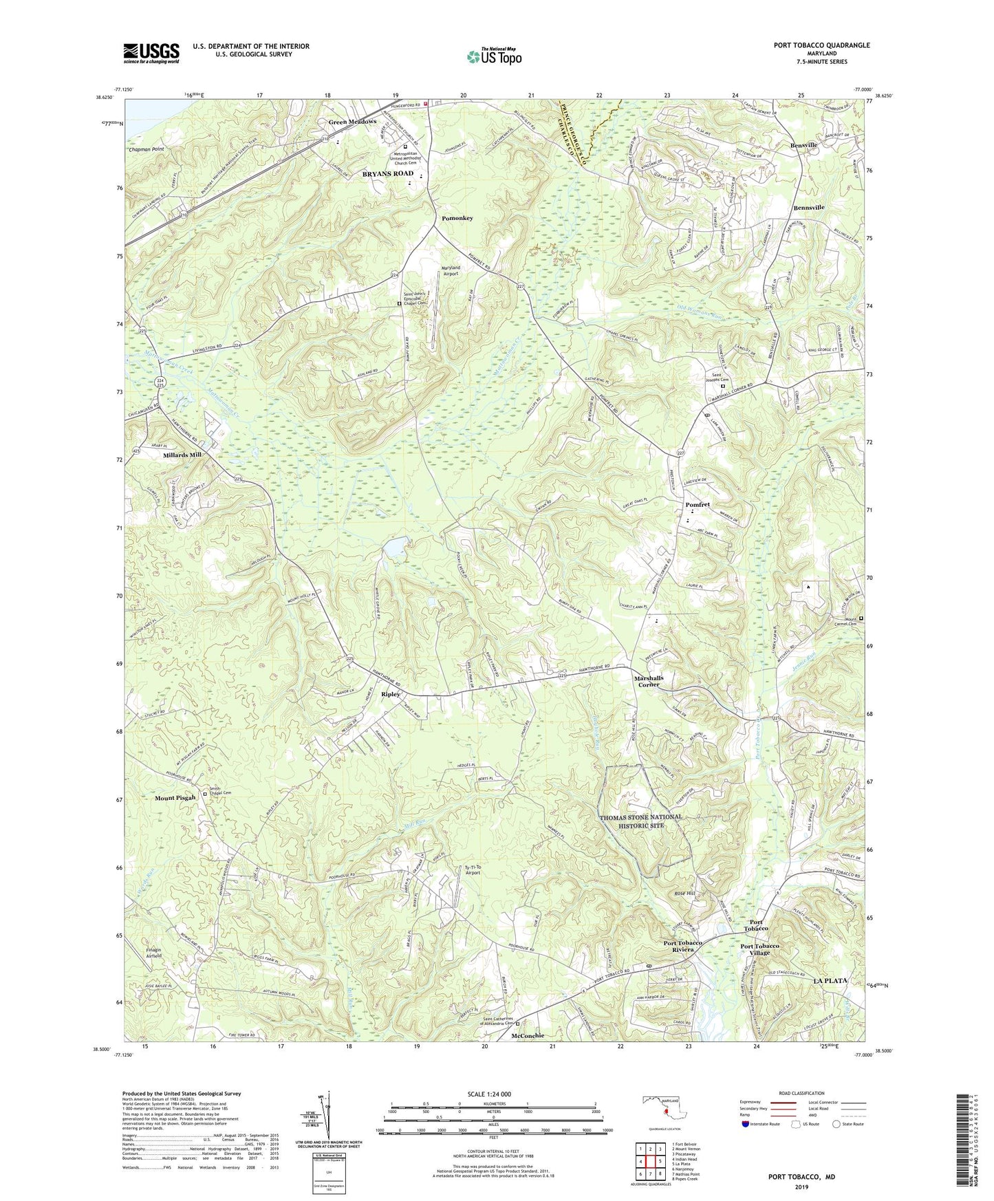
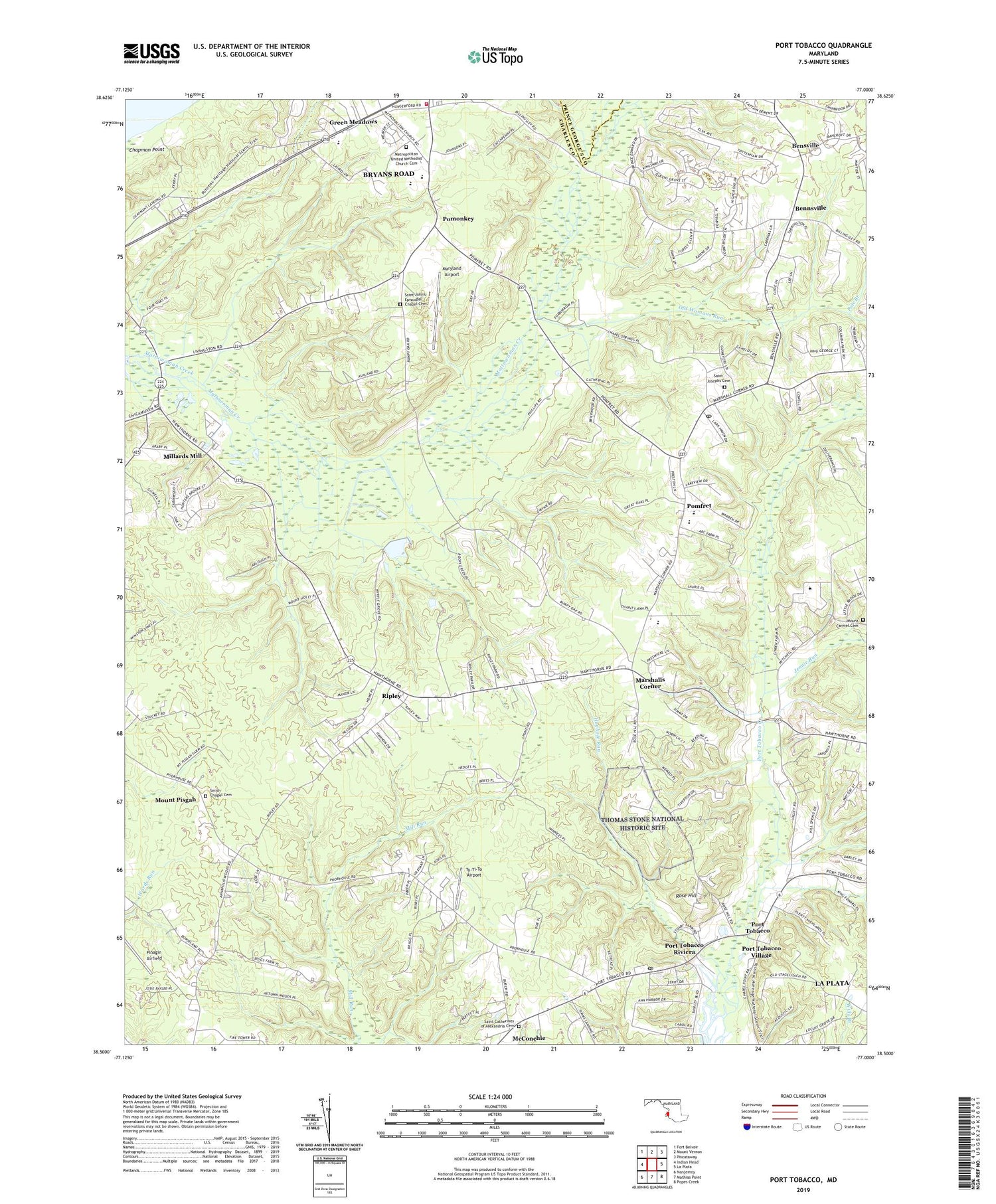
2019 topographic map quadrangle Port Tobacco in the state of Maryland. Scale: 1:24000. Based on the newly updated USGS 7.5' US Topo map series, this map is in the following counties: Charles, Prince George's. The map contains contour data, water features, and other items you are used to seeing on USGS maps, but also has updated roads and other features. This is the next generation of topographic maps. Printed on high-quality waterproof paper with UV fade-resistant inks.
Quads adjacent to this one:
West: Indian Head
Northwest: Fort Belvoir
North: Mount Vernon
Northeast: Piscataway
East: La Plata
Southeast: Popes Creek
South: Mathias Point
Southwest: Nanjemoy
Contains the following named places: Avon Crest, Bennsville, Bennsville Siding, Bensville Census Designated Place, Benville School, Billingsley Forest, Blessed Hope Baptist Church, Bryans Road Census Designated Place, Bryans Road Volunteer Fire Department and Rescue Squad, Buteaux Crossing, Caernarvon Woods, Camelot, Chapman Landing, Chapman Point, Charles County Community College, Charles County Museum, Charles County Public Library - Potomac Branch, Civista Health Center, Columbia Park, Countryside, District 7 Pomonkey, Doctor James Craik Elementary School, Ellerslie Heights, Finagin Airfield, Foxhall Estates, Freedom Village, Garden Estates, Graystone Estates, Green Meadows, Habre De Venture, Hawthorne, Hawthorne Country Club, Hawthorne Manor, Highland Estates, Hoghole Run, Horizon Center, J C Parks Elementary School, Jennie Run, King George Estates, Knotts Crossing, Laurel Acres, Marshalls Corner, Maryland Airport, Mason Springs, Mattawoman Wastewater Treatment Plant, Matthew Henson Middle School, Maurice J McDonough High School, McConchie, Metropolitan Church, Metropolitan United Methodist Church Cemetery, Millards Mill, Montrose, Mount Carmel, Mount Carmel Cemetery, Mount Carmel Estates, Mount Pisgah, Myrtle Grove Estates, Myrtle Grove Lake Dam, Myrtle Grove Wildlife Management Area, Nelson, Oakwood, Old Womans Run, Pole Branch, Pomfret, Pomfret Census Designated Place, Pomfret Estates, Pomfret Post Office, Pomfret Siding, Pomonkey, Pomonkey School, Port Tobacco, Port Tobacco Courthouse Historic Site, Port Tobacco Creek, Port Tobacco Hills, Port Tobacco Historic District, Port Tobacco Lakes, Port Tobacco Post Office, Port Tobacco Riviera, Port Tobacco School, Quiet Acres, Ripley, Robert D Stethem Educational Center, Robie Manor, Rose Hill, Saint Catherines of Alexandria Cemetery, Saint Johns Chapel, Saint John's Episcopal Chapel Cemetery, Saint Josephs Cemetery, Saint Josephs Church, Saint Katherines Church, Saint Marys Star of the Sea School, Shady Acres, Smith Chapel, Smith Chapel Cemetery, Tarrington Creek, Thomas Stone National Historic Site, Town of Port Tobacco Village, Twinbrook Estates, Ty-Ti-To Airport, Valley View, ZIP Codes: 20646, 20675