MyTopo
Dansville Michigan US Topo Map
Couldn't load pickup availability
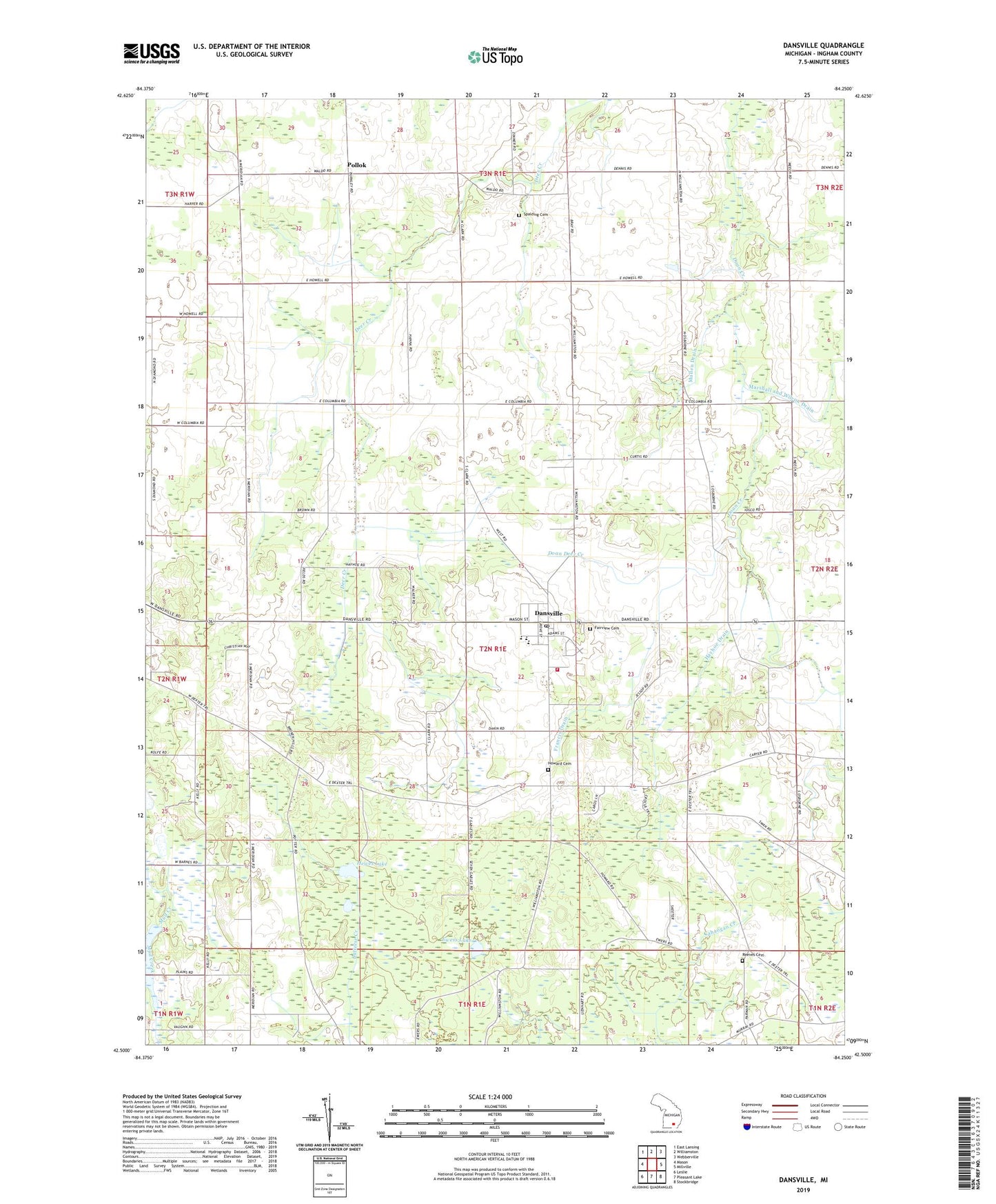
2019 topographic map quadrangle Dansville in the state of Michigan. Scale: 1:24000. Based on the newly updated USGS 7.5' US Topo map series, this map is in the following counties: Ingham. The map contains contour data, water features, and other items you are used to seeing on USGS maps, but also has updated roads and other features. This is the next generation of topographic maps. Printed on high-quality waterproof paper with UV fade-resistant inks.
Quads adjacent to this one:
West: Mason
Northwest: East Lansing
North: Williamston
Northeast: Webberville
East: Millville
Southeast: Stockbridge
South: Pleasant Lake
Southwest: Leslie
Contains the following named places: Brown Drain, Dansville, Dansville Baptist Church, Dansville Elementary School, Dansville Free Methodist Church, Dansville High School, Dansville Library, Dansville Middle School, Dansville Post Office, Dansville United Methodist Church, Doan Deer Creek, Ewers Lake, Fairview Cemetery, Francis Drain, Hayhoe Drain, Hewes Lake, Howard Cemetery, Ingham County, Ingham Township Fire Department, Marshall and Wilcox Drain, Miller Drain, Mullen Drain, Pollok, Pollok Post Office, Reeves Cemetery, Robinson Drain, Spalding Cemetery, Sweeney Drain, Township of Ingham, Village of Dansville, ZIP Code: 48819