MyTopo
Millville Michigan US Topo Map
Couldn't load pickup availability
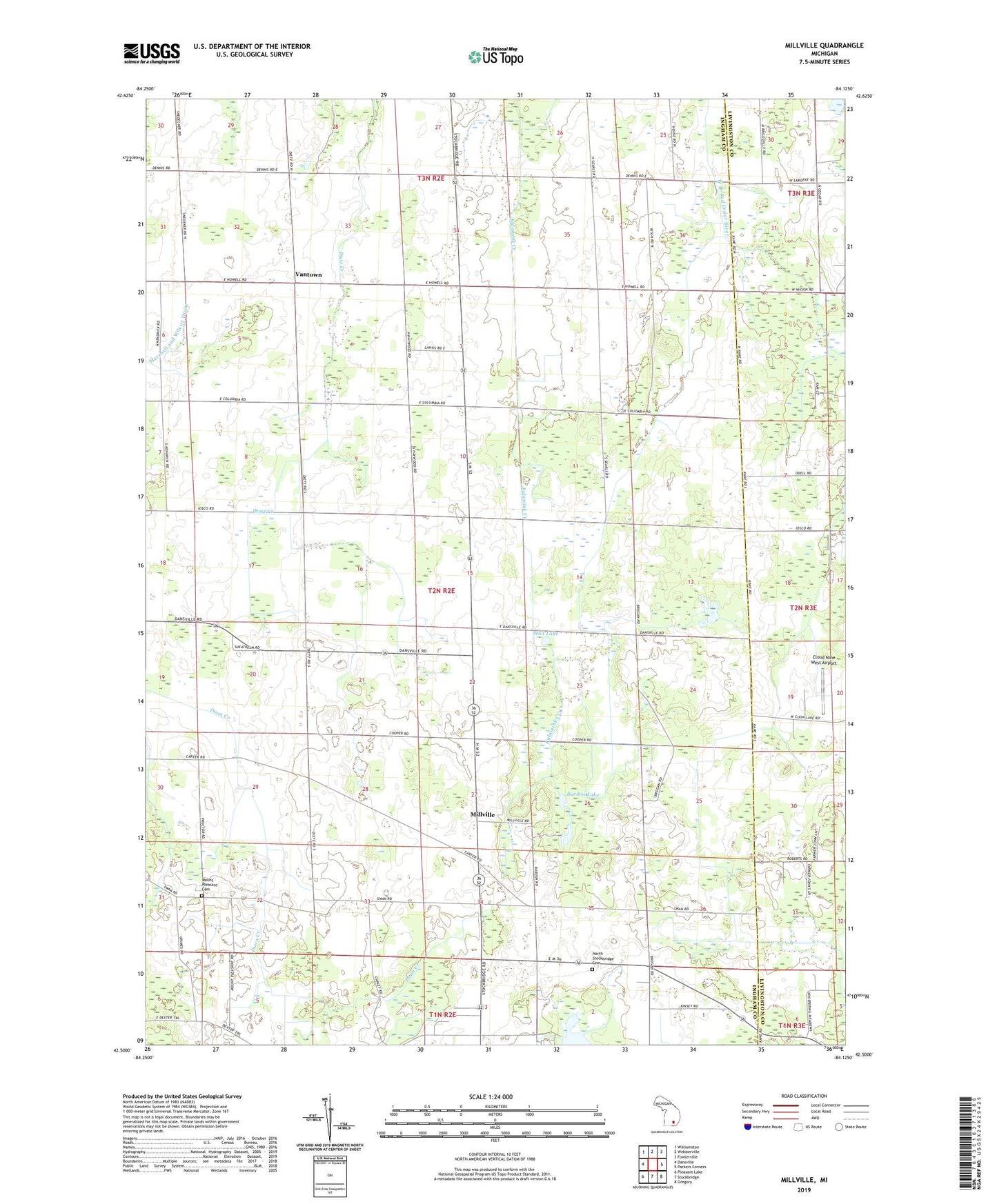
2019 topographic map quadrangle Millville in the state of Michigan. Scale: 1:24000. Based on the newly updated USGS 7.5' US Topo map series, this map is in the following counties: Ingham, Livingston. The map contains contour data, water features, and other items you are used to seeing on USGS maps, but also has updated roads and other features. This is the next generation of topographic maps. Printed on high-quality waterproof paper with UV fade-resistant inks.
Quads adjacent to this one:
West: Dansville
Northwest: Williamston
North: Webberville
Northeast: Fowlerville
East: Parkers Corners
Southeast: Gregory
South: Stockbridge
Southwest: Pleasant Lake
Contains the following named places: Burden Lake, Cloud Nine West Airport, Good Shepherd Mission, Harris Post Office, Holland Drain, McMahon Drain, Middletown Post Office, Millville, Millville United Methodist Church, Mount Olive Church, Mount Pleasant Cemetery, Mud Lake, North Stockbridge Cemetery, Northwest Stockbridge Community Church, Patrick Drain, Township of White Oak, Vantown, Vantown Community Church, Vantown Post Office, White Oak, White Oak Township Hall Historical Marker, Whiteoak Post Office