MyTopo
Negaunee NW Michigan US Topo Map
Couldn't load pickup availability
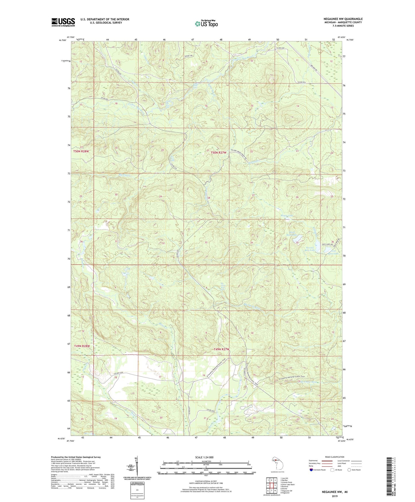
2019 topographic map quadrangle Negaunee NW in the state of Michigan. Scale: 1:24000. Based on the newly updated USGS 7.5' US Topo map series, this map is in the following counties: Marquette. The map contains contour data, water features, and other items you are used to seeing on USGS maps, but also has updated roads and other features. This is the next generation of topographic maps. Printed on high-quality waterproof paper with UV fade-resistant inks.
Quads adjacent to this one:
West: Silver Lake Basin
Northwest: Ives Hill
North: Big Bay
Northeast: Granite Point
East: Buckroe
Southeast: Negaunee
South: Negaunee SW
Southwest: Diorite
Contains the following named places: Big Garlic River Falls, Big Pup Creek, Big Pup Falls, Bushy Creek Falls, First Bass Lake, Hairpin Curve Lookout Tower, Little Pup Creek, Lost Creek, North Star Camp, Regan Lake, Second Bass Lake, Third Bass Lake, Township of Ishpeming, Yellow Dog River Falls