MyTopo
Parma Michigan US Topo Map
Couldn't load pickup availability
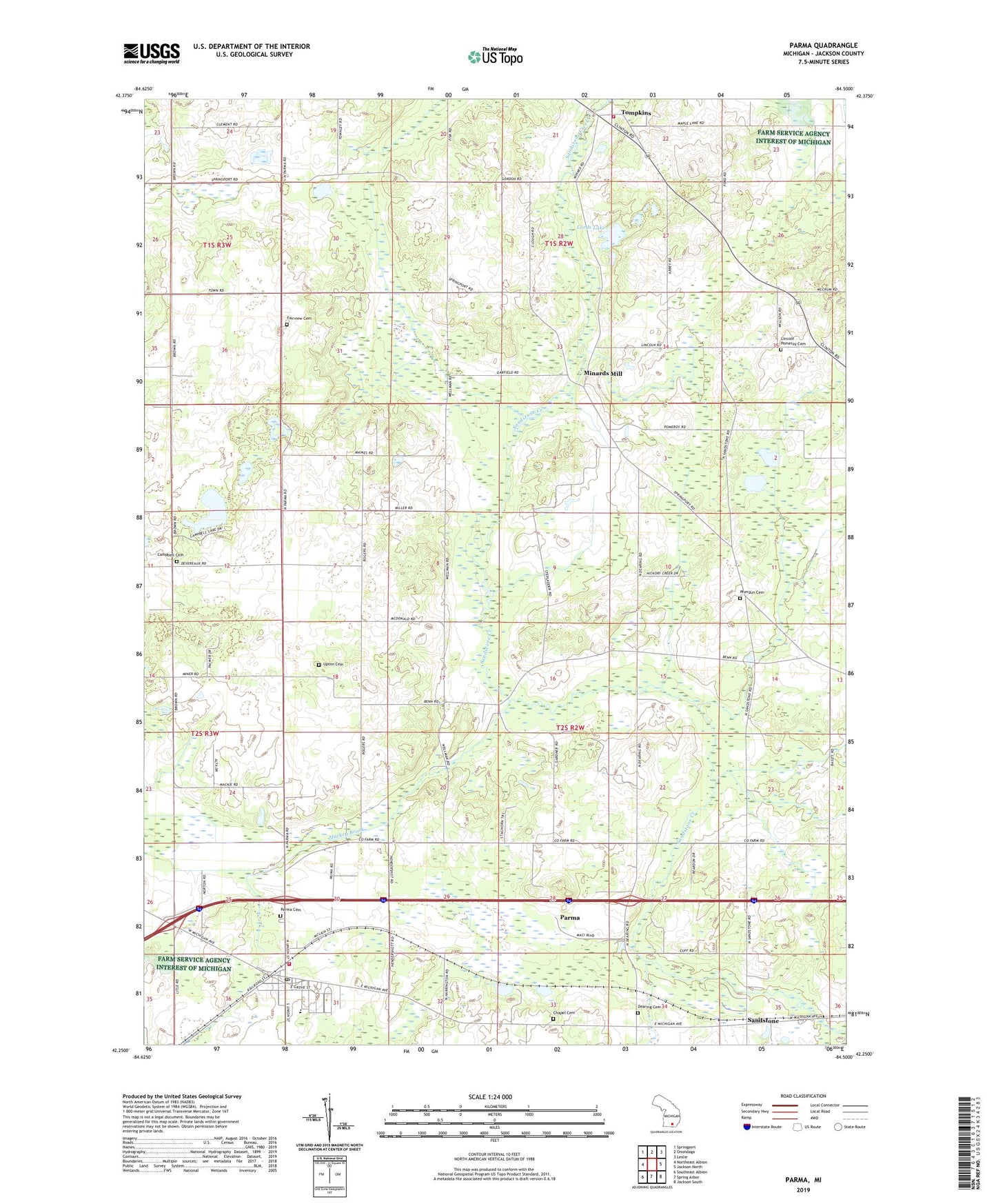
2019 topographic map quadrangle Parma in the state of Michigan. Scale: 1:24000. Based on the newly updated USGS 7.5' US Topo map series, this map is in the following counties: Jackson. The map contains contour data, water features, and other items you are used to seeing on USGS maps, but also has updated roads and other features. This is the next generation of topographic maps. Printed on high-quality waterproof paper with UV fade-resistant inks.
Quads adjacent to this one:
West: Northeast Albion
Northwest: Springport
North: Onondaga
Northeast: Leslie
East: Jackson North
Southeast: Jackson South
South: Spring Arbor
Southwest: Southeast Albion
Contains the following named places: Bailey School, Burr Oak Golf Club, Campbell Cemetery, Campbell School, Chapel Cemetery, Dean School, Dearing Cemetery, Fairview Cemetery, Fassett School, Fisk School, Howe Church, Howe School, Indian Brook, Jackson County Park, Jackson District Library-Parma Branch, Lincoln Pomeroy Cemetery, Lincoln School, Lords Lake, Mackey Brook, Minard Post Office, Minards Mill, North Jackson Lions Park, North Lake, North Parma Church, Parma, Parma Baptist Church, Parma Cemetery, Parma Elementary School, Parma Post Office, Parma Sandstone Fire Department, Parma Station, Parma United Methodist Church, Parma-Sandstone Police Department, Pherdun Cemetery, Richardson School, Rives / Tompkins Fire Department Station 2, Robinson School, Salisbury School, Sandstone, Sandstone Post Office, Sandstone Station, South Lake, Tompkins, Tompkins Post Office, Township of Sandstone, Upton Cemetery, Village of Parma, ZIP Code: 49269