MyTopo
Albany Minnesota US Topo Map
Couldn't load pickup availability
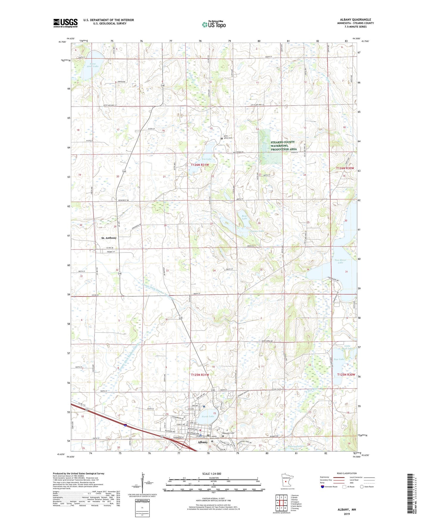
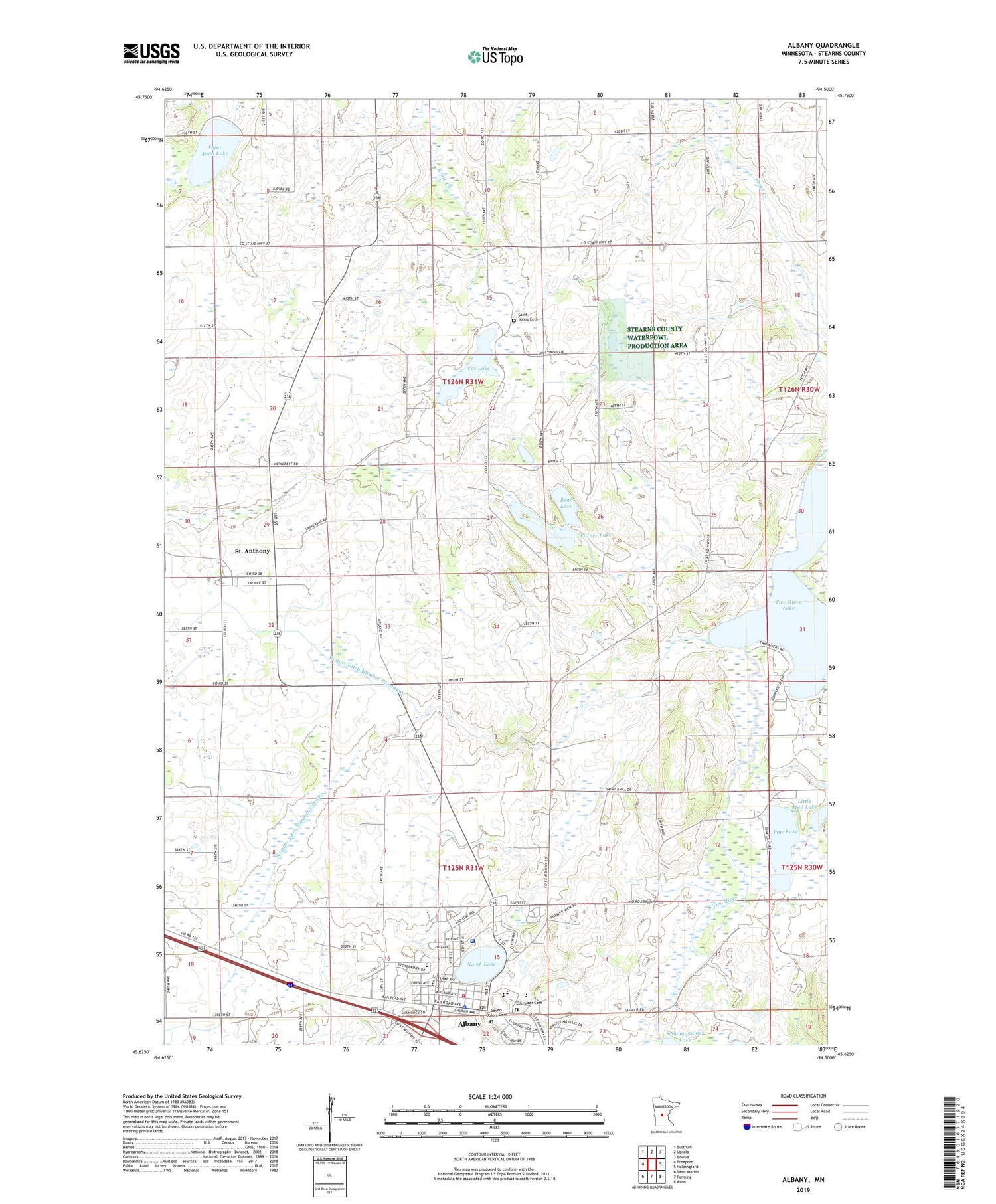
2019 topographic map quadrangle Albany in the state of Minnesota. Scale: 1:24000. Based on the newly updated USGS 7.5' US Topo map series, this map is in the following counties: Stearns. The map contains contour data, water features, and other items you are used to seeing on USGS maps, but also has updated roads and other features. This is the next generation of topographic maps. Printed on high-quality waterproof paper with UV fade-resistant inks.
Quads adjacent to this one:
West: Freeport
Northwest: Burtrum
North: Upsala
Northeast: Bowlus
East: Holdingford
Southeast: Avon
South: Farming
Southwest: Saint Martin
Contains the following named places: Albany, Albany Area Hospital and Medical Center, Albany Fire Department, Albany Golf Club, Albany Medical Center, Albany Police Department, Albany Post Office, Albany Public Library, Albany Senior High School, Albany Softball Park, Bear Lake, City of Albany, City of Saint Anthony, County Ditch Number Fifteen, County Ditch Number Twentytwo, Ebenezer Cemetery, Fish Lake, Holy Family School, KASM-AM (Albany), Little Mud Lake, Littner Lake, Mother of Mercy Nursing Home, North Lake, Our Saviour's Lutheran Church, Pine Lake, Saint Anna Lake, Saint Anthony, Saint Anthony Church, Saint Anthony Post Office, Saint Johns Cemetery, School Number 2031, School Number 2043, School Number 2077, School Number 2081, Seven Dolors Cemetery, Seven Dolors School, Shamrock Mobile Home Park, Skalicky Airstrip, Township of Krain, Two River Lake, Vos Lake, Warga Dairy Farm, ZIP Code: 56307