MyTopo
Blomkest Minnesota US Topo Map
Couldn't load pickup availability
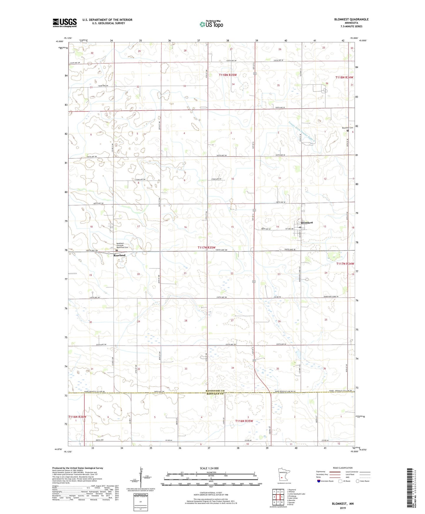
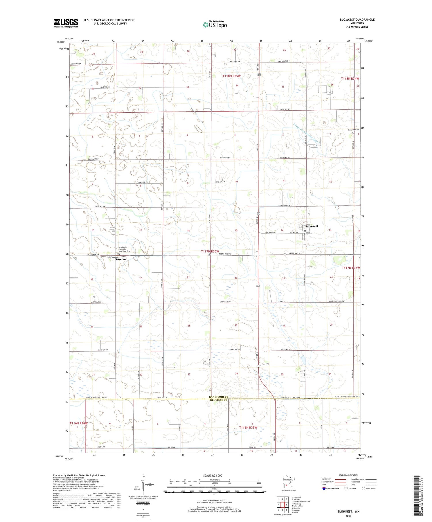
2019 topographic map quadrangle Blomkest in the state of Minnesota. Scale: 1:24000. Based on the newly updated USGS 7.5' US Topo map series, this map is in the following counties: Kandiyohi, Renville. The map contains contour data, water features, and other items you are used to seeing on USGS maps, but also has updated roads and other features. This is the next generation of topographic maps. Printed on high-quality waterproof paper with UV fade-resistant inks.
Quads adjacent to this one:
West: Prinsburg
Northwest: Raymond
North: Willmar
Northeast: Little Kandiyohi Lake
East: Lake Lillian
Southeast: Olivia
South: Danube
Southwest: Renville
Contains the following named places: Blomkest, Blomkest Baptist Church, Blomkest Cemetery, Blomkest Fire Department, Blomkest Post Office, Blomkest Rest Area, City of Blomkest, County Ditch Number Eight, County Ditch Number Eight A, County Ditch Number Eighteen, County Ditch Number Sixteen, Johnson Farms, Poortvliet Dairy, Roseland, Roseland Christian Reformed Cemetery, Roseland Post Office, Roseland Reformed Church, Township of Roseland, ZIP Code: 56216