MyTopo
Dassel Minnesota US Topo Map
Couldn't load pickup availability
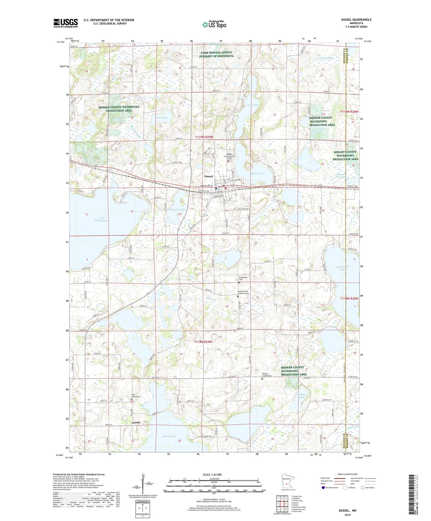
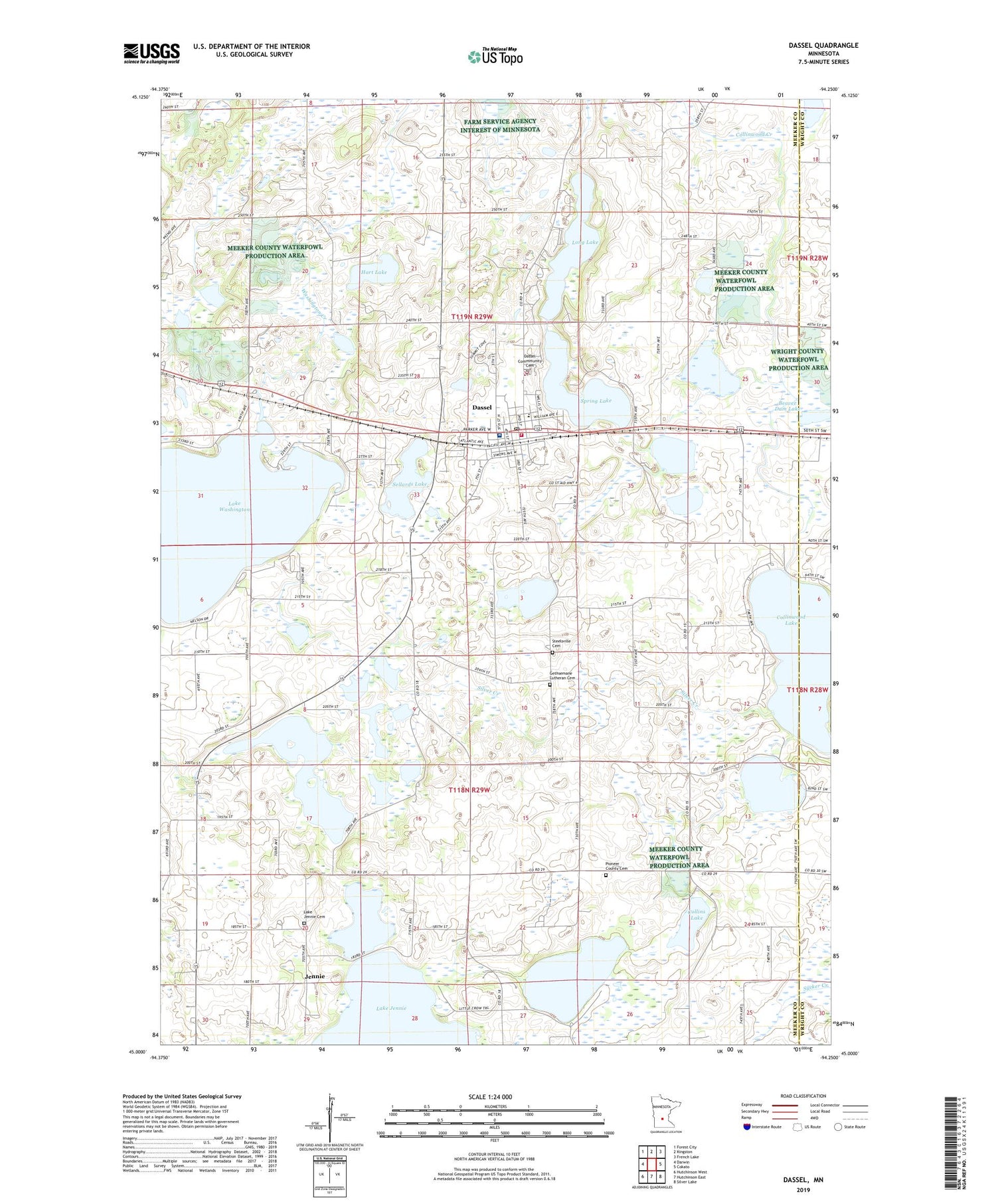
2019 topographic map quadrangle Dassel in the state of Minnesota. Scale: 1:24000. Based on the newly updated USGS 7.5' US Topo map series, this map is in the following counties: Meeker, Wright. The map contains contour data, water features, and other items you are used to seeing on USGS maps, but also has updated roads and other features. This is the next generation of topographic maps. Printed on high-quality waterproof paper with UV fade-resistant inks.
Quads adjacent to this one:
West: Darwin
Northwest: Forest City
North: Kingston
Northeast: French Lake
East: Cokato
Southeast: Silver Lake
South: Hutchinson East
Southwest: Hutchinson West
Contains the following named places: Anchor Independent Bible Church, Beaver Dam Lake, Boo Lake, Butternut Lake, Church of Christ, City of Dassel, Collins District School, Collins Lake, Collinwood Lake, Collinwood Lake Dam, Collinwood School, Darwin Winter Recreation Park, Dassel, Dassel Commmunity Cemetery, Dassel Fire Department, Dassel Hillside Farm, Dassel Lakeside Nursing Home, Dassel Museum, Dassel Police Department, Dassel Post Office, Dassel Public Library, Depot Museum, Evangelical Covenant Church, Fair School Park, First Apostolic Lutheran Church, Gethsemane Lutheran Cemetery, Gethsemane Lutheran Church, Hart Lake, Hutchinson Health Dassel Clinic, Jennie, Jennie Post Office, Judicial Ditch Number Three, Lake Jennie Cemetery, Lake Jennie Church, Lakedale Campground, Little Spring Lake, Long Lake, Maple Lake, Pigeon Lake, Pigeon Lake Overlook, Pioneer Country Church, Pioneer County Cemetery, Sellards Lake, Silver Creek, Spencer Lake, Spring Lake, Spring Lake County Park, Steelsville Cemetery, Steelsville School, Township of Collinwood, Township of Dassel, West View Terrace, Wolf Lake, ZIP Code: 55325