MyTopo
Four Town Minnesota US Topo Map
Couldn't load pickup availability
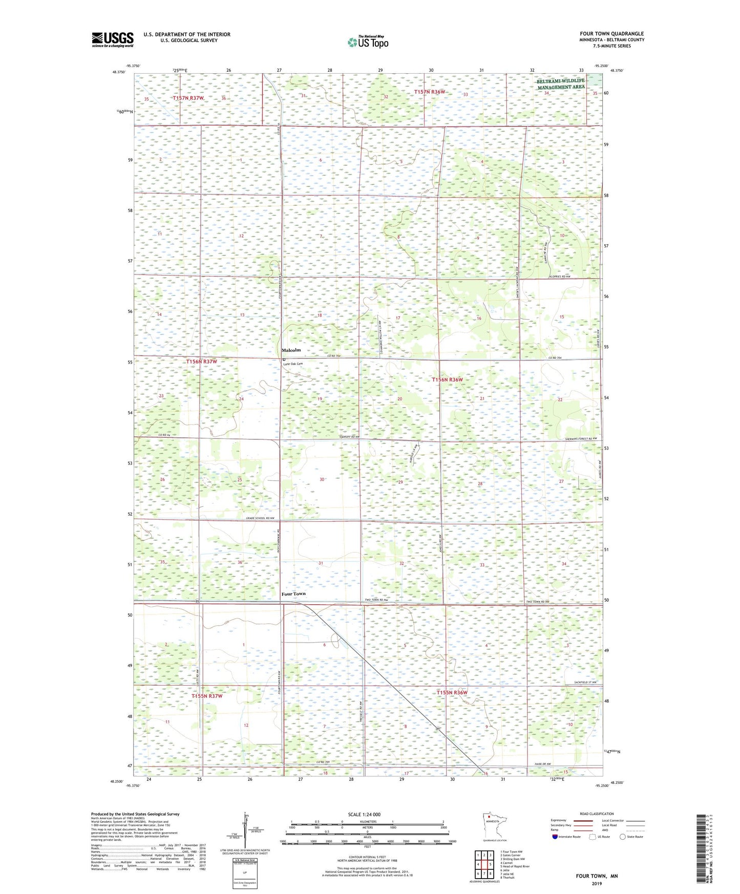
2019 topographic map quadrangle Four Town in the state of Minnesota. Scale: 1:24000. Based on the newly updated USGS 7.5' US Topo map series, this map is in the following counties: Beltrami. The map contains contour data, water features, and other items you are used to seeing on USGS maps, but also has updated roads and other features. This is the next generation of topographic maps. Printed on high-quality waterproof paper with UV fade-resistant inks.
Quads adjacent to this one:
West: Carmel
Northwest: Four Town NW
North: Gates Corner
Northeast: Shilling Dam NW
East: Head of Rapid River
Southeast: Thorhult
South: Jelle NE
Southwest: Jelle
Contains the following named places: Four Town, Four Town Chapel, Four Town Post Office, Linder Lookout Tower, Lone Oak Cemetery, Malcolm, Malcolm Post Office, Steenerson State Wildlife Management Area, Township of Minnie