
MyTopo
Holdingford Minnesota US Topo Map
Couldn't load pickup availability
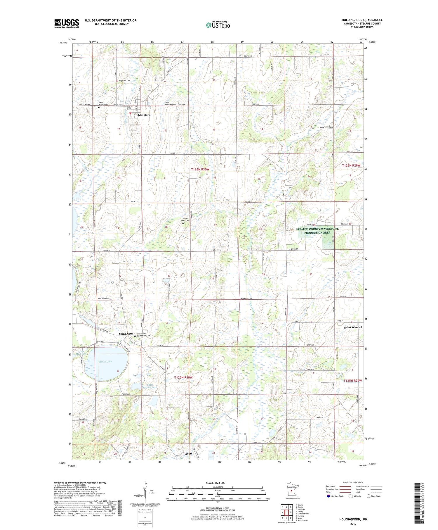
2019 topographic map quadrangle Holdingford in the state of Minnesota. Scale: 1:24000. Based on the newly updated USGS 7.5' US Topo map series, this map is in the following counties: Stearns. The map contains contour data, water features, and other items you are used to seeing on USGS maps, but also has updated roads and other features. This is the next generation of topographic maps. Printed on high-quality waterproof paper with UV fade-resistant inks.
Quads adjacent to this one:
West: Albany
Northwest: Upsala
North: Bowlus
Northeast: Royalton
East: Saint Stephen
Southeast: Saint Joseph
South: Avon
Southwest: Farming
Contains the following named places: City of Holdingford, County Ditch Number Eighteen, Highland Cemetery, Holdingford, Holdingford City Hall, Holdingford High School, Holdingford Medical Clinic, Holdingford Police Department, Holdingford Post Office, Holdingford Rescue Squad and Fire Department, Immaculate Conception Cemetery, Immaculate Conception Church, Krain Creek, Little Pelican Lake, Pelican Lake, Sacred Heart Cemetery, Sacred Heart Mission, Saint Anna, Saint Anna Post Office, Saint Hedwig's Church, Saint Hegwigs Cemetery, Saint Marys Cemetery, Saint Mary's Church, Saint Wendel, Saint Wendell Post Office, School Number 1947, School Number 1985, School Number 1986, School Number 2010, School Number 2054, School Number 2055, School Number 2074, School Number 2079, Township of Avon, Township of Holding, ZIP Code: 56310


