MyTopo
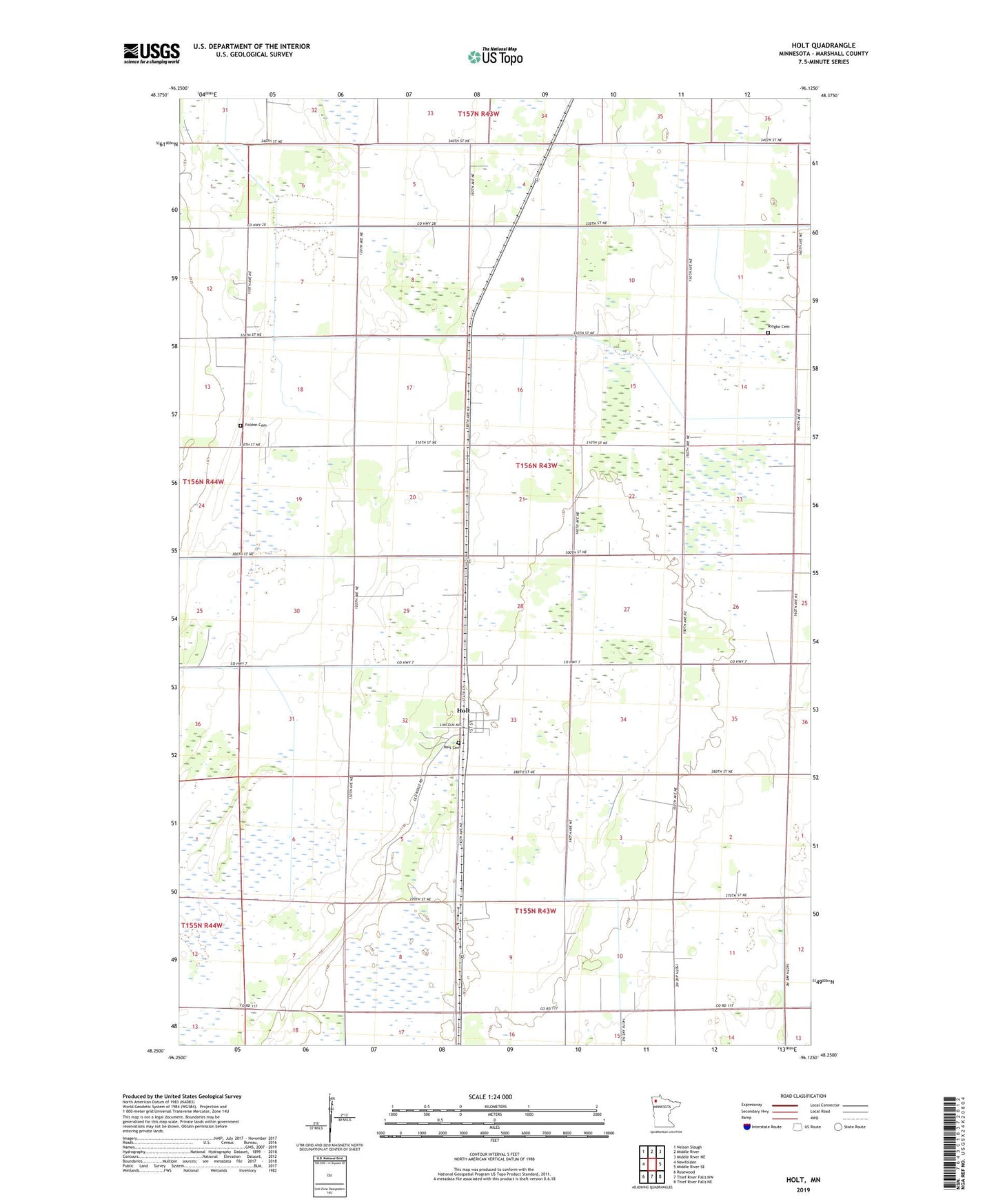
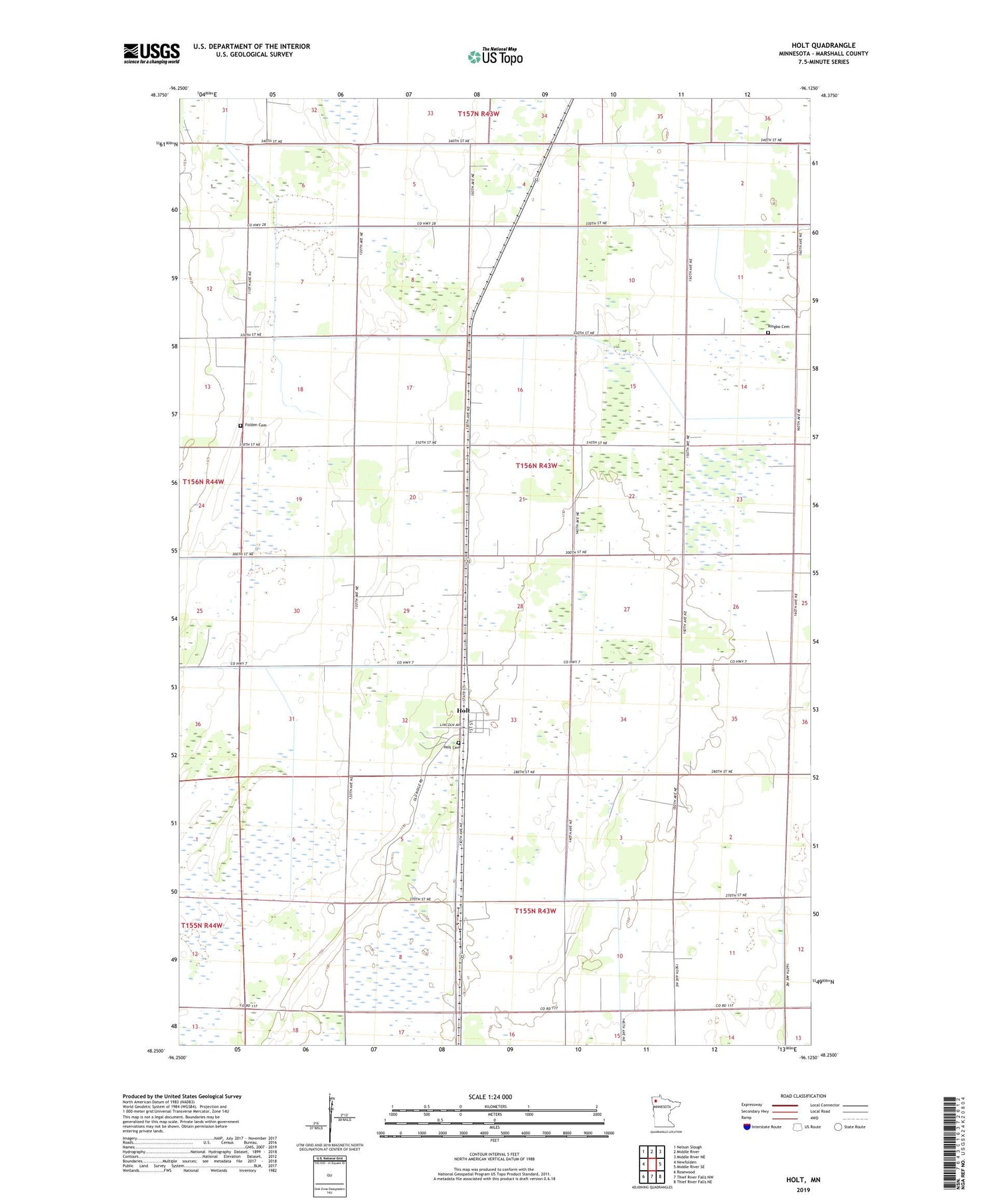
Holt Minnesota US Topo Map
Couldn't load pickup availability
2019 topographic map quadrangle Holt in the state of Minnesota. Scale: 1:24000. Based on the newly updated USGS 7.5' US Topo map series, this map is in the following counties: Marshall. The map contains contour data, water features, and other items you are used to seeing on USGS maps, but also has updated roads and other features. This is the next generation of topographic maps. Printed on high-quality waterproof paper with UV fade-resistant inks.
Quads adjacent to this one:
West: Newfolden
Northwest: Nelson Slough
North: Middle River
Northeast: Middle River NE
East: Middle River SE
Southeast: Thief River Falls NE
South: Thief River Falls NW
Southwest: Rosewood
Contains the following named places: City of Holt, Folden Cemetery, Holt, Holt Cemetery, Holt Post Office, Holt Station, Manor Post Office, Ringbo Cemetery, Ringbo Church, Ringbo Post Office, Township of Holt