MyTopo
Illgen City Minnesota US Topo Map
Couldn't load pickup availability
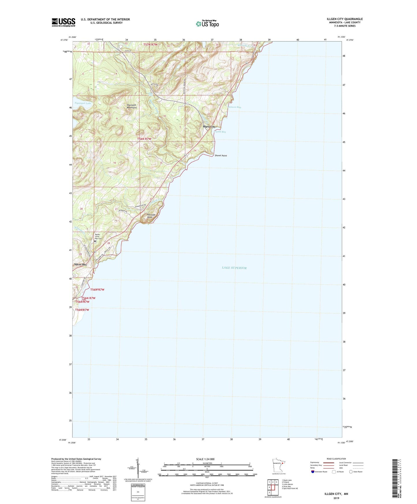
2019 topographic map quadrangle Illgen City in the state of Minnesota. Scale: 1:24000. Based on the newly updated USGS 7.5' US Topo map series, this map is in the following counties: Lake. The map contains contour data, water features, and other items you are used to seeing on USGS maps, but also has updated roads and other features. This is the next generation of topographic maps. Printed on high-quality waterproof paper with UV fade-resistant inks.
Quads adjacent to this one:
West: Silver Bay
Northwest: Doyle Lake
North: Finland
Northeast: Little Marais
Southwest: Split Rock Point NE
Contains the following named places: Baptism River, Baptism River Rest Area, Baptism River State Park, Belmore Bay, Crystal Bay, Crystal Creek, Illgen City, Illgen Falls, Jehovah's Witnesses Congregation, Kennedy Creek, Nipisiquit Lake, Northern Exposure Campground, Palisade Baptist Church, Palisade Creek, Palisade Head, Palisade Head Historical Marker, Reider Silver Bay Cemetery, Shovel Point, Williams Creek