MyTopo
Kelliher Minnesota US Topo Map
Couldn't load pickup availability
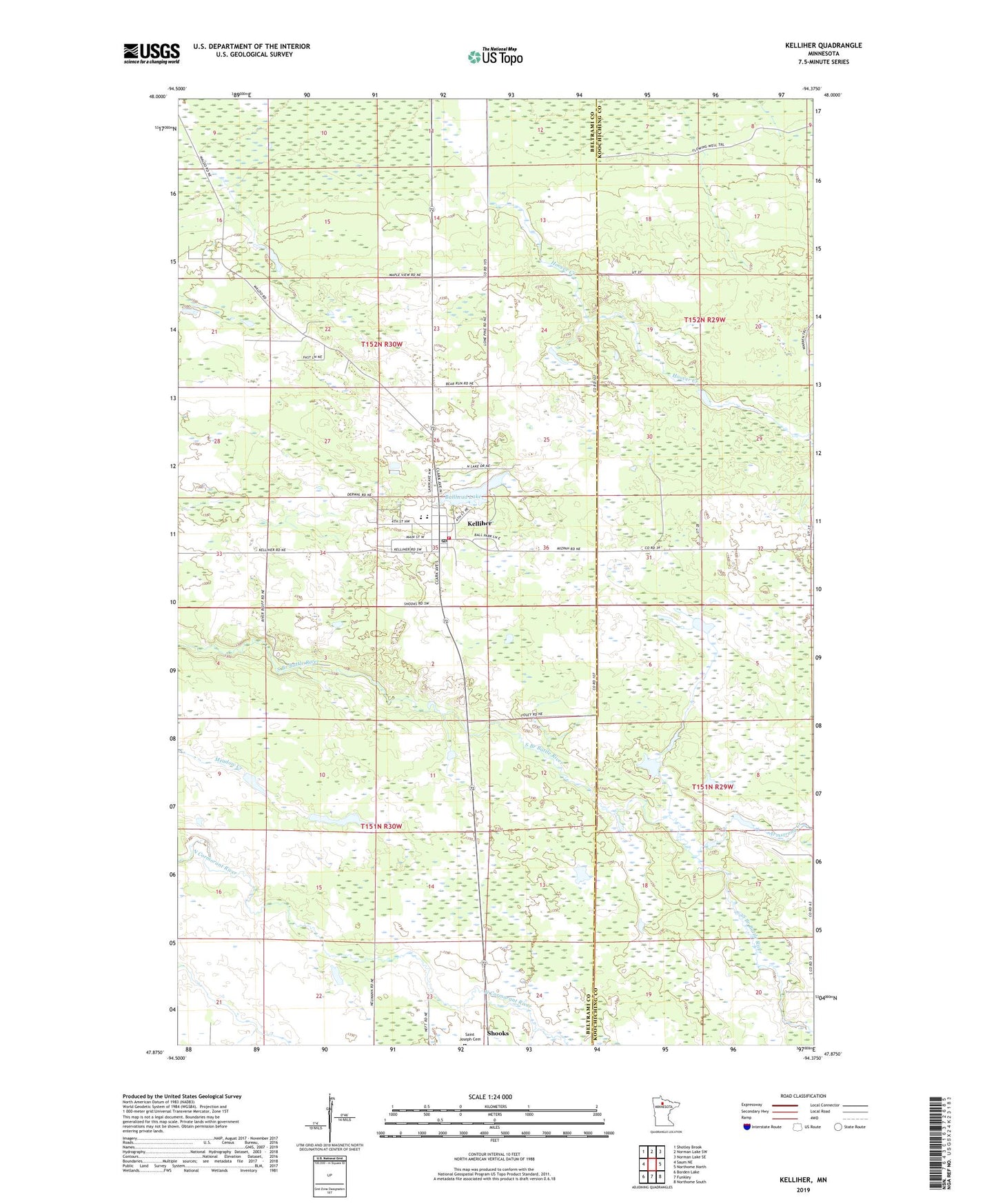
2019 topographic map quadrangle Kelliher in the state of Minnesota. Scale: 1:24000. Based on the newly updated USGS 7.5' US Topo map series, this map is in the following counties: Beltrami, Koochiching. The map contains contour data, water features, and other items you are used to seeing on USGS maps, but also has updated roads and other features. This is the next generation of topographic maps. Printed on high-quality waterproof paper with UV fade-resistant inks.
Quads adjacent to this one:
West: Saum NE
Northwest: Shotley Brook
North: Norman Lake SW
Northeast: Norman Lake SE
East: Northome North
Southeast: Northome South
South: Funkley
Southwest: Borden Lake
Contains the following named places: Armstrong Creek, Bullhead Lake, City of Kelliher, Emmanuel Lutheran Church, Hoover Creek, Kelliher, Kelliher Care Center, Kelliher Health Clinic, Kelliher High School, Kelliher Post Office, Kelliher Shopping Center, Kelliher Volunteer Fire Department, Nazarene Church, Our Saviour's Lutheran Church, Saint Patrick's Catholic Church, Shooks State Wildlife Management Area, Township of Kelliher, Township of Shooks