
MyTopo
Middle River Minnesota US Topo Map
Couldn't load pickup availability
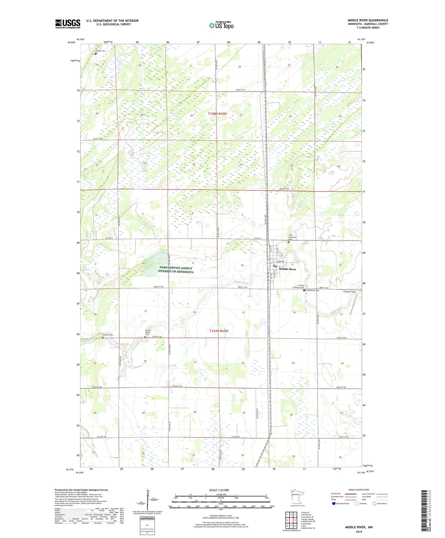
2019 topographic map quadrangle Middle River in the state of Minnesota. Scale: 1:24000. Based on the newly updated USGS 7.5' US Topo map series, this map is in the following counties: Marshall. The map contains contour data, water features, and other items you are used to seeing on USGS maps, but also has updated roads and other features. This is the next generation of topographic maps. Printed on high-quality waterproof paper with UV fade-resistant inks.
Quads adjacent to this one:
West: Nelson Slough
Northwest: Pelan SE
North: Strathcona
Northeast: Greenbush SE
East: Middle River NE
Southeast: Middle River SE
South: Holt
Southwest: Newfolden
Contains the following named places: Chanlin Field, City of Middle River, Finnish Lutheran Cemetery, First Lutheran Cemetery, First Lutheran Church, Gaarde Cemetery, Huntly Cemetery, Ingalls Post Office, Middle River, Middle River Mobile Home Park, Middle River Post Office, Middle River School, Middle River Station, Middle River Volunteer Fire and Rescue Company, Our Saviors Lutheran Church, Saint Joseph's Catholic Church, Spruce Valley Cemetery, Township of Spruce Valley, Tri - County Emergency Medical Services District, Woodman Cemetery


