MyTopo
Swanville Minnesota US Topo Map
Couldn't load pickup availability
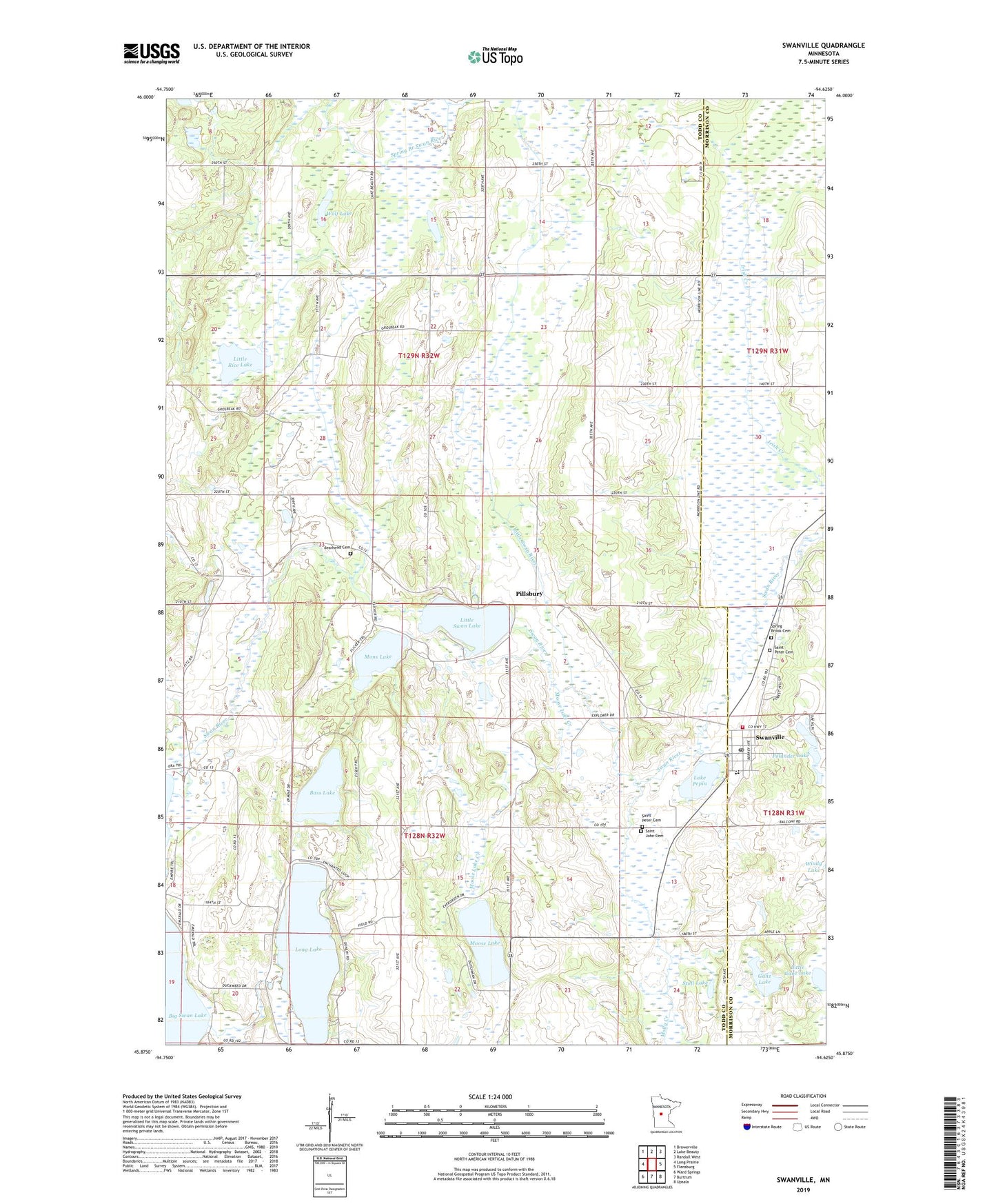
2019 topographic map quadrangle Swanville in the state of Minnesota. Scale: 1:24000. Based on the newly updated USGS 7.5' US Topo map series, this map is in the following counties: Todd, Morrison. The map contains contour data, water features, and other items you are used to seeing on USGS maps, but also has updated roads and other features. This is the next generation of topographic maps. Printed on high-quality waterproof paper with UV fade-resistant inks.
Quads adjacent to this one:
West: Long Prairie
Northwest: Browerville
North: Lake Beauty
Northeast: Randall West
East: Flensburg
Southeast: Upsala
South: Burtrum
Southwest: Ward Springs
Contains the following named places: Bass Lake, Bearhead Cemetery, City of Swanville, Ganz Lake, Lake Pepin, Little Ganz Lake, Little Rice Lake, Little Swan Lake, Little Swan Lake Dam, Little Swan River, Long Lake, Molly Creek, Mons Lake, Moose Lake, Moose Lake Creek, Pillsbury, Pillsbury Post Office, Polander Lake, Saint John Catholic Church, Saint John Cemetery, Saint Peter Cemetery, Saint Peter's Lutheran Church, Spring Branch Swan River, Spring Brook Cemetery, Stoll Lake, Swanville, Swanville Bible Church, Swanville Fire Department, Swanville Post Office, Swanville Public Library, Swanville Schools, Township of Bruce, Township of Burnhamville, Wolf Lake