MyTopo
Trommald Minnesota US Topo Map
Couldn't load pickup availability
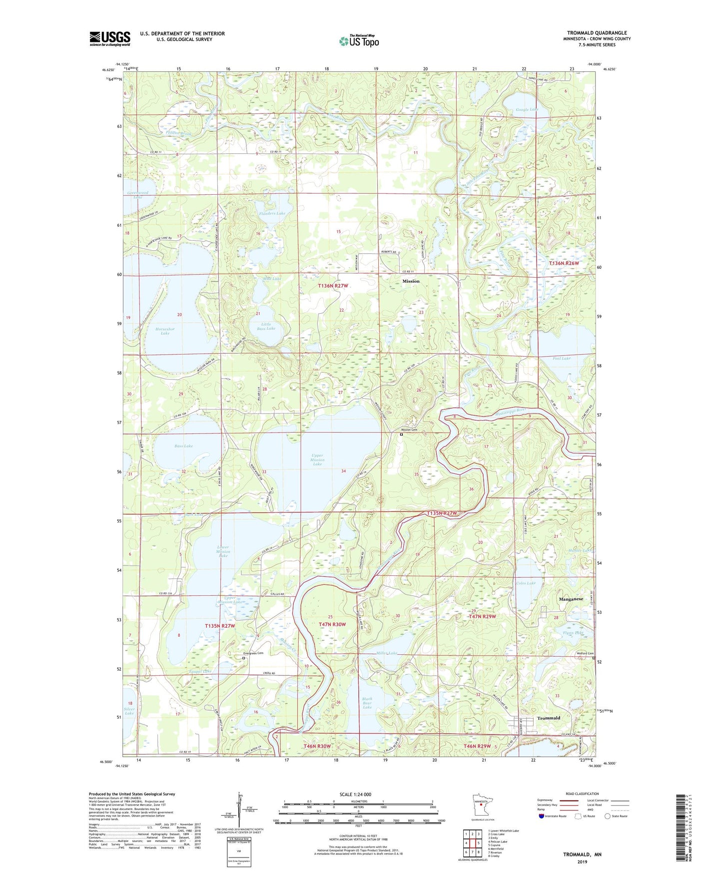
2019 topographic map quadrangle Trommald in the state of Minnesota. Scale: 1:24000. Based on the newly updated USGS 7.5' US Topo map series, this map is in the following counties: Crow Wing. The map contains contour data, water features, and other items you are used to seeing on USGS maps, but also has updated roads and other features. This is the next generation of topographic maps. Printed on high-quality waterproof paper with UV fade-resistant inks.
Quads adjacent to this one:
West: Pelican Lake
Northwest: Lower Whitefish Lake
North: Cross Lake
Northeast: Emily
East: Cuyuna
Southeast: Crosby
South: Riverton
Southwest: Merrifield
Contains the following named places: Bass Lake, Black Bear Lake, Blackbear Lake, Blackbear Lake Dam, City of Trommald, Coles Lake, Crow Wing State Forest, Duck Lake, Evergreen Cemetery, Faupel Lake, Flanders Lake, Flynn Lake, Fool Lake, Google Lake, Greenwood Lake, Half Moon Lake, Horseshoe Lake, Little Bass Lake, Little Pine River, Lower Mission Lake, Manganese, Manganese Post Office, Maroco Mine, Miller Lake, Mission, Mission Beach Resort and Campground, Mission Cemetery, Mission Creek, Mission Post Office, Mud Lake, Musser Mine, Ossipee Community Church, Pelican Brook, Pine River, Sunset Bay Resort and Campground, Township of Mission, Township of Wolford, Trommald, Trommald Post Office, Upper Mission Lake, Wolford Cemetery, ZIP Code: 56465