MyTopo
Benwood Mississippi US Topo Map
Couldn't load pickup availability
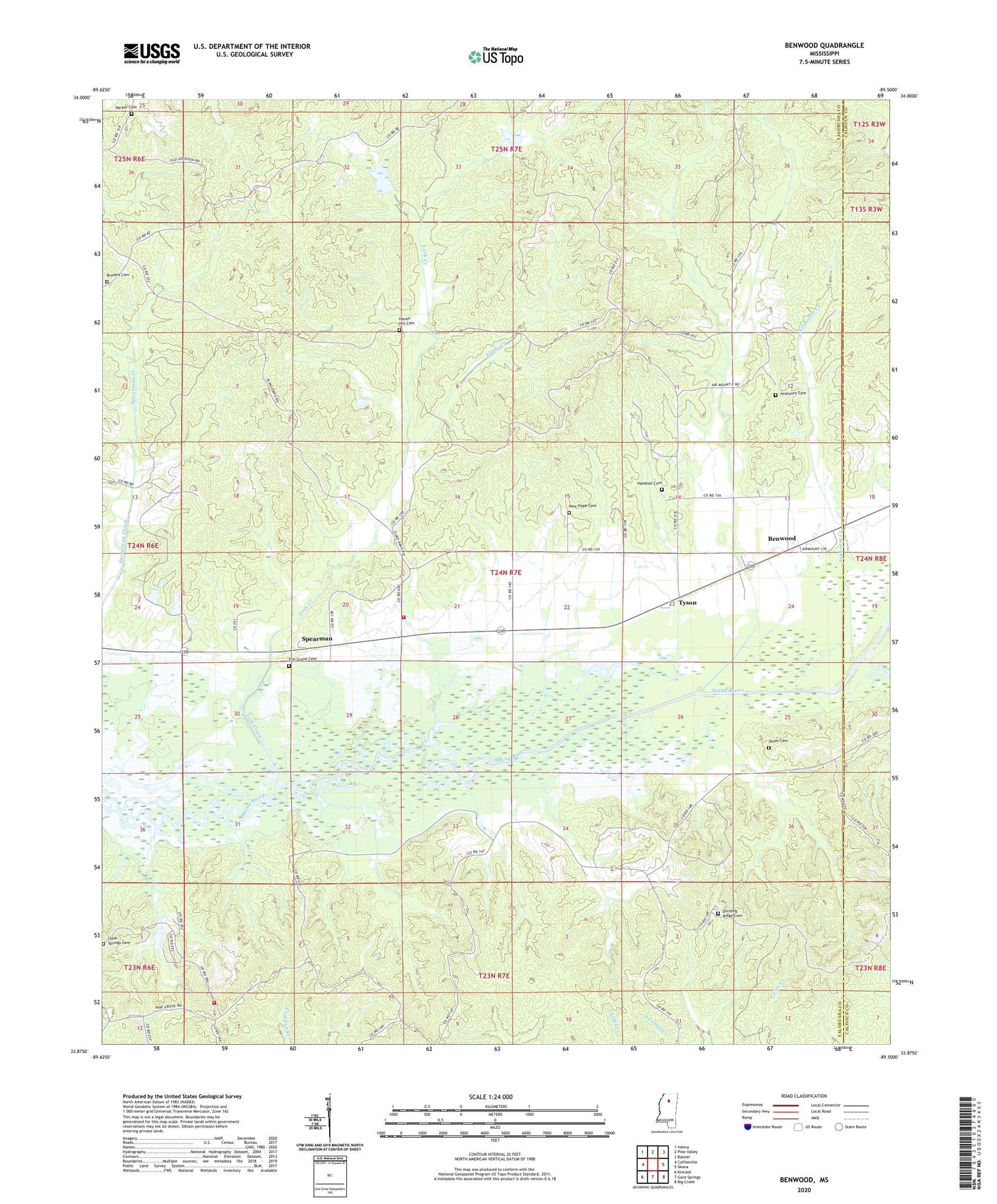
2020 topographic map quadrangle Benwood in the state of Mississippi. Scale: 1:24000. Based on the newly updated USGS 7.5' US Topo map series, this map is in the following counties: Yalobusha, Calhoun. The map contains contour data, water features, and other items you are used to seeing on USGS maps, but also has updated roads and other features. This is the next generation of topographic maps. Printed on high-quality waterproof paper with UV fade-resistant inks.
Quads adjacent to this one:
West: Coffeeville
Northwest: Velma
North: Pine Valley
Northeast: Banner
East: Skuna
Southeast: Big Creek
South: Gore Springs
Southwest: Kincaid
Contains the following named places: Air Mount, Airmount Church, Airmount School, Arimount Cemetery, Arimount Creek, Benwood, Brooms Cemetery, Clear Springs Cemetery, Clear Springs Church, Clear Springs Volunteer Fire Department, Dividing Ridge Cemetery, Dividing Ridge Church, Elm Grove Cemetery, Elm Grove Church, Glady Creek, Hamblet Cemetery, Hamblet Church, Harbor Cemetery, Haven Hill Cemetery, Haven Hill Church, Honey Cut, Hyde, Jones Cemetery, Jones Creek, Jones Mills, New Hope, New Hope Cemetery, New Hope Missionary Baptist Church, Pate Branch, Post Oak, Skuna River Canal, Skuna Valley Volunteer Fire Department, Spearman, Turkey Creek Watershed Y-20-39 Dam, Turkey Creek Watershed Y-20-73 Dam, Tyson, York Creek