MyTopo
Gautier South Mississippi US Topo Map
Couldn't load pickup availability
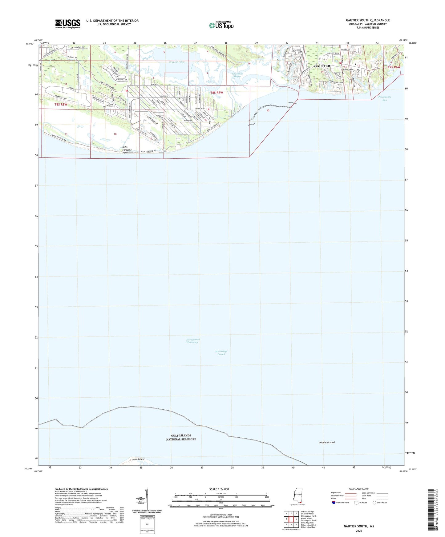
2020 topographic map quadrangle Gautier South in the state of Mississippi. Scale: 1:24000. Based on the newly updated USGS 7.5' US Topo map series, this map is in the following counties: Jackson. The map contains contour data, water features, and other items you are used to seeing on USGS maps, but also has updated roads and other features. This is the next generation of topographic maps. Printed on high-quality waterproof paper with UV fade-resistant inks.
Quads adjacent to this one:
West: Deer Island
Northwest: Ocean Springs
North: Gautier North
Northeast: Pascagoula North
East: Pascagoula South
Southeast: Horn Island East
South: Horn Island West
Southwest: Dog Keys Pass
Contains the following named places: Bacot Park, Belle Fontaine Point, Bethel Cemetery, Bethel Church, Camp Lamotte, Central Jackson County Fire Department Station 1, Coast Meadows Mobile Home Park, Fountainbleau Volunteer Fire Department, Gautier Fire Department South Station, Gautier Junior High School, Graveline Bay, Graveline Bayou, Graveline Bayou Boat Ramp, Gulf Park Estates Fire Department Station 1, Middle Ground, Saint Andrews Golf Course, Southside Baptist Church, Supervisor District 5