MyTopo
Sarepta Mississippi US Topo Map
Couldn't load pickup availability
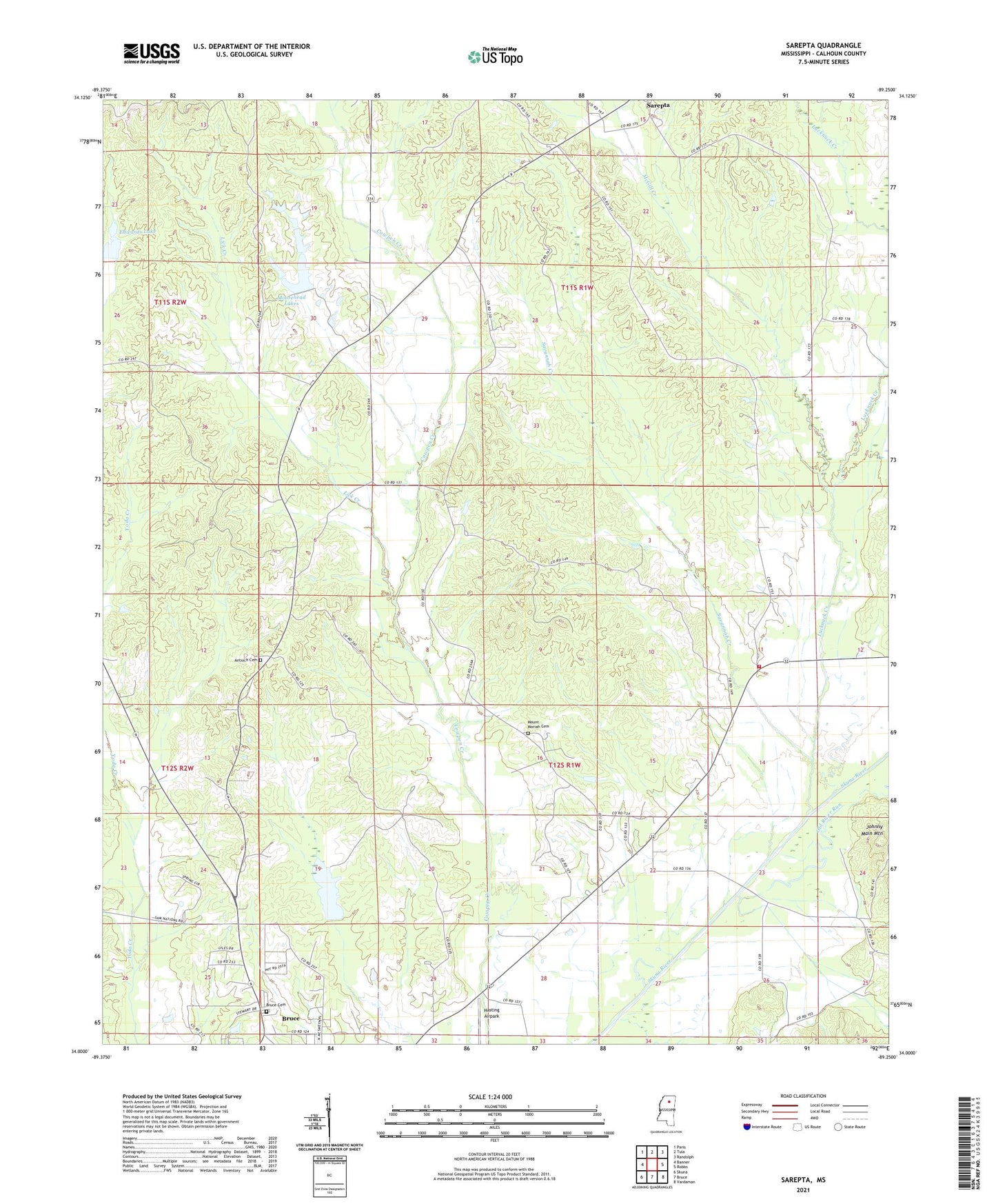
2021 topographic map quadrangle Sarepta in the state of Mississippi. Scale: 1:24000. Based on the newly updated USGS 7.5' US Topo map series, this map is in the following counties: Calhoun. The map contains contour data, water features, and other items you are used to seeing on USGS maps, but also has updated roads and other features. This is the next generation of topographic maps. Printed on high-quality waterproof paper with UV fade-resistant inks.
Quads adjacent to this one:
West: Banner
Northwest: Paris
North: Tula
Northeast: Randolph
East: Robbs
Southeast: Vardaman
South: Bruce
Southwest: Skuna
Contains the following named places: Antioch Cemetery, Antioch Church, Bethel Primitive Baptist Church, Bruce Cemetery, Busyton, Calvary Church, Chickenbone Fire Department, Duff Chapel, E E Moorehead Lake Dam, Edwards Lake, Gullicks Lake, Hasting Airpark, Johnny Main Mountain, Lantrip Church, Lick Creek, Lucknuck Creek, McGill Creek, Moorehead Lakes, Mount Comfort Baptist Church, Mount Moriah Cemetery, Mount Moriah Church, Old River Run, Persimmon Creek Structure Y-21-9 Dam, Pleasant Ridge Church, Sarepta, Savannah Creek, Supervisor District 2