MyTopo
Slayden Mississippi US Topo Map
Couldn't load pickup availability
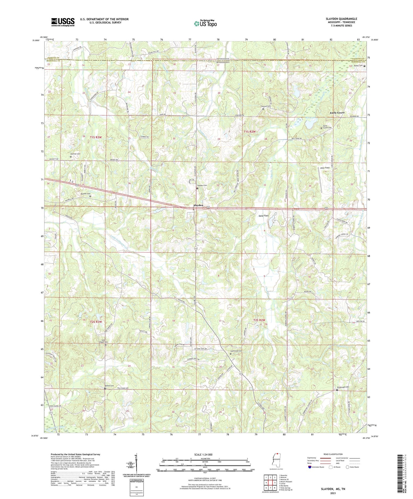
2021 topographic map quadrangle Slayden in the state of Mississippi. Scale: 1:24000. Based on the newly updated USGS 7.5' US Topo map series, this map is in the following counties: Marshall, Fayette. The map contains contour data, water features, and other items you are used to seeing on USGS maps, but also has updated roads and other features. This is the next generation of topographic maps. Printed on high-quality waterproof paper with UV fade-resistant inks.
Quads adjacent to this one:
West: Mount Pleasant
Northwest: Rossville
North: Moscow
Northeast: Moscow SE
East: Lamar
Southeast: Holly Springs SE
South: Holly Springs
Southwest: Red Banks
Contains the following named places: Bailey Cemetery, Bethel Cemetery, Boswell Cemetery, Concord Cemetery, Concord Church, Concord School, Dawson Creek, Early Grove, Early Grove Cemetery, Gaters School, Gatewood Cemetery, Gatewood Church, Hurdle School, Isom Chapel Cemetery, Isom Chapel Christian Methodist Episcopal Church, Isom School, Jeter Field, Kimbrough Cemetery, Kimbrough Chapel, Knocks School, Marshall County School, Mill Pond, Pittman Cemetery, Roberts Chapel, Rocks School, Sand Flats, Sand Flats Junior High School, Slayden, Slayden Baptist Church, Slayden Cemetery, Slayden School, Supervisor District 2