MyTopo
Sweatman Mississippi US Topo Map
Couldn't load pickup availability
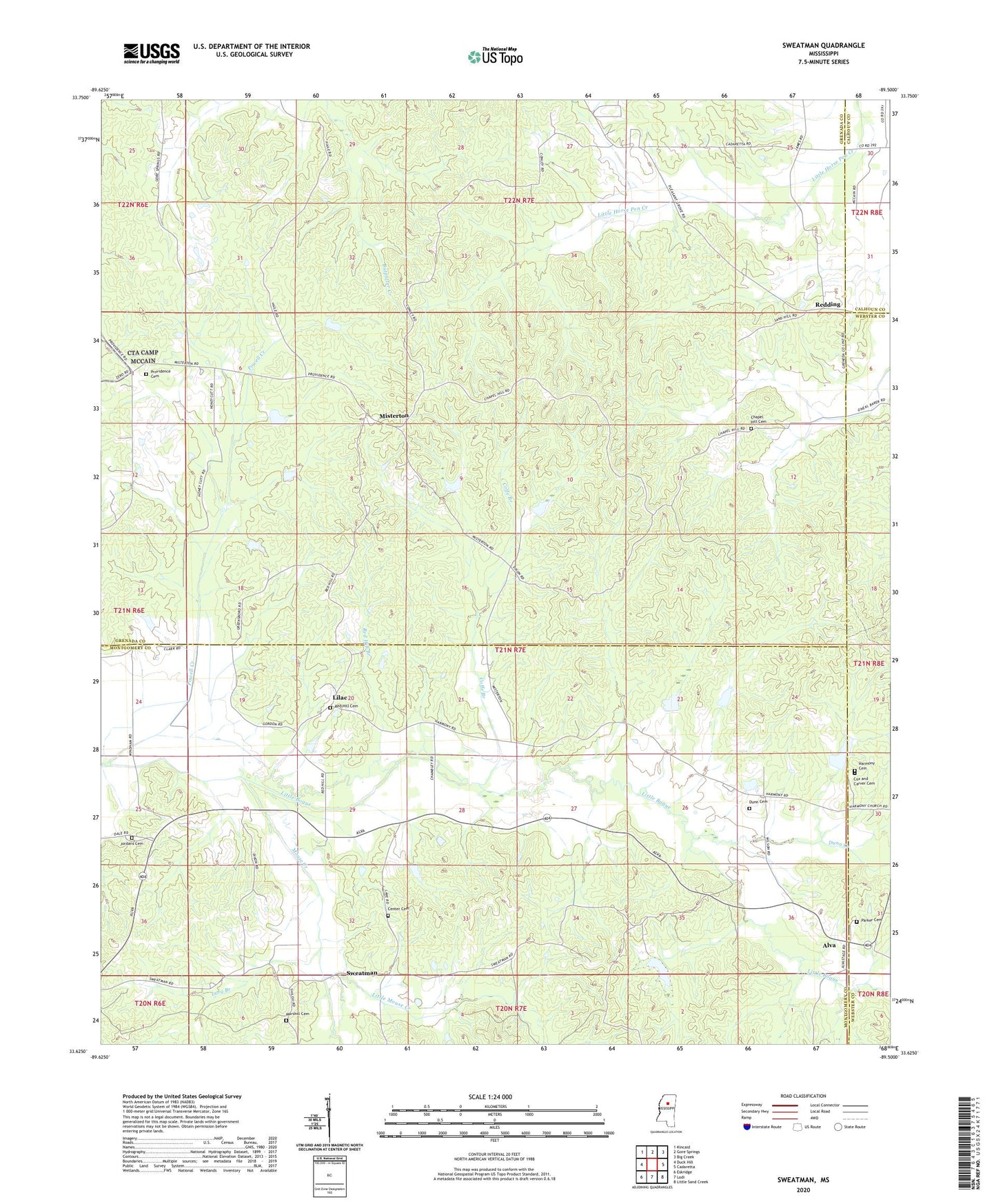
2020 topographic map quadrangle Sweatman in the state of Mississippi. Scale: 1:24000. Based on the newly updated USGS 7.5' US Topo map series, this map is in the following counties: Grenada, Montgomery, Webster, Calhoun. The map contains contour data, water features, and other items you are used to seeing on USGS maps, but also has updated roads and other features. This is the next generation of topographic maps. Printed on high-quality waterproof paper with UV fade-resistant inks.
Quads adjacent to this one:
West: Duck Hill
Northwest: Kincaid
North: Gore Springs
Northeast: Big Creek
East: Cadaretta
Southeast: Little Sand Creek
South: Lodi
Southwest: Eskridge
Contains the following named places: Alva, Bethel Church, Blackjack Church, Bogue Watershed Y-30-105 Dam, Bogue Watershed Y-30-106 Dam, Bogue Watershed Y-30-107 Dam, Bogue Watershed Y-30-20 Dam, Bogue Watershed Y-30-43 Dam, Bogue Watershed Y-30-51 Dam, Bogue Watershed Y-30-57 Dam, Bogue Watershed Y-30-58 Dam, Bogue Watershed Y-30-84 Dam, Bogue Watershed Y-30-90 Dam, Center Hill Cemetery, Center Hill Church, Centerside School, Chapel Hill Cemetery, Church Hill Church, Coffe Branch, Cox and Carver Cemetery, Dunn Cemetery, Dunn Creek, Dunns Store, East Fork Bogue Creek, Harmony Cemetery, Hopewell Church, Jordans Cemetery, Larg Branch, Lilac, Little Mouse Creek, Mars Hill Cemetery, Marshill Church, Misterton, Mouse Creek, Parker Cemetery, Powell Creek, Providence, Providence Baptist Church, Providence Cemetery, Providence School, Red Hill Branch, Red Hill Church, Red Hill Church Cemetery, Redding, Saint Mark Church, Sweatman, Unity Church, Windham Dam, ZIP Code: 38929