MyTopo
Utica West Mississippi US Topo Map
Couldn't load pickup availability
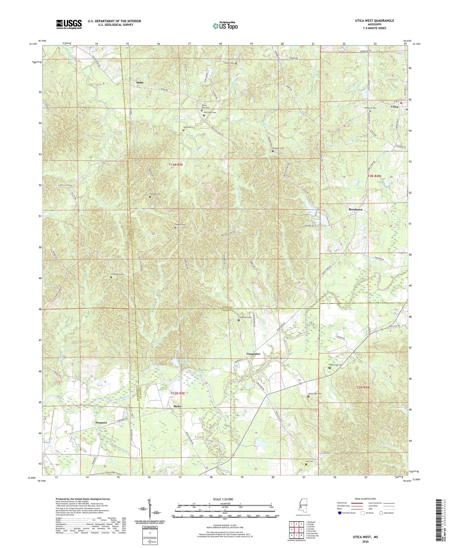
2020 topographic map quadrangle Utica West in the state of Mississippi. Scale: 1:24000. Based on the newly updated USGS 7.5' US Topo map series, this map is in the following counties: Hinds, Copiah, Claiborne. The map contains contour data, water features, and other items you are used to seeing on USGS maps, but also has updated roads and other features. This is the next generation of topographic maps. Printed on high-quality waterproof paper with UV fade-resistant inks.
Quads adjacent to this one:
West: Carlisle
Northwest: Big Black
North: Cayuga
Northeast: Learned
East: Utica East
Southeast: Dentville
South: Dentville NW
Southwest: Hermanville
Contains the following named places: Anderson Cemetery, Breeden Cemetery, Byrnes School, Carpenter, Carpenter Cemetery, Carroway Pond Dam, Choctaw Creek, Duke, Fatherree Cemetery, Freemount Church, Griffin Cemetery, Hickory Ridge School, Hill Cemetery, Hunts Store, I L Trotter Junior Lake Dam, Insmore, Institute, Lemon Cemetery, McClellan Cemetery, McClellan Creek, Mercy Seat School, Mud Creek, Myles, Myles Plantation, Nutt Cemetery, Oak Ridge School, Owens Creek, Payton Branch, Potter Creek, Reed Lake Dam, Reed School, Reeds Lake Dam, Reedtown, Ritchey Cemetery, Ross School, Ruel-A-Lou Lake, Scutchalo Creek, Scutchalo Falls, Seven Star Cemetery, Seven Star Church, Springfield Church, Utica High School, Utica Post Office, Utica Volunteer Fire Department, White Oak Baptist Church, White Oak Cemetery, White Oak Creek, Williams School, ZIP Code: 39175