MyTopo
Gardner Missouri US Topo Map
Couldn't load pickup availability
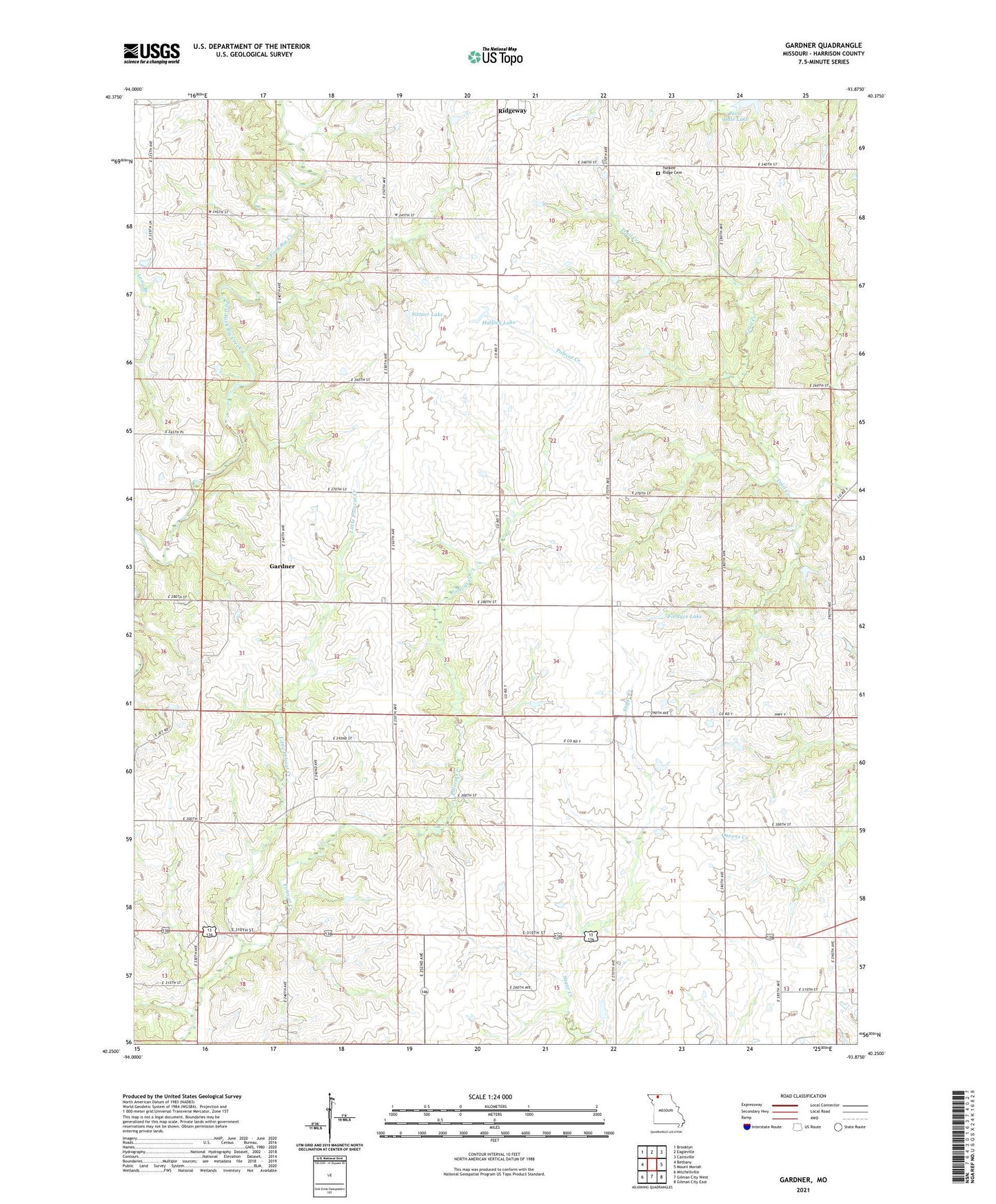
2021 topographic map quadrangle Gardner in the state of Missouri. Scale: 1:24000. Based on the newly updated USGS 7.5' US Topo map series, this map is in the following counties: Harrison. The map contains contour data, water features, and other items you are used to seeing on USGS maps, but also has updated roads and other features. This is the next generation of topographic maps. Printed on high-quality waterproof paper with UV fade-resistant inks.
Quads adjacent to this one:
West: Bethany
Northwest: Brooklyn
North: Eagleville
Northeast: Cainsville
East: Mount Moriah
Southeast: Gilman City East
South: Gilman City West
Southwest: Mitchellville
Contains the following named places: Fordyce Lake, Fordyce Lake Dam, Gardner, Green Castle School, Hallock Lake, Hallock Lake Dam, Harcomo Lake Dam, Harrison County, Hickory School, High Point School, Hunt School, Jesse Hale Lake, Kirkley Church, Liberty School, Linthacum Lake Dam North, Linthacum Lake Dam South, Little Polecat Creek, Long Branch, Mount Olive Church, Oak Grove School, Prairie Chapel, Sittner Lake, Sittner Lake Dam, Township of Grant, Walnut School, Yankee Ridge Cemetery, ZIP Code: 64481