MyTopo
Marceline Missouri US Topo Map
Couldn't load pickup availability
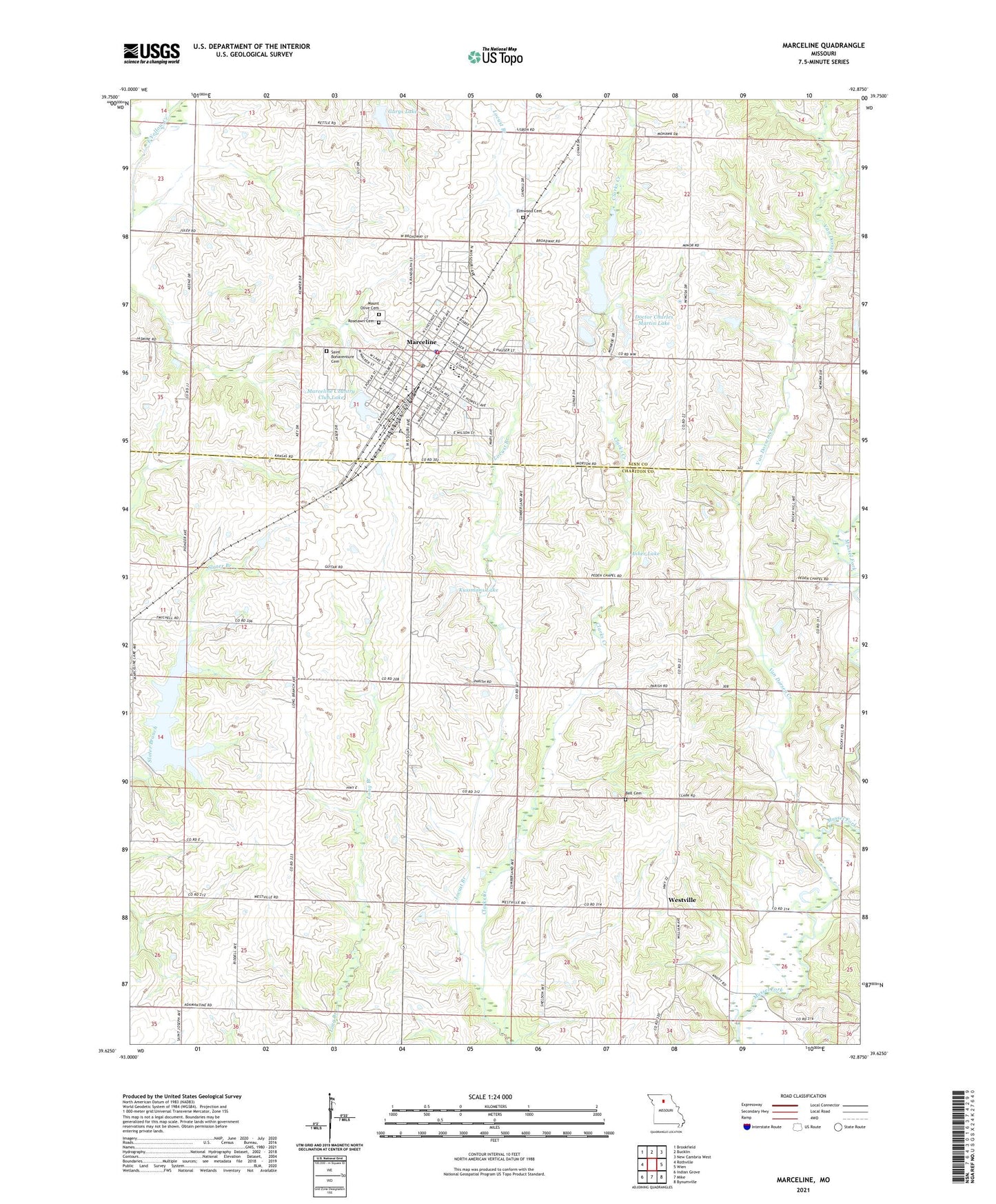
2021 topographic map quadrangle Marceline in the state of Missouri. Scale: 1:24000. Based on the newly updated USGS 7.5' US Topo map series, this map is in the following counties: Chariton, Linn. The map contains contour data, water features, and other items you are used to seeing on USGS maps, but also has updated roads and other features. This is the next generation of topographic maps. Printed on high-quality waterproof paper with UV fade-resistant inks.
Quads adjacent to this one:
West: Rothville
Northwest: Brookfield
North: Bucklin
Northeast: New Cambria West
East: Wien
Southeast: Bynumville
South: Mike
Southwest: Indian Grove
Contains the following named places: Asher Lake, Asher Lake Dam, Bell Cemetery, City of Marceline, Curry School, Doctor Charles Martin Dam, Doctor Charles Martin Lake, Eastman School, Elm Grove School, Elmwood Cemetery, Garys Lake, Hardin School, Kussmans Lake, Kussmans Lake Dam, Locust Branch, Marceline, Marceline City Reservoir Dam, Marceline Country Club Lake, Marceline Fire Department, Marceline Municipal Airport, Marceline New Reservoir Dam, Marceline Old Reservoir, Marceline Police Department, Marceline Post Office, Maupin School, Mount Olive Cemetery, New Marceline City Lake, Oldham School, Parish School, Park School, Peden Chapel, Roselawn Cemetery, Saint Bonaventure Cemetery, Saint Bonaventure School, Saint Francis Hospital Heliport, Santa Fe Country Club Dam, Smith Center School, Tarpening Lake East Dam, Tarpening Lake Northwest Dam, Tarpening Lake Southwest Dam, Township of Clark, Township of Marceline, Van Dorsen Creek, Westville, Westville School, White Lake, White Lake Dam, ZIP Code: 64658