MyTopo
Bushnell Hill Montana US Topo Map
Regular price
$16.95
Regular price
Sale price
$16.95
Unit price
per
Couldn't load pickup availability
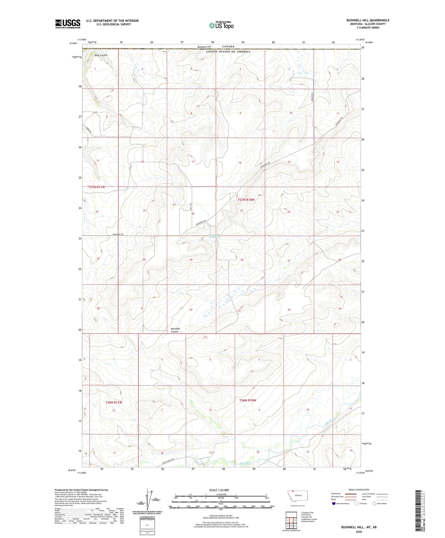
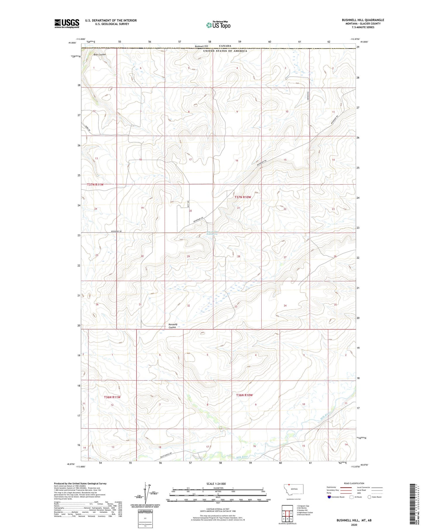
2020 topographic map quadrangle Bushnell Hill in the state of Montana. Scale: 1:24000. Based on the newly updated USGS 7.5' US Topo map series, this map is in the following counties: Glacier. The map contains contour data, water features, and other items you are used to seeing on USGS maps, but also has updated roads and other features. This is the next generation of topographic maps. Printed on high-quality waterproof paper with UV fade-resistant inks.
Quads adjacent to this one:
West: Emigrant Gap
East: Del Bonita
Southeast: Rimrock Ranch
South: Nightshoot Coulee
Southwest: Hoodoo Hill
Contains the following named places: Bish Coulee, Bushnell Hill, Hole-In-The-Wall Spring