MyTopo
Corvallis Montana US Topo Map
Couldn't load pickup availability
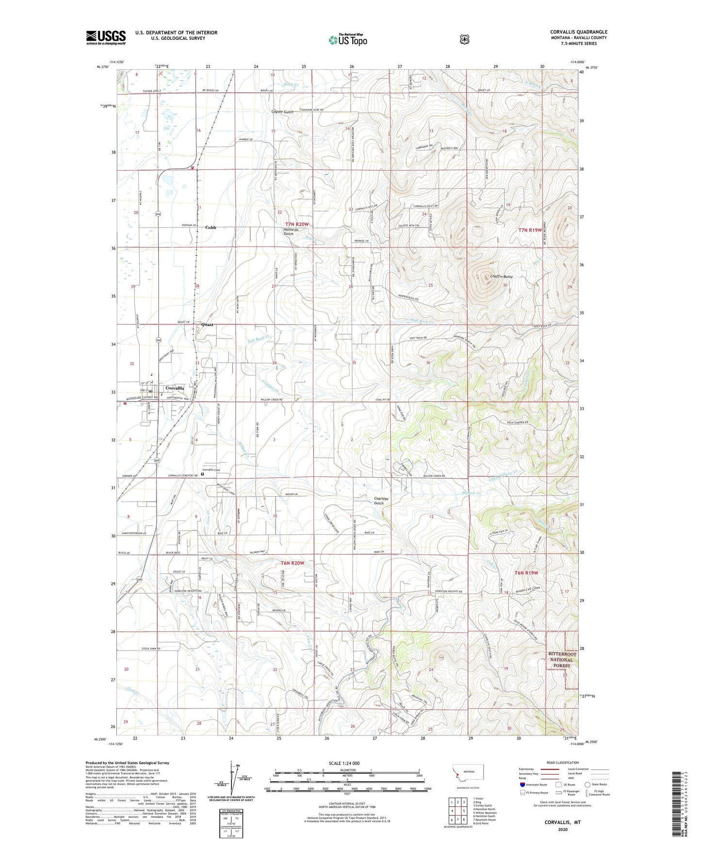
2020 topographic map quadrangle Corvallis in the state of Montana. Scale: 1:24000. Based on the newly updated USGS 7.5' US Topo map series, this map is in the following counties: Ravalli. The map contains contour data, water features, and other items you are used to seeing on USGS maps, but also has updated roads and other features. This is the next generation of topographic maps. Printed on high-quality waterproof paper with UV fade-resistant inks.
Quads adjacent to this one:
West: Hamilton North
Northwest: Victor
North: Bing
Northeast: Corley Gulch
East: Willow Mountain
Southeast: Gird Point
South: Mountain House
Southwest: Hamilton South
Contains the following named places: 06N20W01CDCD01 Well, 06N20W03ABBB01 Well, 06N20W03BD__01 Well, 06N20W04ADCC01 Well, 06N20W04BC__01 Well, 06N20W04CC__01 Well, 06N20W08AA__01 Well, 06N20W10CB__01 Well, 06N20W14BAAD01 Well, 06N20W14BBBB01 Well, 06N20W15ADAD01 Well, 07N20W11DADD01 Well, 07N20W16AB__01 Well, 07N20W16AC__01 Well, 07N20W17AA__01 Well, 07N20W17DAD_01 Well, 07N20W20DD__01 Well, 07N20W21AB__01 Well, 07N20W21BA__01 Well, 07N20W21CD__01 Well, 07N20W22CB__01 Well, 07N20W22DA__01 Well, 07N20W23DCBB01 Well, 07N20W26CDD_01 Well, 07N20W28BC__01 Well, 07N20W32DD__01 Well, 07N20W32DDD_02 Well, 07N20W36BBCC01 Well, Arron Care Home, Birch Creek, Bitterroot Irrigation District Canal, Calf Creek, Chaffin Butte, Charleys Gulch, Coalpit Creek, Cobb, Corvallis, Corvallis Canal, Corvallis Cemetery, Corvallis Census Designated Place, Corvallis Community Church, Corvallis Fire District Station 1, Corvallis Fire District Station 2, Corvallis High School, Corvallis Mobile Home Park, Corvallis Post Office, Corvallis Siding, Corvallis United Methodist Church, Cow Creek, Coyote Gulch, Dry Creek, Edna Thomas Middle School, Fort Skedaddle, Holloron Gulch, Little Willow Creek, Lower Lateral, Ponderosa Mobile Home Park, Quast, Quentin Brown Primary School, Shimmon Airport, Soft Rock Creek, Stuart Creek, The Church of Jesus Christ of Latter Day Saints, Upper Lateral, Western Montana Experiment Station, Willow Creek School