MyTopo
Hoodoo Hill Montana US Topo Map
Couldn't load pickup availability
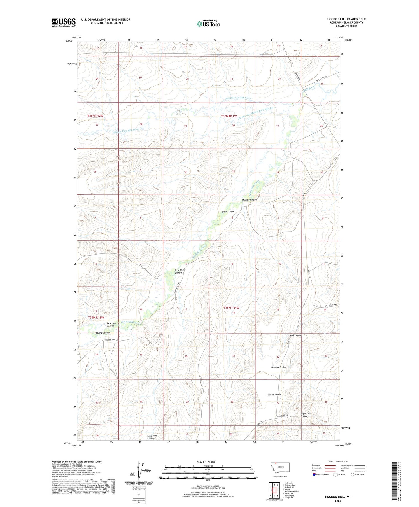
2020 topographic map quadrangle Hoodoo Hill in the state of Montana. Scale: 1:24000. Based on the newly updated USGS 7.5' US Topo map series, this map is in the following counties: Glacier. The map contains contour data, water features, and other items you are used to seeing on USGS maps, but also has updated roads and other features. This is the next generation of topographic maps. Printed on high-quality waterproof paper with UV fade-resistant inks.
Quads adjacent to this one:
West: Wetzel
Northwest: Hall Coulee
North: Emigrant Gap
Northeast: Bushnell Hill
East: Nightshoot Coulee
Southeast: Sharp Lake
South: Browning NE
Southwest: Horse Lake
Contains the following named places: Burd Coulee, Hoodoo Hill, Middle Fork Milk River, Murphy Coulee, Old Channel Middle Fork Milk River, Peterson Coulee, Sand Rock Coulee, South Fork Milk River, Spring Coulee